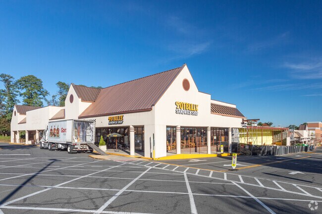
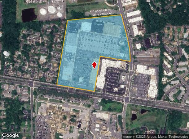
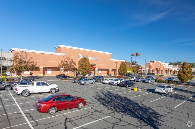
Property Record
9600 Main St, Fairfax, VA 22031
NEARBY LISTINGS FOR SALE OR LEASE
Property Detail
9600 Main St
58-3-02-023-A
Fairfax
Storebuilding
PICKETT RD/LT RIV TNPK 2 PCLS - 1442707 SF 5651-440
X
Fairfax City
5155240003E
Virginia
0
33.12 AC
2025
Fairfax City
300300
Washington, DC
400,226 SF
Washington-Arlington-Alexandria, DC-VA-MD-WV
DEMOGRAPHICS near 9600 Main St
1 Mile
3 Mile
5 Mile
2024 Total Population
10,771
122,224
315,645
2029 Population
10,927
122,026
312,317
Pop Growth 2024-2029
+ 1.45%
(0.16%)
(1.05%)
Average Age
41
39
39
2024 Total Households
3,838
40,907
109,188
HH Growth 2024-2029
+ 1.75%
(0.09%)
(1.14%)
Median Household Inc
$142,499
$148,667
$141,760
Avg Household Size
2.80
2.80
2.80
2024 Avg HH Vehicles
2.00
2.00
2.00
Median Home Value
$720,228
$701,436
$694,389
Median Year Built
1971
1975
1977
Nearby Places
Map Layers
Map Styles
 Street
 Aerial
- Restaurants
- Banks
- Shops
- Fitness
- Groceries
PUBLIC TRANSPORTATION
COMMUTER RAIL
Burke Centre (Manassas Line - Virginia Railway Express)
DRIVE
WALK
Distance
Burke Centre (Manassas Line - Virginia Railway Express)
13 min
5.1 mi
Rolling Road (Manassas Line - Virginia Railway Express)
DRIVE
WALK
Distance
Rolling Road (Manassas Line - Virginia Railway Express)
11 min
5.1 mi
AIRPORT
Ronald Reagan Washington Ntl
DRIVE
WALK
Distance
Ronald Reagan Washington Ntl
28 min
14.7 mi
Washington Dulles International
DRIVE
WALK
Distance
Washington Dulles International
35 min
17.1 mi
Freight Ports
Port of Baltimore
DRIVE
WALK
Distance
Port of Baltimore
77 min
55.3 mi
Nearby Properties
Address
Land Use
TOTAL SIZE
Lot Size
Zoning
Address
Land Use
TOTAL SIZE
Lot Size
Zoning
1,434,346 SF
29.59 AC
430
Address
Land Use
TOTAL SIZE
Lot Size
Zoning
829,629 SF
21.30 AC
430
Address
Land Use
TOTAL SIZE
Lot Size
Zoning
1,393,336 SF
43.08 AC
400
Address
Land Use
TOTAL SIZE
Lot Size
Zoning
538,794 SF
3.44 AC
400
Address
Land Use
TOTAL SIZE
Lot Size
Zoning
819,540 SF
8.81 AC
COMMERCIAL
Address
Land Use
TOTAL SIZE
Lot Size
Zoning
340.34 AC
110
Address
Land Use
TOTAL SIZE
Lot Size
Zoning
82,818 SF
6.16 AC
PLANNED DE
Address
Land Use
TOTAL SIZE
Lot Size
Zoning
775,934 SF
13.98 AC
312
Address
Land Use
TOTAL SIZE
Lot Size
Zoning
382,776 SF
11.02 AC
400
Address
Land Use
TOTAL SIZE
Lot Size
Zoning
255,553 SF
25.61 AC
RESIDENTIA
Address
Land Use
TOTAL SIZE
Lot Size
Zoning
494,819 SF
68.15 AC
120
Address
Land Use
TOTAL SIZE
Lot Size
Zoning
984,982 SF
69.27 AC
300
Address
Land Use
TOTAL SIZE
Lot Size
Zoning
466,884 SF
5.70 AC
350
Address
Land Use
TOTAL SIZE
Lot Size
Zoning
300,730 SF
9.60 AC
400
Address
Land Use
TOTAL SIZE
Lot Size
Zoning
504,528 SF
20.91 AC
220
Address
Land Use
TOTAL SIZE
Lot Size
Zoning
354,464 SF
7.51 AC
400
Address
Land Use
TOTAL SIZE
Lot Size
Zoning
230,346 SF
25.18 AC
460
Address
Land Use
TOTAL SIZE
Lot Size
Zoning
779,512 SF
22.66 AC
550
Address
Land Use
TOTAL SIZE
Lot Size
Zoning
260,278 SF
5.78 AC
400
Address
Land Use
TOTAL SIZE
Lot Size
Zoning
424,763 SF
47.76 AC
SPLIT ZONE
Address
Land Use
TOTAL SIZE
Lot Size
Zoning
199,327 SF
18.64 AC
460
Address
Land Use
TOTAL SIZE
Lot Size
Zoning
500 SF
9.67 AC
180
Address
Land Use
TOTAL SIZE
Lot Size
Zoning
339,028 SF
75.81 AC
120
Address
Land Use
TOTAL SIZE
Lot Size
Zoning
443,750 SF
33.08 AC
530
Address
Land Use
TOTAL SIZE
Lot Size
Zoning
Address
Land Use
TOTAL SIZE
Lot Size
Zoning
414,162 SF
97.56 AC
110
Address
Land Use
TOTAL SIZE
Lot Size
Zoning
353,340 SF
7.89 AC
400
Address
Land Use
TOTAL SIZE
Lot Size
Zoning
341,924 SF
12.78 AC
220
Address
Land Use
TOTAL SIZE
Lot Size
Zoning
500 SF
14.27 AC
110
The World's #1 Commercial Real Estate Marketplace
Connect with us
© 2025 CoStar Group
The information above has been obtained from sources believed reliable. While we do not doubt its accuracy we have not verified it and make no guarantee, warranty or representation about it. It is your responsibility to independently confirm its accuracy and completeness. Any projections, opinions, assumptions, or estimates used are for example only and do not represent the current or future performance of the property. The value of this transaction to you depends on tax and other factors which should be evaluated by your tax, financial, and legal advisors. You and your advisors should conduct a careful, independent investigation of the property to determine to your satisfaction the suitability of the property for your needs.