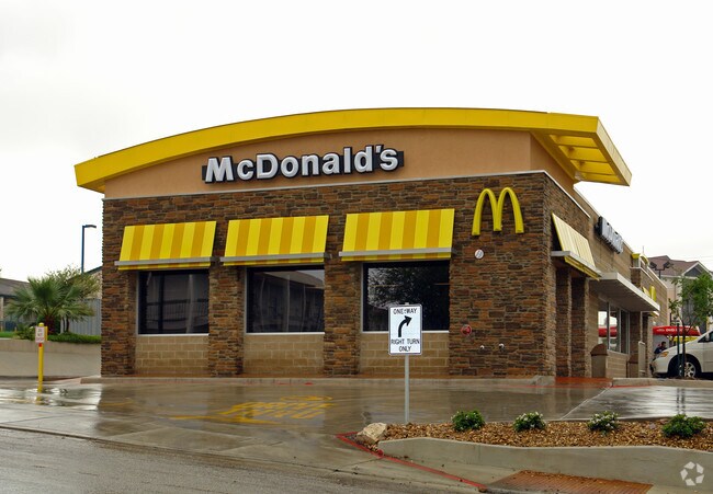
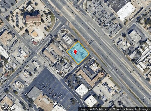
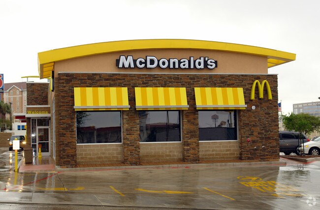
Property Record
9600 W Interstate 10, San Antonio, TX 78230
NEARBY LISTINGS FOR SALE OR LEASE
Property Detail
9600 W Interstate 10
San Antonio-New Braunfels, TX
Conv A/S Code
16465-000-0021
NCB 16465 BLK LOT NE IRRG 178.97 FT OF 2
Restaurantdrivein
Bexar
X
Texas
48029C0245G
21
2024
1.07 AC
2025
Northwest
181003
San Antonio
5,775 SF
DEMOGRAPHICS near 9600 W Interstate 10
1 Mile
3 Mile
5 Mile
2024 Total Population
23,452
141,380
344,145
2029 Population
24,999
150,754
365,857
Pop Growth 2024-2029
+ 6.60%
+ 6.63%
+ 6.31%
Average Age
34
37
38
2024 Total Households
10,480
65,049
146,821
HH Growth 2024-2029
+ 6.78%
+ 6.90%
+ 6.60%
Median Household Inc
$46,868
$50,957
$53,840
Avg Household Size
2.20
2.10
2.30
2024 Avg HH Vehicles
1.00
1.00
2.00
Median Home Value
$238,756
$250,985
$234,868
Median Year Built
1981
1984
1982
Nearby Places
Map Layers
Map Styles
 Street
 Aerial
- Restaurants
- Banks
- Shops
- Fitness
- Groceries
PUBLIC TRANSPORTATION
AIRPORT
San Antonio International
DRIVE
WALK
Distance
San Antonio International
11 min
7.3 mi
Freight Ports
Calhoun Port
DRIVE
WALK
Distance
Calhoun Port
193 min
158.1 mi
Nearby Properties
Address
Land Use
TOTAL SIZE
Lot Size
Zoning
Address
Land Use
TOTAL SIZE
Lot Size
Zoning
1,414,945 SF
16.77 AC
Address
Land Use
TOTAL SIZE
Lot Size
Zoning
4,465,972 SF
231.60 AC
Address
Land Use
TOTAL SIZE
Lot Size
Zoning
609,267 SF
30.47 AC
Address
Land Use
TOTAL SIZE
Lot Size
Zoning
227,586 SF
25.46 AC
Address
Land Use
TOTAL SIZE
Lot Size
Zoning
429,561 SF
25.70 AC
Address
Land Use
TOTAL SIZE
Lot Size
Zoning
331,715 SF
9.04 AC
Address
Land Use
TOTAL SIZE
Lot Size
Zoning
97.47 AC
Address
Land Use
TOTAL SIZE
Lot Size
Zoning
352,231 SF
19.54 AC
Address
Land Use
TOTAL SIZE
Lot Size
Zoning
724,148 SF
18.70 AC
Address
Land Use
TOTAL SIZE
Lot Size
Zoning
278,352 SF
10 AC
Address
Land Use
TOTAL SIZE
Lot Size
Zoning
306,959 SF
15.24 AC
Address
Land Use
TOTAL SIZE
Lot Size
Zoning
482,412 SF
22.97 AC
Address
Land Use
TOTAL SIZE
Lot Size
Zoning
559,808 SF
24.43 AC
Address
Land Use
TOTAL SIZE
Lot Size
Zoning
152,266 SF
18.72 AC
Address
Land Use
TOTAL SIZE
Lot Size
Zoning
183,249 SF
21.94 AC
Address
Land Use
TOTAL SIZE
Lot Size
Zoning
349,074 SF
27.84 AC
Address
Land Use
TOTAL SIZE
Lot Size
Zoning
301,817 SF
12.22 AC
Address
Land Use
TOTAL SIZE
Lot Size
Zoning
121,989 SF
18.03 AC
Address
Land Use
TOTAL SIZE
Lot Size
Zoning
171,316 SF
14.20 AC
Address
Land Use
TOTAL SIZE
Lot Size
Zoning
227,744 SF
3.99 AC
Address
Land Use
TOTAL SIZE
Lot Size
Zoning
223,288 SF
17.01 AC
Address
Land Use
TOTAL SIZE
Lot Size
Zoning
283,165 SF
12.19 AC
Address
Land Use
TOTAL SIZE
Lot Size
Zoning
239,623 SF
26.63 AC
Address
Land Use
TOTAL SIZE
Lot Size
Zoning
506,058 SF
25.23 AC
Address
Land Use
TOTAL SIZE
Lot Size
Zoning
201,339 SF
9.32 AC
Address
Land Use
TOTAL SIZE
Lot Size
Zoning
152,676 SF
13.74 AC
Address
Land Use
TOTAL SIZE
Lot Size
Zoning
288,719 SF
14.66 AC
Address
Land Use
TOTAL SIZE
Lot Size
Zoning
495,484 SF
5.81 AC
Address
Land Use
TOTAL SIZE
Lot Size
Zoning
61.64 AC
Address
Land Use
TOTAL SIZE
Lot Size
Zoning
250,174 SF
14.26 AC
The World's #1 Commercial Real Estate Marketplace
Connect with us
© 2025 CoStar Group
The information above has been obtained from sources believed reliable. While we do not doubt its accuracy we have not verified it and make no guarantee, warranty or representation about it. It is your responsibility to independently confirm its accuracy and completeness. Any projections, opinions, assumptions, or estimates used are for example only and do not represent the current or future performance of the property. The value of this transaction to you depends on tax and other factors which should be evaluated by your tax, financial, and legal advisors. You and your advisors should conduct a careful, independent investigation of the property to determine to your satisfaction the suitability of the property for your needs.