Property Record
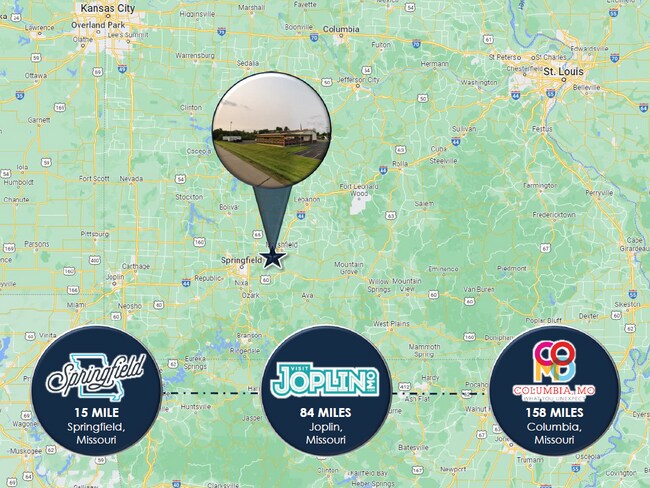
9602 E State Highway Oo, Strafford, MO 65757


Property Detail
9602 E State Highway Oo
11-02-100-029
14.79A M/L E1/2 LOT 7 NE1/4 LY S HWY I-44 & N OF RR R/W (EX RD) & (EX BEG 1332.35 FT W & 213.55 FT S NE COR E 50 FT SEL Y 304.47 FT S 355.29 FT WLY 355.70 FT N TO BEG) 2/29/20
Servicestation
Greene
INC
Missouri
B and X Area of moderate flood hazard, usually the area between the limits of the 100-year and 500-year floods.
7
2025
14.79 AC
2025
Outlying Greene County
004601
Springfield
1,364 SF
Springfield, MO
NEARBY LISTINGS FOR SALE OR LEASE
DEMOGRAPHICS near 9602 E State Highway Oo
1 mile
3 mile
5 mile
2025 Total Population
327
4,688
7,678
2030 Population
343
4,909
8,025
Pop Growth 2025-2030
+ 4.89%
+ 4.71%
+ 4.52%
Average Age
39
40
41
2025 Total Households
120
1,774
2,959
HH Growth 2025-2030
+ 5.00%
+ 4.79%
+ 4.63%
Median Household Inc
$73,845
$73,543
$77,222
Avg Household Size
2.60
2.60
2.50
2025 Avg HH Vehicles
2.00
2.00
2.00
Median Home Value
$199,999
$213,095
$249,125
Median Year Built
1990
1989
1988
Nearby Places
Map Layers
Map Styles
 Street
 Aerial
Transit
 Traffic
 Biking
Places
Listings with unknown addresses are not visible on the map
- Restaurants
- Banks
- Shops
- Fitness
- Groceries
PUBLIC TRANSPORTATION
AIRPORT
Springfield-Branson Ntl
Drive
Walk
Distance
Springfield-Branson Ntl
33 min
21.8 mi
SALE & LEASE HISTORY
LISTING DATE
SALE/LEASE

May 17, 2024
For Sale
Nearby Properties
Address
Land Use
TOTAL SIZE
Lot Size
Zoning
Address
Land Use
TOTAL SIZE
Lot Size
Zoning
9.17 AC
INC.
Address
Land Use
TOTAL SIZE
Lot Size
Zoning
8.66 AC
INC
Address
Land Use
TOTAL SIZE
Lot Size
Zoning
10.11 AC
INC
Address
Land Use
TOTAL SIZE
Lot Size
Zoning
85.20 AC
Address
Land Use
TOTAL SIZE
Lot Size
Zoning
18,820 SF
24.63 AC
Address
Land Use
TOTAL SIZE
Lot Size
Zoning
1,500 SF
27.47 AC
Address
Land Use
TOTAL SIZE
Lot Size
Zoning
10.07 AC
INC.
Address
Land Use
TOTAL SIZE
Lot Size
Zoning
17.48 AC
INC
Address
Land Use
TOTAL SIZE
Lot Size
Zoning
Address
Land Use
TOTAL SIZE
Lot Size
Zoning
17.36 AC
INC.
Address
Land Use
TOTAL SIZE
Lot Size
Zoning
10 AC
INC.
Address
Land Use
TOTAL SIZE
Lot Size
Zoning
12.03 AC
INC
Address
Land Use
TOTAL SIZE
Lot Size
Zoning
2.97 AC
INC
Address
Land Use
TOTAL SIZE
Lot Size
Zoning
22,000 SF
13.72 AC
Address
Land Use
TOTAL SIZE
Lot Size
Zoning
23,806 SF
42.74 AC
INC
Address
Land Use
TOTAL SIZE
Lot Size
Zoning
2.79 AC
INC
Address
Land Use
TOTAL SIZE
Lot Size
Zoning
6.93 AC
INC
Address
Land Use
TOTAL SIZE
Lot Size
Zoning
31,101 SF
12 AC
INC
Address
Land Use
TOTAL SIZE
Lot Size
Zoning
Address
Land Use
TOTAL SIZE
Lot Size
Zoning
14,080 SF
10.71 AC
Address
Land Use
TOTAL SIZE
Lot Size
Zoning
2.06 AC
INC.
Address
Land Use
TOTAL SIZE
Lot Size
Zoning
8,146 SF
2.32 AC
INC
Address
Land Use
TOTAL SIZE
Lot Size
Zoning
4,253 SF
26.40 AC
INC
Address
Land Use
TOTAL SIZE
Lot Size
Zoning
14,556 SF
4.71 AC
Address
Land Use
TOTAL SIZE
Lot Size
Zoning
16.22 AC
Address
Land Use
TOTAL SIZE
Lot Size
Zoning
5,519 SF
2.85 AC
INC
Address
Land Use
TOTAL SIZE
Lot Size
Zoning
5,643 SF
3.49 AC
INC
Address
Land Use
TOTAL SIZE
Lot Size
Zoning
12.35 AC
INC
Address
Land Use
TOTAL SIZE
Lot Size
Zoning
4.63 AC
INC
The World's #1 Commercial Real Estate Marketplace
Connect with us
© 2026 CoStar Group
The information above has been obtained from sources believed reliable. While we do not doubt its accuracy we have not verified it and make no guarantee, warranty or representation about it. It is your responsibility to independently confirm its accuracy and completeness. Any projections, opinions, assumptions, or estimates used are for example only and do not represent the current or future performance of the property. The value of this transaction to you depends on tax and other factors which should be evaluated by your tax, financial, and legal advisors. You and your advisors should conduct a careful, independent investigation of the property to determine to your satisfaction the suitability of the property for your needs.