Property Record
9605 Main Rd, Mattituck, NY 11952
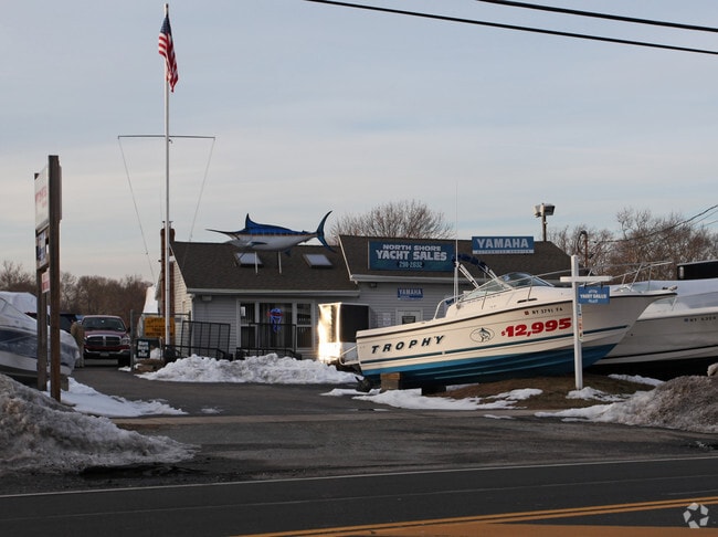

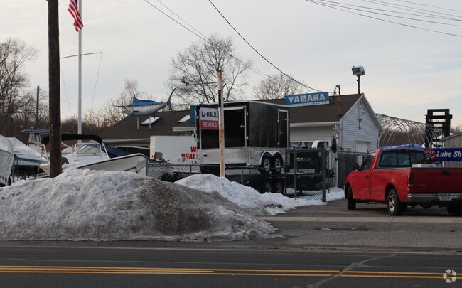
Property Detail
9605 Main Rd
Nassau County-Suffolk County, NY
BOOK 11957 PAGE 557 BILL 015680
1000-122-00-06-00-012-000
SUFFOLK
Warehouse
New York
B R-40
12
B and X Area of moderate flood hazard, usually the area between the limits of the 100-year and 500-year floods.
1.75 AC
2024
Eastern Suffolk
2025
Long Island (New York)
170004
NEARBY LISTINGS FOR SALE OR LEASE
DEMOGRAPHICS near 9605 Main Rd
1 mile
3 mile
5 mile
2025 Total Population
2,585
8,172
15,385
2030 Population
2,679
8,452
15,875
Pop Growth 2025-2030
+ 3.64%
+ 3.43%
+ 3.18%
Average Age
46
46
47
2025 Total Households
1,013
3,251
6,145
HH Growth 2025-2030
+ 3.36%
+ 3.17%
+ 2.98%
Median Household Inc
$123,029
$118,472
$118,647
Avg Household Size
2.50
2.40
2.40
2025 Avg HH Vehicles
2.00
2.00
2.00
Median Home Value
$812,178
$789,841
$795,166
Median Year Built
1975
1975
1976
Nearby Places
Map Layers
Map Styles
 Street
 Aerial
Layers
 Traffic
 Biking
Places
Listings with unknown addresses are not visible on the map
- Restaurants
- Banks
- Shops
- Fitness
- Groceries
PUBLIC TRANSPORTATION
TRANSIT/SUBWAY
Mattituck Station (Greenport Branch - Long Island Rail Road)
Drive
Walk
Distance
Mattituck Station (Greenport Branch - Long Island Rail Road)
3 min
15 min
0.8 mi
COMMUTER RAIL
Mattituck Station (Greenport Branch - Long Island Rail Road)
Drive
Walk
Distance
Mattituck Station (Greenport Branch - Long Island Rail Road)
3 min
14 min
0.7 mi
Riverhead Station (Greenport Branch - Long Island Rail Road)
Drive
Walk
Distance
Riverhead Station (Greenport Branch - Long Island Rail Road)
17 min
8.9 mi
AIRPORT
Long Island MacArthur
Drive
Walk
Distance
Long Island MacArthur
59 min
37.5 mi
Nearby Properties
Address
Land Use
TOTAL SIZE
Lot Size
Zoning
Address
Land Use
TOTAL SIZE
Lot Size
Zoning
30.40 AC
R-80
Address
Land Use
TOTAL SIZE
Lot Size
Zoning
5.01 AC
10
Address
Land Use
TOTAL SIZE
Lot Size
Zoning
5,338 SF
159.30 AC
4
Address
Land Use
TOTAL SIZE
Lot Size
Zoning
11.39 AC
10
Address
Land Use
TOTAL SIZE
Lot Size
Zoning
1,980 SF
63.11 AC
09
Address
Land Use
TOTAL SIZE
Lot Size
Zoning
2,928 SF
85.90 AC
04
Address
Land Use
TOTAL SIZE
Lot Size
Zoning
392 SF
52.39 AC
09
Address
Land Use
TOTAL SIZE
Lot Size
Zoning
2,302 SF
26.20 AC
09
Address
Land Use
TOTAL SIZE
Lot Size
Zoning
9,230 SF
19.70 AC
04
Address
Land Use
TOTAL SIZE
Lot Size
Zoning
3,945 SF
6.27 AC
APZ
Address
Land Use
TOTAL SIZE
Lot Size
Zoning
392 SF
19.31 AC
09
Address
Land Use
TOTAL SIZE
Lot Size
Zoning
8.75 AC
B
Address
Land Use
TOTAL SIZE
Lot Size
Zoning
5,483 SF
18.43 AC
04
Address
Land Use
TOTAL SIZE
Lot Size
Zoning
2,317 SF
0.71 AC
04
Address
Land Use
TOTAL SIZE
Lot Size
Zoning
82.20 AC
04
Address
Land Use
TOTAL SIZE
Lot Size
Zoning
4,514 SF
0.64 AC
03
Address
Land Use
TOTAL SIZE
Lot Size
Zoning
3,620 SF
11.50 AC
04
Address
Land Use
TOTAL SIZE
Lot Size
Zoning
41.20 AC
03
Address
Land Use
TOTAL SIZE
Lot Size
Zoning
3,470 SF
4.17 AC
APZ
Address
Land Use
TOTAL SIZE
Lot Size
Zoning
Address
Land Use
TOTAL SIZE
Lot Size
Zoning
7.87 AC
RA80
Address
Land Use
TOTAL SIZE
Lot Size
Zoning
2,699 SF
21 AC
04
Address
Land Use
TOTAL SIZE
Lot Size
Zoning
1,937 SF
20.33 AC
04
Address
Land Use
TOTAL SIZE
Lot Size
Zoning
1,612 SF
16.53 AC
APZ
Address
Land Use
TOTAL SIZE
Lot Size
Zoning
63.50 AC
04
Address
Land Use
TOTAL SIZE
Lot Size
Zoning
5,188 SF
0.96 AC
RB80
Address
Land Use
TOTAL SIZE
Lot Size
Zoning
960 SF
5.96 AC
Address
Land Use
TOTAL SIZE
Lot Size
Zoning
5,365 SF
2.90 AC
APZ
Address
Land Use
TOTAL SIZE
Lot Size
Zoning
924 SF
12.85 AC
04
Address
Land Use
TOTAL SIZE
Lot Size
Zoning
2.60 AC
APZ
The World's #1 Commercial Real Estate Marketplace
Connect with us
© 2026 CoStar Group
The information above has been obtained from sources believed reliable. While we do not doubt its accuracy we have not verified it and make no guarantee, warranty or representation about it. It is your responsibility to independently confirm its accuracy and completeness. Any projections, opinions, assumptions, or estimates used are for example only and do not represent the current or future performance of the property. The value of this transaction to you depends on tax and other factors which should be evaluated by your tax, financial, and legal advisors. You and your advisors should conduct a careful, independent investigation of the property to determine to your satisfaction the suitability of the property for your needs.