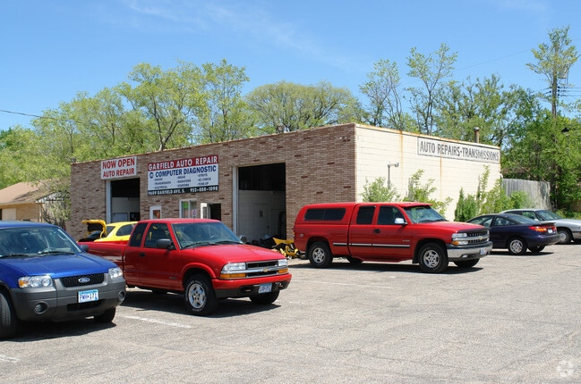
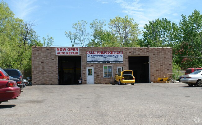
Property Record
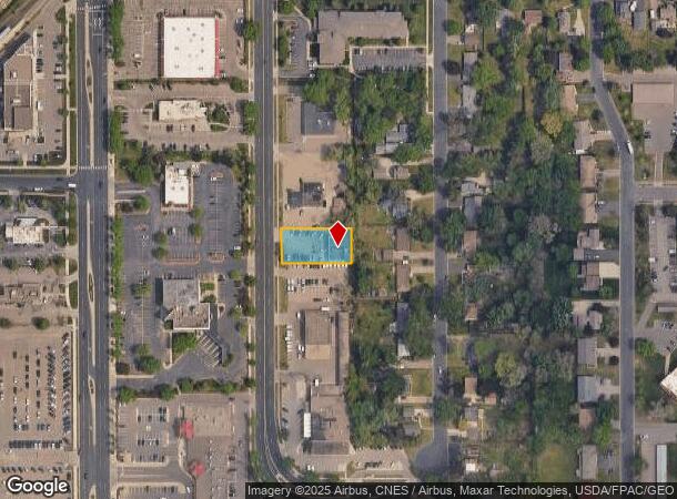
9609 Garfield Ave S, Minneapolis, MN 55420
NEARBY LISTINGS FOR SALE OR LEASE
Property Detail
9609 Garfield Ave S
Minneapolis-St. Paul-Bloomington, MN-WI
Oxboro Heath
15-027-24-23-0034
LOT 008 BLOCK 011 A OXBORO HEATH W 1/2 EX ST W 90 X 175.5
Commercialnec
Hennepin
X
Minnesota
27053C0458F
8
2024
0.36 AC
2024
Southdale
125500
Minneapolis/St Paul
2,700 SF
DEMOGRAPHICS near 9609 Garfield Ave S
1 Mile
3 Mile
5 Mile
2024 Total Population
11,149
72,128
207,142
2029 Population
10,943
70,779
206,190
Pop Growth 2024-2029
(1.85%)
(1.87%)
(0.46%)
Average Age
41
41
41
2024 Total Households
4,807
30,051
88,253
HH Growth 2024-2029
(1.98%)
(2.02%)
(0.46%)
Median Household Inc
$61,292
$73,957
$80,005
Avg Household Size
2.20
2.30
2.20
2024 Avg HH Vehicles
2.00
2.00
2.00
Median Home Value
$260,922
$290,676
$305,564
Median Year Built
1966
1964
1971
Nearby Places
Map Layers
Map Styles
 Street
 Aerial
- Restaurants
- Banks
- Shops
- Fitness
- Groceries
PUBLIC TRANSPORTATION
AIRPORT
Minneapolis-St Paul International/Wold-Chamberlain
DRIVE
WALK
Distance
Minneapolis-St Paul International/Wold-Chamberlain
13 min
7.0 mi
SALE & LEASE HISTORY
LISTING DATE
SALE/LEASE

Nov 29, 2018
For Sale
Jul 07, 2020
For Sale
Apr 29, 2019
For Sale
Apr 29, 2019
For Lease
Apr 05, 2018
For Sale
Nearby Properties
Address
Land Use
TOTAL SIZE
Lot Size
Zoning
Address
Land Use
TOTAL SIZE
Lot Size
Zoning
1,233,880 SF
63.49 AC
Address
Land Use
TOTAL SIZE
Lot Size
Zoning
1,341.19 AC
Address
Land Use
TOTAL SIZE
Lot Size
Zoning
21.50 AC
Address
Land Use
TOTAL SIZE
Lot Size
Zoning
154,216 SF
0.81 AC
GLC3*
Address
Land Use
TOTAL SIZE
Lot Size
Zoning
35.28 AC
Address
Land Use
TOTAL SIZE
Lot Size
Zoning
78,800 SF
2.12 AC
Address
Land Use
TOTAL SIZE
Lot Size
Zoning
435,796 SF
36.44 AC
Address
Land Use
TOTAL SIZE
Lot Size
Zoning
4.20 AC
Address
Land Use
TOTAL SIZE
Lot Size
Zoning
129,658 SF
13.52 AC
Address
Land Use
TOTAL SIZE
Lot Size
Zoning
98,676 SF
8.77 AC
Address
Land Use
TOTAL SIZE
Lot Size
Zoning
Address
Land Use
TOTAL SIZE
Lot Size
Zoning
114,617 SF
17.68 AC
Address
Land Use
TOTAL SIZE
Lot Size
Zoning
122,021 SF
21.74 AC
Address
Land Use
TOTAL SIZE
Lot Size
Zoning
60,320 SF
11.50 AC
Address
Land Use
TOTAL SIZE
Lot Size
Zoning
6.87 AC
Address
Land Use
TOTAL SIZE
Lot Size
Zoning
142,229 SF
26.61 AC
Address
Land Use
TOTAL SIZE
Lot Size
Zoning
32,748 SF
2.24 AC
Address
Land Use
TOTAL SIZE
Lot Size
Zoning
19,441 SF
1.37 AC
Address
Land Use
TOTAL SIZE
Lot Size
Zoning
52,316 SF
3.56 AC
MDD6
Address
Land Use
TOTAL SIZE
Lot Size
Zoning
4.20 AC
Address
Land Use
TOTAL SIZE
Lot Size
Zoning
24,209 SF
5.90 AC
Address
Land Use
TOTAL SIZE
Lot Size
Zoning
Address
Land Use
TOTAL SIZE
Lot Size
Zoning
70,904 SF
17.42 AC
Address
Land Use
TOTAL SIZE
Lot Size
Zoning
4.20 AC
Address
Land Use
TOTAL SIZE
Lot Size
Zoning
138,826 SF
23.39 AC
Address
Land Use
TOTAL SIZE
Lot Size
Zoning
75,831 SF
10.85 AC
Address
Land Use
TOTAL SIZE
Lot Size
Zoning
14,568 SF
14.97 AC
Address
Land Use
TOTAL SIZE
Lot Size
Zoning
16,825 SF
2.75 AC
Address
Land Use
TOTAL SIZE
Lot Size
Zoning
28,957 SF
3.36 AC
Address
Land Use
TOTAL SIZE
Lot Size
Zoning
The World's #1 Commercial Real Estate Marketplace
Connect with us
© 2025 CoStar Group
The information above has been obtained from sources believed reliable. While we do not doubt its accuracy we have not verified it and make no guarantee, warranty or representation about it. It is your responsibility to independently confirm its accuracy and completeness. Any projections, opinions, assumptions, or estimates used are for example only and do not represent the current or future performance of the property. The value of this transaction to you depends on tax and other factors which should be evaluated by your tax, financial, and legal advisors. You and your advisors should conduct a careful, independent investigation of the property to determine to your satisfaction the suitability of the property for your needs.