Property Record
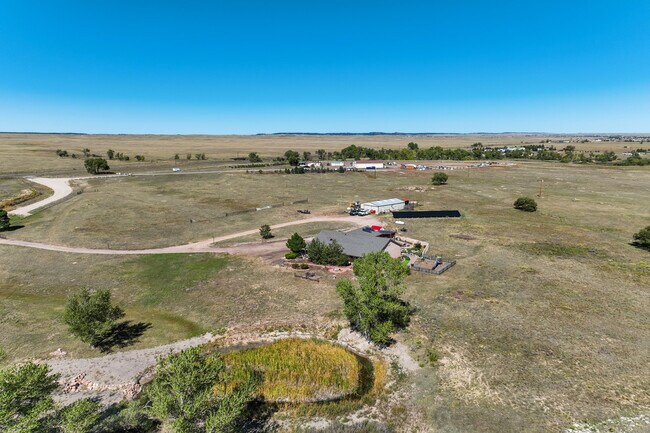
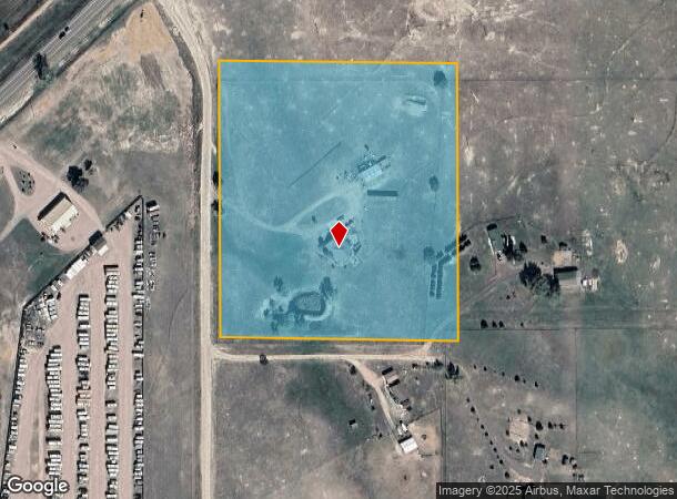
9611 Curtis Rd, Peyton, CO 80831

This Property Is For Sale
NEARBY LISTINGS FOR SALE OR LEASE
-
-
View all Peyton listings for sale on LoopNet.com
Property Detail
9611 Curtis Rd
Colorado Springs, CO
Monument Add
42270-00-011
El Paso
Sfr
Colorado
X
11.52 AC
08041C0556G
Southeast
2,430 SF
Colorado Springs
DEMOGRAPHICS near 9611 Curtis Rd
1 Mile
3 Mile
5 Mile
2024 Total Population
138
15,459
29,226
2029 Population
147
16,046
30,450
Pop Growth 2024-2029
+ 6.52%
+ 3.80%
+ 4.19%
Average Age
34
35
37
2024 Total Households
41
4,569
9,234
HH Growth 2024-2029
+ 4.88%
+ 3.87%
+ 4.39%
Median Household Inc
$140,277
$125,805
$124,620
Avg Household Size
3.30
3.30
3.10
2024 Avg HH Vehicles
3.00
2.00
3.00
Median Home Value
$488,461
$443,884
$450,912
Median Year Built
2011
2008
2006
Nearby Places
Map Layers
Map Styles
 Street
 Aerial
- Restaurants
- Banks
- Shops
- Fitness
- Groceries
PUBLIC TRANSPORTATION
AIRPORT
City of Colorado Springs Municipal
DRIVE
WALK
Distance
City of Colorado Springs Municipal
29 min
15.1 mi
Nearby Properties
Address
Land Use
TOTAL SIZE
Lot Size
Zoning
Address
Land Use
TOTAL SIZE
Lot Size
Zoning
43,256 SF
4.49 AC
PUD
Address
Land Use
TOTAL SIZE
Lot Size
Zoning
43,256 SF
4.73 AC
Address
Land Use
TOTAL SIZE
Lot Size
Zoning
39,446 SF
10.71 AC
RR-5
Address
Land Use
TOTAL SIZE
Lot Size
Zoning
46,935 SF
13.62 AC
PUD
Address
Land Use
TOTAL SIZE
Lot Size
Zoning
16,915 SF
5.19 AC
PUD
Address
Land Use
TOTAL SIZE
Lot Size
Zoning
7,573 SF
757.70 AC
PUD R-4 R-
Address
Land Use
TOTAL SIZE
Lot Size
Zoning
16,455 SF
6.89 AC
A-35 RR-2.
Address
Land Use
TOTAL SIZE
Lot Size
Zoning
700 SF
53.98 AC
Address
Land Use
TOTAL SIZE
Lot Size
Zoning
219.19 AC
PUD
Address
Land Use
TOTAL SIZE
Lot Size
Zoning
12,111 SF
2.54 AC
PUD
Address
Land Use
TOTAL SIZE
Lot Size
Zoning
29,113 SF
3.43 AC
CR
Address
Land Use
TOTAL SIZE
Lot Size
Zoning
326.51 AC
RR2
Address
Land Use
TOTAL SIZE
Lot Size
Zoning
1.46 AC
CR
Address
Land Use
TOTAL SIZE
Lot Size
Zoning
29,494 SF
4.11 AC
CR
Address
Land Use
TOTAL SIZE
Lot Size
Zoning
54,150 SF
35.33 AC
CS
Address
Land Use
TOTAL SIZE
Lot Size
Zoning
480 AC
A-35
Address
Land Use
TOTAL SIZE
Lot Size
Zoning
5,561 SF
280 AC
RR5
Address
Land Use
TOTAL SIZE
Lot Size
Zoning
5,341 SF
69.25 AC
A35
Address
Land Use
TOTAL SIZE
Lot Size
Zoning
39.40 AC
PUD
Address
Land Use
TOTAL SIZE
Lot Size
Zoning
31.29 AC
RR-5
Address
Land Use
TOTAL SIZE
Lot Size
Zoning
49.68 AC
M
Address
Land Use
TOTAL SIZE
Lot Size
Zoning
70 AC
PUD
Address
Land Use
TOTAL SIZE
Lot Size
Zoning
6,383 SF
37.73 AC
A35
Address
Land Use
TOTAL SIZE
Lot Size
Zoning
3,332 SF
3.26 AC
PUD
Address
Land Use
TOTAL SIZE
Lot Size
Zoning
2,340 SF
27.11 AC
PUD
Address
Land Use
TOTAL SIZE
Lot Size
Zoning
134.17 AC
A-35 CR M
Address
Land Use
TOTAL SIZE
Lot Size
Zoning
24,440 SF
2.25 AC
R-4 GA-O
Address
Land Use
TOTAL SIZE
Lot Size
Zoning
2,340 SF
3.33 AC
PUD
Address
Land Use
TOTAL SIZE
Lot Size
Zoning
1.46 AC
Address
Land Use
TOTAL SIZE
Lot Size
Zoning
0.97 AC
CR
The World's #1 Commercial Real Estate Marketplace
Connect with us
© 2026 CoStar Group
The information above has been obtained from sources believed reliable. While we do not doubt its accuracy we have not verified it and make no guarantee, warranty or representation about it. It is your responsibility to independently confirm its accuracy and completeness. Any projections, opinions, assumptions, or estimates used are for example only and do not represent the current or future performance of the property. The value of this transaction to you depends on tax and other factors which should be evaluated by your tax, financial, and legal advisors. You and your advisors should conduct a careful, independent investigation of the property to determine to your satisfaction the suitability of the property for your needs.