Property Record
9618 Iowa Colony Blvd, Rosharon, TX 77583

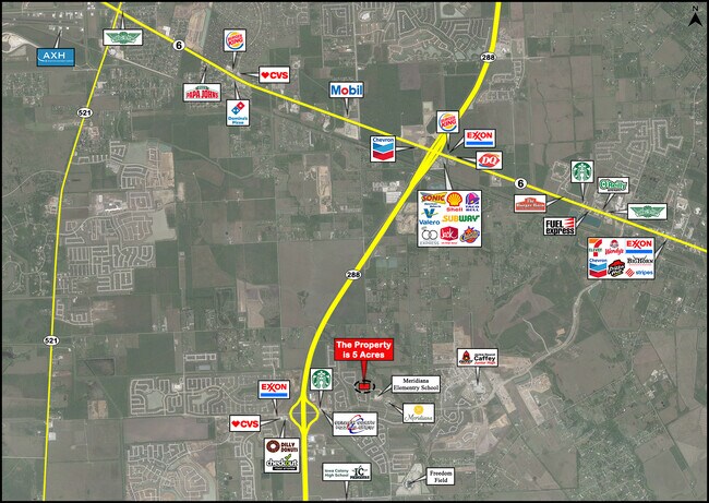
NEARBY LISTINGS FOR SALE OR LEASE
Property Detail
9618 Iowa Colony Blvd
Houston-The Woodlands-Sugar Land, TX
H T & B R R
0515-0017-110
A0515 H T & B R R TRACT 6-7 (PT) ACRES 3.00
Agriculturalland
Brazoria
AE
Texas
48039C0110K
17.05 AC
2024
South Hwy 35
2025
Houston
661800
DEMOGRAPHICS near 9618 Iowa Colony Blvd
1 Mile
3 Mile
5 Mile
2024 Total Population
3,765
17,394
51,602
2029 Population
4,425
20,352
60,593
Pop Growth 2024-2029
+ 17.53%
+ 17.01%
+ 17.42%
Average Age
37
34
34
2024 Total Households
1,240
5,500
16,171
HH Growth 2024-2029
+ 17.66%
+ 17.18%
+ 17.64%
Median Household Inc
$103,611
$87,526
$86,426
Avg Household Size
3.00
3.10
3.10
2024 Avg HH Vehicles
2.00
2.00
2.00
Median Home Value
$359,245
$304,124
$270,737
Median Year Built
2011
2011
2010
Nearby Places
Map Layers
Map Styles
 Street
 Aerial
- Restaurants
- Banks
- Shops
- Fitness
- Groceries
PUBLIC TRANSPORTATION
AIRPORT
William P Hobby
DRIVE
WALK
Distance
William P Hobby
33 min
20.4 mi
Freight Ports
Port of Houston
DRIVE
WALK
Distance
Port of Houston
38 min
27.2 mi
SALE & LEASE HISTORY
LISTING DATE
SALE/LEASE

Jan 14, 2021
For Sale
Nearby Properties
Address
Land Use
TOTAL SIZE
Lot Size
Zoning
Address
Land Use
TOTAL SIZE
Lot Size
Zoning
170.62 AC
Address
Land Use
TOTAL SIZE
Lot Size
Zoning
125,750 SF
28.32 AC
Address
Land Use
TOTAL SIZE
Lot Size
Zoning
115,423 SF
12.13 AC
Address
Land Use
TOTAL SIZE
Lot Size
Zoning
Address
Land Use
TOTAL SIZE
Lot Size
Zoning
199,508 SF
18.04 AC
Address
Land Use
TOTAL SIZE
Lot Size
Zoning
121,138 SF
11.52 AC
Address
Land Use
TOTAL SIZE
Lot Size
Zoning
65,012 SF
13 AC
Address
Land Use
TOTAL SIZE
Lot Size
Zoning
65,403 SF
14.65 AC
Address
Land Use
TOTAL SIZE
Lot Size
Zoning
28,708 SF
9.57 AC
Address
Land Use
TOTAL SIZE
Lot Size
Zoning
14,968 SF
1.81 AC
Address
Land Use
TOTAL SIZE
Lot Size
Zoning
214,827 SF
15.70 AC
0033
Address
Land Use
TOTAL SIZE
Lot Size
Zoning
94,094 SF
5.86 AC
Address
Land Use
TOTAL SIZE
Lot Size
Zoning
47,500 SF
Address
Land Use
TOTAL SIZE
Lot Size
Zoning
16,298 SF
2.87 AC
Address
Land Use
TOTAL SIZE
Lot Size
Zoning
75,548 SF
12.30 AC
Address
Land Use
TOTAL SIZE
Lot Size
Zoning
9,030 SF
20.41 AC
Address
Land Use
TOTAL SIZE
Lot Size
Zoning
17,250 SF
2.39 AC
Address
Land Use
TOTAL SIZE
Lot Size
Zoning
29,625 SF
2.01 AC
Address
Land Use
TOTAL SIZE
Lot Size
Zoning
7,298 SF
7.97 AC
Address
Land Use
TOTAL SIZE
Lot Size
Zoning
17,756 SF
3.27 AC
Address
Land Use
TOTAL SIZE
Lot Size
Zoning
14,726 SF
1.80 AC
Address
Land Use
TOTAL SIZE
Lot Size
Zoning
3,257 SF
105.55 AC
0428
Address
Land Use
TOTAL SIZE
Lot Size
Zoning
17,700 SF
2.59 AC
Address
Land Use
TOTAL SIZE
Lot Size
Zoning
4,743 SF
1.35 AC
Address
Land Use
TOTAL SIZE
Lot Size
Zoning
9,298 SF
3.22 AC
Address
Land Use
TOTAL SIZE
Lot Size
Zoning
4,559 SF
1.07 AC
Address
Land Use
TOTAL SIZE
Lot Size
Zoning
25,613 SF
10.11 AC
0034
Address
Land Use
TOTAL SIZE
Lot Size
Zoning
10,080 SF
4.06 AC
Address
Land Use
TOTAL SIZE
Lot Size
Zoning
7,256 SF
1.91 AC
Address
Land Use
TOTAL SIZE
Lot Size
Zoning
15,184 SF
9.86 AC
0584
The World's #1 Commercial Real Estate Marketplace
Connect with us
© 2025 CoStar Group
The information above has been obtained from sources believed reliable. While we do not doubt its accuracy we have not verified it and make no guarantee, warranty or representation about it. It is your responsibility to independently confirm its accuracy and completeness. Any projections, opinions, assumptions, or estimates used are for example only and do not represent the current or future performance of the property. The value of this transaction to you depends on tax and other factors which should be evaluated by your tax, financial, and legal advisors. You and your advisors should conduct a careful, independent investigation of the property to determine to your satisfaction the suitability of the property for your needs.