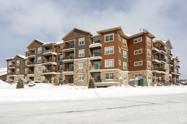
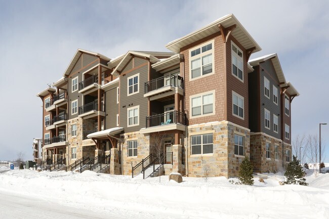
Property Record
9618 Watts Rd, Verona, WI 53593
NEARBY LISTINGS FOR SALE OR LEASE
Property Detail
9618 Watts Rd
Madison, WI
Certified Survey Map No 15161 As
0708-283-0301-9
CERTIFIED SURVEY MAP NO 15161 AS RECORDED IN DANE COUNTY REGISTER OF DEEDS IN VO L 107 PAGE 243 OF CERTIFIED SURVEYS, LOT 1.
Commercialnec
Dane
X
Wisconsin
55025C0395G
107
2024
4.45 AC
2024
Outer Verona
010802
Milwaukee/Madison
18,242 SF
DEMOGRAPHICS near 9618 Watts Rd
1 Mile
3 Mile
5 Mile
2024 Total Population
6,259
46,500
124,994
2029 Population
6,599
48,630
130,226
Pop Growth 2024-2029
+ 5.43%
+ 4.58%
+ 4.19%
Average Age
35
38
39
2024 Total Households
2,786
21,642
55,354
HH Growth 2024-2029
+ 5.53%
+ 4.57%
+ 4.30%
Median Household Inc
$134,089
$93,945
$91,730
Avg Household Size
2.20
2.10
2.20
2024 Avg HH Vehicles
2.00
2.00
2.00
Median Home Value
$440,743
$423,587
$375,450
Median Year Built
2011
2000
1991
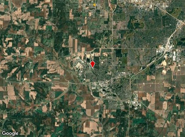
Nearby Places
Map Layers
Map Styles
 Street
 Aerial
- Restaurants
- Banks
- Shops
- Fitness
- Groceries
PUBLIC TRANSPORTATION
AIRPORT
Dane County Regional/Truax Field
DRIVE
WALK
Distance
Dane County Regional/Truax Field
35 min
17.3 mi
Freight Ports
Port Milwaukee
DRIVE
WALK
Distance
Port Milwaukee
116 min
94.0 mi
Nearby Properties
Address
Land Use
TOTAL SIZE
Lot Size
Zoning
Address
Land Use
TOTAL SIZE
Lot Size
Zoning
77,296 SF
4.84 AC
TR-U1
Address
Land Use
TOTAL SIZE
Lot Size
Zoning
27,201 SF
7.65 AC
TR-U2
Address
Land Use
TOTAL SIZE
Lot Size
Zoning
27,201 SF
10.08 AC
TR-U2
Address
Land Use
TOTAL SIZE
Lot Size
Zoning
290,535 SF
11.25 AC
PD
Address
Land Use
TOTAL SIZE
Lot Size
Zoning
244,074 SF
7.96 AC
SR-V2
Address
Land Use
TOTAL SIZE
Lot Size
Zoning
3.35 AC
Address
Land Use
TOTAL SIZE
Lot Size
Zoning
231,107 SF
4.59 AC
PD
Address
Land Use
TOTAL SIZE
Lot Size
Zoning
2.76 AC
Address
Land Use
TOTAL SIZE
Lot Size
Zoning
3.45 AC
SR-V2
Address
Land Use
TOTAL SIZE
Lot Size
Zoning
236,626 SF
5.63 AC
PD
Address
Land Use
TOTAL SIZE
Lot Size
Zoning
5.58 AC
Address
Land Use
TOTAL SIZE
Lot Size
Zoning
3.56 AC
Address
Land Use
TOTAL SIZE
Lot Size
Zoning
3.96 AC
Address
Land Use
TOTAL SIZE
Lot Size
Zoning
2.43 AC
SR-V2
Address
Land Use
TOTAL SIZE
Lot Size
Zoning
3.71 AC
Address
Land Use
TOTAL SIZE
Lot Size
Zoning
6.66 AC
Address
Land Use
TOTAL SIZE
Lot Size
Zoning
152,075 SF
3.54 AC
PD
Address
Land Use
TOTAL SIZE
Lot Size
Zoning
5.23 AC
Address
Land Use
TOTAL SIZE
Lot Size
Zoning
142,001 SF
4.18 AC
SR-V2
Address
Land Use
TOTAL SIZE
Lot Size
Zoning
20,787 SF
4.56 AC
TR-U1
Address
Land Use
TOTAL SIZE
Lot Size
Zoning
3.62 AC
Address
Land Use
TOTAL SIZE
Lot Size
Zoning
7.77 AC
Address
Land Use
TOTAL SIZE
Lot Size
Zoning
6.32 AC
Address
Land Use
TOTAL SIZE
Lot Size
Zoning
48,253 SF
1.50 AC
PD
Address
Land Use
TOTAL SIZE
Lot Size
Zoning
3.12 AC
Address
Land Use
TOTAL SIZE
Lot Size
Zoning
101,056 SF
1.94 AC
PD
Address
Land Use
TOTAL SIZE
Lot Size
Zoning
117,530 SF
2.47 AC
PD
Address
Land Use
TOTAL SIZE
Lot Size
Zoning
118,926 SF
4.80 AC
SR-V2
Address
Land Use
TOTAL SIZE
Lot Size
Zoning
147,249 SF
4.91 AC
PD
The World's #1 Commercial Real Estate Marketplace
Connect with us
© 2025 CoStar Group
The information above has been obtained from sources believed reliable. While we do not doubt its accuracy we have not verified it and make no guarantee, warranty or representation about it. It is your responsibility to independently confirm its accuracy and completeness. Any projections, opinions, assumptions, or estimates used are for example only and do not represent the current or future performance of the property. The value of this transaction to you depends on tax and other factors which should be evaluated by your tax, financial, and legal advisors. You and your advisors should conduct a careful, independent investigation of the property to determine to your satisfaction the suitability of the property for your needs.