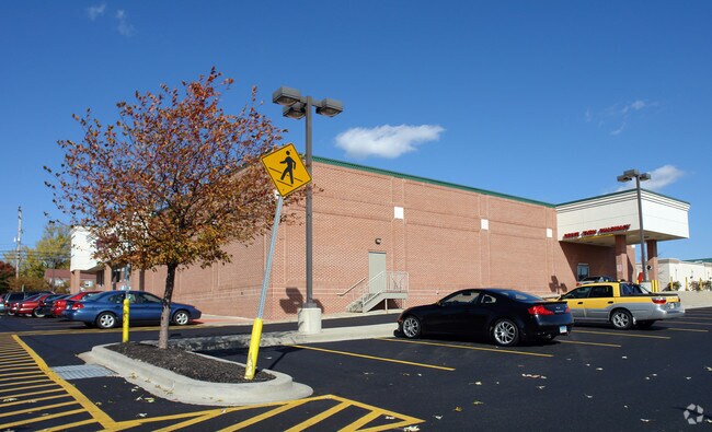
Property Record
9621 Belair Rd, Nottingham, MD 21236


NEARBY LISTINGS FOR SALE OR LEASE
Property Detail
9621 Belair Rd
Baltimore-Columbia-Towson, MD
Belair & Chapel Road
11-2300010545
1.6974 AC
Storebuilding
Baltimore
X
Maryland
2400100290G
1
2024
1.70 AC
2025
Baltimore County East
411309
Baltimore
14,712 SF
DEMOGRAPHICS near 9621 Belair Rd
1 Mile
3 Mile
5 Mile
2024 Total Population
10,633
61,060
140,374
2029 Population
10,546
60,272
138,525
Pop Growth 2024-2029
(0.82%)
(1.29%)
(1.32%)
Average Age
45
43
41
2024 Total Households
4,322
23,507
54,925
HH Growth 2024-2029
(0.88%)
(1.43%)
(1.43%)
Median Household Inc
$87,315
$99,134
$86,542
Avg Household Size
2.40
2.50
2.50
2024 Avg HH Vehicles
2.00
2.00
2.00
Median Home Value
$341,121
$338,900
$314,355
Median Year Built
1986
1986
1981
Nearby Places
Map Layers
Map Styles
 Street
 Aerial
- Restaurants
- Banks
- Shops
- Fitness
- Groceries
PUBLIC TRANSPORTATION
COMMUTER RAIL
Martin State Airport (Penn Line - Maryland Area Regional Commuter Trains (The MARC))
DRIVE
WALK
Distance
Martin State Airport (Penn Line - Maryland Area Regional Commuter Trains (The MARC))
17 min
8.4 mi
AIRPORT
Baltimore/Washington International Thurgood Marshall
DRIVE
WALK
Distance
Baltimore/Washington International Thurgood Marshall
41 min
25.7 mi
Freight Ports
Port of Baltimore
DRIVE
WALK
Distance
Port of Baltimore
31 min
19.2 mi
Nearby Properties
Address
Land Use
TOTAL SIZE
Lot Size
Zoning
Address
Land Use
TOTAL SIZE
Lot Size
Zoning
1,704,075 SF
76.16 AC
Address
Land Use
TOTAL SIZE
Lot Size
Zoning
307,785 SF
30.50 AC
ML
Address
Land Use
TOTAL SIZE
Lot Size
Zoning
527,364 SF
18.11 AC
BM
Address
Land Use
TOTAL SIZE
Lot Size
Zoning
584,740 SF
32.61 AC
Address
Land Use
TOTAL SIZE
Lot Size
Zoning
16.08 AC
DR16
Address
Land Use
TOTAL SIZE
Lot Size
Zoning
19.93 AC
Address
Land Use
TOTAL SIZE
Lot Size
Zoning
214,738 SF
5.92 AC
Address
Land Use
TOTAL SIZE
Lot Size
Zoning
190,826 SF
9.89 AC
Address
Land Use
TOTAL SIZE
Lot Size
Zoning
240,121 SF
9.97 AC
Address
Land Use
TOTAL SIZE
Lot Size
Zoning
12.20 AC
DR16
Address
Land Use
TOTAL SIZE
Lot Size
Zoning
225,070 SF
20.65 AC
Address
Land Use
TOTAL SIZE
Lot Size
Zoning
239,798 SF
11.90 AC
Address
Land Use
TOTAL SIZE
Lot Size
Zoning
222,711 SF
39.21 AC
DR55
Address
Land Use
TOTAL SIZE
Lot Size
Zoning
9.54 AC
DR16
Address
Land Use
TOTAL SIZE
Lot Size
Zoning
7.72 AC
DR5.5
Address
Land Use
TOTAL SIZE
Lot Size
Zoning
64,480 SF
20.43 AC
Address
Land Use
TOTAL SIZE
Lot Size
Zoning
12.81 AC
DR16
Address
Land Use
TOTAL SIZE
Lot Size
Zoning
12.09 AC
DR5.5
Address
Land Use
TOTAL SIZE
Lot Size
Zoning
7.85 AC
DR5.5
Address
Land Use
TOTAL SIZE
Lot Size
Zoning
9.79 AC
DR5.5
Address
Land Use
TOTAL SIZE
Lot Size
Zoning
13,708 SF
15.67 AC
BLCCC
Address
Land Use
TOTAL SIZE
Lot Size
Zoning
10,605 SF
12.96 AC
BL
Address
Land Use
TOTAL SIZE
Lot Size
Zoning
100,725 SF
6.30 AC
BL
Address
Land Use
TOTAL SIZE
Lot Size
Zoning
10.88 AC
DR16
Address
Land Use
TOTAL SIZE
Lot Size
Zoning
82,227 SF
7.20 AC
BM
Address
Land Use
TOTAL SIZE
Lot Size
Zoning
7.16 AC
BM
Address
Land Use
TOTAL SIZE
Lot Size
Zoning
16.96 AC
DR5.5
Address
Land Use
TOTAL SIZE
Lot Size
Zoning
24.17 AC
DR5.5
Address
Land Use
TOTAL SIZE
Lot Size
Zoning
136,736 SF
9.82 AC
BM
Address
Land Use
TOTAL SIZE
Lot Size
Zoning
117,354 SF
17.74 AC
BM
The World's #1 Commercial Real Estate Marketplace
Connect with us
© 2025 CoStar Group
The information above has been obtained from sources believed reliable. While we do not doubt its accuracy we have not verified it and make no guarantee, warranty or representation about it. It is your responsibility to independently confirm its accuracy and completeness. Any projections, opinions, assumptions, or estimates used are for example only and do not represent the current or future performance of the property. The value of this transaction to you depends on tax and other factors which should be evaluated by your tax, financial, and legal advisors. You and your advisors should conduct a careful, independent investigation of the property to determine to your satisfaction the suitability of the property for your needs.