Property Record
9625 Surface Hill Rd, Mint Hill, NC 28227

NEARBY LISTINGS FOR SALE OR LEASE
Property Detail
9625 Surface Hill Rd
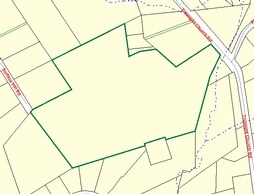
137-122-01
9625 SURFACE HILL RD
Residentialnec
Mecklenburg
AE
North Carolina
3710550300K
1
2024
29.37 AC
2025
East Charlotte
005719
Charlotte
4,144 SF
Charlotte-Concord-Gastonia, NC-SC
DEMOGRAPHICS near 9625 Surface Hill Rd
1 mile
3 mile
5 mile
2024 Total Population
2,115
37,363
102,093
2029 Population
2,243
39,889
108,655
Pop Growth 2024-2029
+ 6.05%
+ 6.76%
+ 6.43%
Average Age
43
39
39
2024 Total Households
728
12,941
36,528
HH Growth 2024-2029
+ 6.04%
+ 6.66%
+ 6.34%
Median Household Inc
$71,052
$73,610
$70,243
Avg Household Size
2.70
2.80
2.70
2024 Avg HH Vehicles
2.00
2.00
2.00
Median Home Value
$347,288
$294,718
$287,448
Median Year Built
1989
1998
1992
Nearby Places
Map Layers
Map Styles
 Street
 Aerial
Transit
 Traffic
 Biking
Places
Listings with unknown addresses are not visible on the map
- Restaurants
- Banks
- Shops
- Fitness
- Groceries
PUBLIC TRANSPORTATION
AIRPORT
Concord-Padgett Regional
Drive
Walk
Distance
Concord-Padgett Regional
27 min
18.5 mi
Charlotte/Douglas International
Drive
Walk
Distance
Charlotte/Douglas International
39 min
20.7 mi
Freight Ports
North Charleston Terminal
Drive
Walk
Distance
North Charleston Terminal
247 min
214.3 mi
Nearby Properties
Address
Land Use
TOTAL SIZE
Lot Size
Zoning
Address
Land Use
TOTAL SIZE
Lot Size
Zoning
261,708 SF
34.03 AC
Address
Land Use
TOTAL SIZE
Lot Size
Zoning
539,702 SF
83.70 AC
I
Address
Land Use
TOTAL SIZE
Lot Size
Zoning
290,268 SF
19.96 AC
R17MFCD
Address
Land Use
TOTAL SIZE
Lot Size
Zoning
187,371 SF
7.31 AC
Address
Land Use
TOTAL SIZE
Lot Size
Zoning
333,774 SF
64.04 AC
I
Address
Land Use
TOTAL SIZE
Lot Size
Zoning
96,071 SF
7.44 AC
Address
Land Use
TOTAL SIZE
Lot Size
Zoning
239,983 SF
21.41 AC
I-G(CD)
Address
Land Use
TOTAL SIZE
Lot Size
Zoning
78,372 SF
14.08 AC
IGCUD
Address
Land Use
TOTAL SIZE
Lot Size
Zoning
58,134 SF
5.08 AC
IGCUD
Address
Land Use
TOTAL SIZE
Lot Size
Zoning
104,386 SF
13 AC
R4
Address
Land Use
TOTAL SIZE
Lot Size
Zoning
86,432 SF
20.01 AC
I
Address
Land Use
TOTAL SIZE
Lot Size
Zoning
40,890 SF
2.92 AC
O-A DO-B(C
Address
Land Use
TOTAL SIZE
Lot Size
Zoning
80,888 SF
8.20 AC
Address
Land Use
TOTAL SIZE
Lot Size
Zoning
67,080 SF
7.99 AC
Address
Land Use
TOTAL SIZE
Lot Size
Zoning
146,650 SF
15.45 AC
CC
Address
Land Use
TOTAL SIZE
Lot Size
Zoning
124,191 SF
13.86 AC
CC
Address
Land Use
TOTAL SIZE
Lot Size
Zoning
104,214 SF
1.69 AC
MUDD-O
Address
Land Use
TOTAL SIZE
Lot Size
Zoning
120,944 SF
16.40 AC
R-15(CD)
Address
Land Use
TOTAL SIZE
Lot Size
Zoning
62,619 SF
11.93 AC
I-G(CD)
Address
Land Use
TOTAL SIZE
Lot Size
Zoning
108,786 SF
9.95 AC
I1
Address
Land Use
TOTAL SIZE
Lot Size
Zoning
49,878 SF
6.11 AC
Address
Land Use
TOTAL SIZE
Lot Size
Zoning
77,876 SF
26.47 AC
R
Address
Land Use
TOTAL SIZE
Lot Size
Zoning
108,250 SF
10.07 AC
CC
Address
Land Use
TOTAL SIZE
Lot Size
Zoning
45,974 SF
9.85 AC
O-A DO-B(C
Address
Land Use
TOTAL SIZE
Lot Size
Zoning
73,255 SF
13.35 AC
R
Address
Land Use
TOTAL SIZE
Lot Size
Zoning
55,576 SF
10.80 AC
CC
Address
Land Use
TOTAL SIZE
Lot Size
Zoning
60,402 SF
10.46 AC
BP
Address
Land Use
TOTAL SIZE
Lot Size
Zoning
68,653 SF
17.30 AC
R3
Address
Land Use
TOTAL SIZE
Lot Size
Zoning
69,108 SF
14.95 AC
I-G(CD)
Address
Land Use
TOTAL SIZE
Lot Size
Zoning
54,876 SF
6.35 AC
R
The World's #1 Commercial Real Estate Marketplace
Connect with us
© 2026 CoStar Group
The information above has been obtained from sources believed reliable. While we do not doubt its accuracy we have not verified it and make no guarantee, warranty or representation about it. It is your responsibility to independently confirm its accuracy and completeness. Any projections, opinions, assumptions, or estimates used are for example only and do not represent the current or future performance of the property. The value of this transaction to you depends on tax and other factors which should be evaluated by your tax, financial, and legal advisors. You and your advisors should conduct a careful, independent investigation of the property to determine to your satisfaction the suitability of the property for your needs.