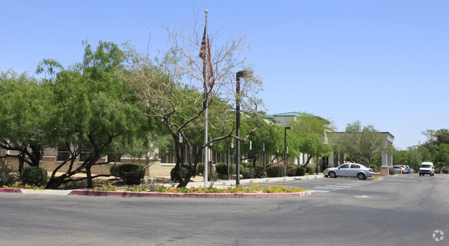
Property Record
9630 E Shea Blvd, Scottsdale, AZ 85260


Save to a Folder
{{folder.Name}}
{{folder.ListingIds.length}} Properties
{{folder.ListingIds.length}} Property
Create a New Folder
Property Detail
9630 E Shea Blvd
217-26-013A
S 495F OF W 660F EX S 65F RD & EX W 33F RD & EX 1 5F X 15F TRI IN SW COR P/D 6334/395
Orphanage
Maricopa
C-T
Arizona
C and X Area of minimal flood hazard, usually depicted on FIRMs as above the 500-year flood level.
6.19 AC
2025
Central Scottsdale
2025
Phoenix
216836
Phoenix-Mesa-Chandler, AZ
68,276 SF
NEARBY LISTINGS FOR SALE OR LEASE
-
-
View all Scottsdale listings for sale on LoopNet.com
DEMOGRAPHICS near 9630 E Shea Blvd
1 mile
3 mile
5 mile
2025 Total Population
11,244
71,971
144,880
2030 Population
11,983
75,379
152,428
Pop Growth 2025-2030
+ 6.57%
+ 4.74%
+ 5.21%
Average Age
51
47
46
2025 Total Households
5,798
33,562
66,197
HH Growth 2025-2030
+ 6.83%
+ 4.87%
+ 5.42%
Median Household Inc
$99,782
$111,841
$118,097
Avg Household Size
1.90
2.10
2.10
2025 Avg HH Vehicles
2.00
2.00
2.00
Median Home Value
$692,429
$783,808
$830,633
Median Year Built
1987
1988
1990
Nearby Places
Map Layers
Map Styles
 Street
 Aerial
Layers
 Traffic
 Biking
Places
Listings with unknown addresses are not visible on the map
- Restaurants
- Banks
- Shops
- Fitness
- Groceries
PUBLIC TRANSPORTATION
AIRPORT
Phoenix Sky Harbor International
Drive
Walk
Distance
Phoenix Sky Harbor International
26 min
18.5 mi
Phoenix-Mesa Gateway
Drive
Walk
Distance
Phoenix-Mesa Gateway
47 min
33.9 mi
Nearby Properties
Address
Land Use
TOTAL SIZE
Lot Size
Zoning
Address
Land Use
TOTAL SIZE
Lot Size
Zoning
500,010 SF
4.52 AC
PF
Address
Land Use
TOTAL SIZE
Lot Size
Zoning
6.71 AC
PAD
Address
Land Use
TOTAL SIZE
Lot Size
Zoning
623,263 SF
27.34 AC
M-H
Address
Land Use
TOTAL SIZE
Lot Size
Zoning
7,803 SF
2.31 AC
I-P
Address
Land Use
TOTAL SIZE
Lot Size
Zoning
533,288 SF
18.61 AC
I-P
Address
Land Use
TOTAL SIZE
Lot Size
Zoning
824,672 SF
11.52 AC
Address
Land Use
TOTAL SIZE
Lot Size
Zoning
124,656 SF
160 AC
R-35
Address
Land Use
TOTAL SIZE
Lot Size
Zoning
380,106 SF
38.10 AC
C-T
Address
Land Use
TOTAL SIZE
Lot Size
Zoning
355,757 SF
32.44 AC
C-R
Address
Land Use
TOTAL SIZE
Lot Size
Zoning
734,506 SF
7.75 AC
C-T
Address
Land Use
TOTAL SIZE
Lot Size
Zoning
542,795 SF
5.56 AC
PCP
Address
Land Use
TOTAL SIZE
Lot Size
Zoning
515,127 SF
7.57 AC
C-T
Address
Land Use
TOTAL SIZE
Lot Size
Zoning
250,415 SF
21 AC
I-P
Address
Land Use
TOTAL SIZE
Lot Size
Zoning
423,600 SF
5.13 AC
I1
Address
Land Use
TOTAL SIZE
Lot Size
Zoning
163,075 SF
17.77 AC
C-R
Address
Land Use
TOTAL SIZE
Lot Size
Zoning
353,691 SF
16.18 AC
M-H
Address
Land Use
TOTAL SIZE
Lot Size
Zoning
345,713 SF
18.25 AC
M-H
Address
Land Use
TOTAL SIZE
Lot Size
Zoning
247,810 SF
29.27 AC
Address
Land Use
TOTAL SIZE
Lot Size
Zoning
20,355 SF
38.96 AC
M-H
Address
Land Use
TOTAL SIZE
Lot Size
Zoning
290,758 SF
5.11 AC
C-C
Address
Land Use
TOTAL SIZE
Lot Size
Zoning
321,782 SF
7.62 AC
M-H
Address
Land Use
TOTAL SIZE
Lot Size
Zoning
283,212 SF
5.38 AC
Address
Land Use
TOTAL SIZE
Lot Size
Zoning
360,143 SF
11.88 AC
C-C
Address
Land Use
TOTAL SIZE
Lot Size
Zoning
144,102 SF
18.45 AC
R-18
Address
Land Use
TOTAL SIZE
Lot Size
Zoning
339,020 SF
15.13 AC
M-H
Address
Land Use
TOTAL SIZE
Lot Size
Zoning
256,962 SF
5.20 AC
PF
Address
Land Use
TOTAL SIZE
Lot Size
Zoning
241,967 SF
6.85 AC
Address
Land Use
TOTAL SIZE
Lot Size
Zoning
141,534 SF
6.94 AC
I-P
Address
Land Use
TOTAL SIZE
Lot Size
Zoning
361,486 SF
16.92 AC
M-H
Address
Land Use
TOTAL SIZE
Lot Size
Zoning
112,595 SF
9.28 AC
C-C
The World's #1 Commercial Real Estate Marketplace
Connect with us
© 2026 CoStar Group
The information above has been obtained from sources believed reliable. While we do not doubt its accuracy we have not verified it and make no guarantee, warranty or representation about it. It is your responsibility to independently confirm its accuracy and completeness. Any projections, opinions, assumptions, or estimates used are for example only and do not represent the current or future performance of the property. The value of this transaction to you depends on tax and other factors which should be evaluated by your tax, financial, and legal advisors. You and your advisors should conduct a careful, independent investigation of the property to determine to your satisfaction the suitability of the property for your needs.