Property Record
9632 Cline Ave, Highland, IN 46322
NEARBY LISTINGS FOR SALE OR LEASE
Property Detail
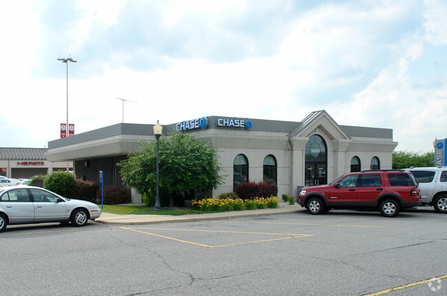
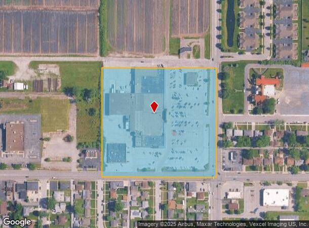
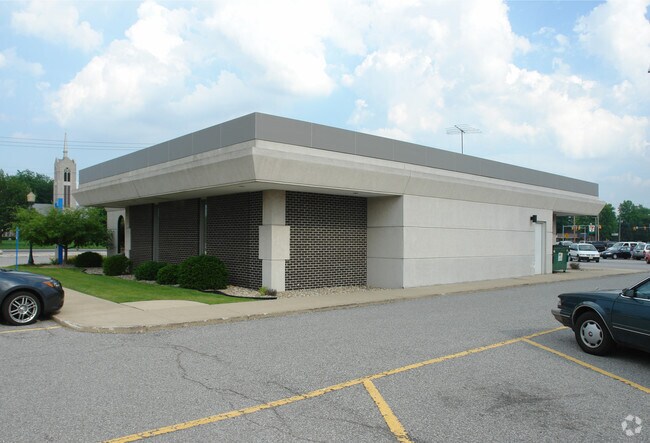
9632 Cline Ave
45-07-27-476-007.000-026
PT. E.1/2 OF SE.1/4 SE.1/4 S.27 T.36 R.9 9.6AC
Supermarket
Lake
X
Indiana
18089C0141F
1
2024
9.60 AC
2025
Indiana
040801
Chicago
111,363 SF
Chicago-Naperville-Elgin, IL-IN
DEMOGRAPHICS near 9632 Cline Ave
1 Mile
3 Mile
5 Mile
2024 Total Population
12,123
54,268
177,486
2029 Population
12,055
54,038
177,655
Pop Growth 2024-2029
(0.56%)
(0.42%)
+ 0.10%
Average Age
41
41
41
2024 Total Households
4,952
22,603
70,979
HH Growth 2024-2029
(0.63%)
(0.50%)
+ 0.05%
Median Household Inc
$73,326
$67,926
$62,982
Avg Household Size
2.40
2.40
2.40
2024 Avg HH Vehicles
2.00
2.00
2.00
Median Home Value
$189,250
$193,600
$193,778
Median Year Built
1964
1966
1967
Nearby Places
Map Layers
Map Styles
 Street
 Aerial
- Restaurants
- Banks
- Shops
- Fitness
- Groceries
PUBLIC TRANSPORTATION
COMMUTER RAIL
Dyer Amtrak (Cardinal - Amtrak)
DRIVE
WALK
Distance
Dyer Amtrak (Cardinal - Amtrak)
15 min
6.1 mi
Clark Road (Gary) Station (South Shore Line - Northern Indiana Commuter Transportation District (South Shore Line))
DRIVE
WALK
Distance
Clark Road (Gary) Station (South Shore Line - Northern Indiana Commuter Transportation District (South Shore Line))
12 min
6.7 mi
AIRPORT
Chicago Midway International
DRIVE
WALK
Distance
Chicago Midway International
48 min
31.8 mi
Freight Ports
Port Milwaukee
DRIVE
WALK
Distance
Port Milwaukee
148 min
115.9 mi
Nearby Properties
Address
Land Use
TOTAL SIZE
Lot Size
Zoning
Address
Land Use
TOTAL SIZE
Lot Size
Zoning
233,023 SF
37.73 AC
Address
Land Use
TOTAL SIZE
Lot Size
Zoning
233,767 SF
37.03 AC
Address
Land Use
TOTAL SIZE
Lot Size
Zoning
168,766 SF
19.16 AC
Address
Land Use
TOTAL SIZE
Lot Size
Zoning
130,558 SF
9.89 AC
R33
Address
Land Use
TOTAL SIZE
Lot Size
Zoning
190,457 SF
10.63 AC
Address
Land Use
TOTAL SIZE
Lot Size
Zoning
214,752 SF
10.41 AC
R3
Address
Land Use
TOTAL SIZE
Lot Size
Zoning
153,073 SF
4.88 AC
Address
Land Use
TOTAL SIZE
Lot Size
Zoning
80,444 SF
13.41 AC
R3
Address
Land Use
TOTAL SIZE
Lot Size
Zoning
77,091 SF
2.08 AC
Address
Land Use
TOTAL SIZE
Lot Size
Zoning
233,769 SF
29.04 AC
R3
Address
Land Use
TOTAL SIZE
Lot Size
Zoning
217,104 SF
10.45 AC
Address
Land Use
TOTAL SIZE
Lot Size
Zoning
79,169 SF
2.76 AC
Address
Land Use
TOTAL SIZE
Lot Size
Zoning
105,000 SF
2.90 AC
Address
Land Use
TOTAL SIZE
Lot Size
Zoning
64,971 SF
6.98 AC
Address
Land Use
TOTAL SIZE
Lot Size
Zoning
34,116 SF
73.40 AC
Address
Land Use
TOTAL SIZE
Lot Size
Zoning
79,059 SF
7.07 AC
R3
Address
Land Use
TOTAL SIZE
Lot Size
Zoning
100,000 SF
7.29 AC
R3
Address
Land Use
TOTAL SIZE
Lot Size
Zoning
167,108 SF
10.18 AC
Address
Land Use
TOTAL SIZE
Lot Size
Zoning
105,671 SF
11.35 AC
R33
Address
Land Use
TOTAL SIZE
Lot Size
Zoning
69,576 SF
2.55 AC
Address
Land Use
TOTAL SIZE
Lot Size
Zoning
53,096 SF
8.64 AC
R3
Address
Land Use
TOTAL SIZE
Lot Size
Zoning
60,234 SF
9.01 AC
Address
Land Use
TOTAL SIZE
Lot Size
Zoning
68.50 AC
Address
Land Use
TOTAL SIZE
Lot Size
Zoning
33,920 SF
83.34 AC
Address
Land Use
TOTAL SIZE
Lot Size
Zoning
39,814 SF
2.49 AC
Address
Land Use
TOTAL SIZE
Lot Size
Zoning
55,656 SF
1.99 AC
R3
Address
Land Use
TOTAL SIZE
Lot Size
Zoning
148,851 SF
20.81 AC
Address
Land Use
TOTAL SIZE
Lot Size
Zoning
74,229 SF
10.04 AC
Address
Land Use
TOTAL SIZE
Lot Size
Zoning
28,138 SF
2.33 AC
R33
Address
Land Use
TOTAL SIZE
Lot Size
Zoning
61,425 SF
3.29 AC
The World's #1 Commercial Real Estate Marketplace
Connect with us
© 2026 CoStar Group
The information above has been obtained from sources believed reliable. While we do not doubt its accuracy we have not verified it and make no guarantee, warranty or representation about it. It is your responsibility to independently confirm its accuracy and completeness. Any projections, opinions, assumptions, or estimates used are for example only and do not represent the current or future performance of the property. The value of this transaction to you depends on tax and other factors which should be evaluated by your tax, financial, and legal advisors. You and your advisors should conduct a careful, independent investigation of the property to determine to your satisfaction the suitability of the property for your needs.