Property Record
96335 Dawson Rd, Brookings, OR 97415


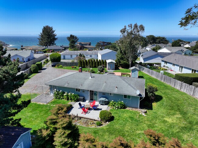
Property Detail
96335 Dawson Rd
R13804
ACRES 0.46
Sfr
Curry
X
Oregon
41015C1230F
0.46 AC
2025
Oregon West Area
2025
Other Market Areas
950301
Brookings, OR
1,040 SF
NEARBY LISTINGS FOR SALE OR LEASE
-
-
View all Brookings listings for sale on LoopNet.com
DEMOGRAPHICS near 96335 Dawson Rd
1 mile
3 mile
5 mile
2024 Total Population
1,452
8,710
13,925
2029 Population
1,515
9,031
14,443
Pop Growth 2024-2029
+ 4.34%
+ 3.69%
+ 3.72%
Average Age
50
47
50
2024 Total Households
654
3,855
6,441
HH Growth 2024-2029
+ 4.59%
+ 3.81%
+ 3.79%
Median Household Inc
$111,983
$73,676
$64,589
Avg Household Size
2.20
2.20
2.10
2024 Avg HH Vehicles
3.00
2.00
2.00
Median Home Value
$445,302
$378,724
$378,051
Median Year Built
1993
1988
1989
Nearby Places
Map Layers
Map Styles
 Street
 Aerial
Transit
 Traffic
 Biking
Places
Listings with unknown addresses are not visible on the map
- Restaurants
- Banks
- Shops
- Fitness
- Groceries
SALE & LEASE HISTORY
LISTING DATE
SALE/LEASE

Mar 17, 2025
For Sale
Nearby Properties
Address
Land Use
TOTAL SIZE
Lot Size
Zoning
Address
Land Use
TOTAL SIZE
Lot Size
Zoning
Address
Land Use
TOTAL SIZE
Lot Size
Zoning
17.11 AC
M2
Address
Land Use
TOTAL SIZE
Lot Size
Zoning
17.11 AC
C3
Address
Land Use
TOTAL SIZE
Lot Size
Zoning
85.33 AC
RI/I/C-4
Address
Land Use
TOTAL SIZE
Lot Size
Zoning
24,939 SF
1.24 AC
C4
Address
Land Use
TOTAL SIZE
Lot Size
Zoning
10.67 AC
M2
Address
Land Use
TOTAL SIZE
Lot Size
Zoning
31,375 SF
2.91 AC
IP
Address
Land Use
TOTAL SIZE
Lot Size
Zoning
52,416 SF
5.39 AC
R2
Address
Land Use
TOTAL SIZE
Lot Size
Zoning
1.38 AC
C3
Address
Land Use
TOTAL SIZE
Lot Size
Zoning
26,343 SF
2.66 AC
C4
Address
Land Use
TOTAL SIZE
Lot Size
Zoning
21,026 SF
16.96 AC
R-1-6
Address
Land Use
TOTAL SIZE
Lot Size
Zoning
17.11 AC
M2
Address
Land Use
TOTAL SIZE
Lot Size
Zoning
1,536 SF
1.28 AC
R3
Address
Land Use
TOTAL SIZE
Lot Size
Zoning
30,322 SF
1.66 AC
C3
Address
Land Use
TOTAL SIZE
Lot Size
Zoning
11,113 SF
0.90 AC
R2
Address
Land Use
TOTAL SIZE
Lot Size
Zoning
1,820 SF
1.35 AC
C3
Address
Land Use
TOTAL SIZE
Lot Size
Zoning
8,055 SF
0.64 AC
R2
Address
Land Use
TOTAL SIZE
Lot Size
Zoning
2.11 AC
R3
Address
Land Use
TOTAL SIZE
Lot Size
Zoning
1.80 AC
PO-1
Address
Land Use
TOTAL SIZE
Lot Size
Zoning
16,277 SF
5 AC
FG
Address
Land Use
TOTAL SIZE
Lot Size
Zoning
7,168 SF
1.43 AC
C4
Address
Land Use
TOTAL SIZE
Lot Size
Zoning
1,502 SF
139 AC
P/OS
Address
Land Use
TOTAL SIZE
Lot Size
Zoning
2.57 AC
C3
Address
Land Use
TOTAL SIZE
Lot Size
Zoning
5,862 SF
1.32 AC
R16
Address
Land Use
TOTAL SIZE
Lot Size
Zoning
6,566 SF
0.62 AC
R-1-6
Address
Land Use
TOTAL SIZE
Lot Size
Zoning
5,404 SF
7.24 AC
R2
Address
Land Use
TOTAL SIZE
Lot Size
Zoning
9,600 SF
5 AC
RR5
Address
Land Use
TOTAL SIZE
Lot Size
Zoning
7,542 SF
0.97 AC
R16
Address
Land Use
TOTAL SIZE
Lot Size
Zoning
10,735 SF
0.33 AC
C3
The World's #1 Commercial Real Estate Marketplace
Connect with us
© 2026 CoStar Group
The information above has been obtained from sources believed reliable. While we do not doubt its accuracy we have not verified it and make no guarantee, warranty or representation about it. It is your responsibility to independently confirm its accuracy and completeness. Any projections, opinions, assumptions, or estimates used are for example only and do not represent the current or future performance of the property. The value of this transaction to you depends on tax and other factors which should be evaluated by your tax, financial, and legal advisors. You and your advisors should conduct a careful, independent investigation of the property to determine to your satisfaction the suitability of the property for your needs.