Property Record
9637 E 71St St, Tulsa, OK 74133


Property Detail
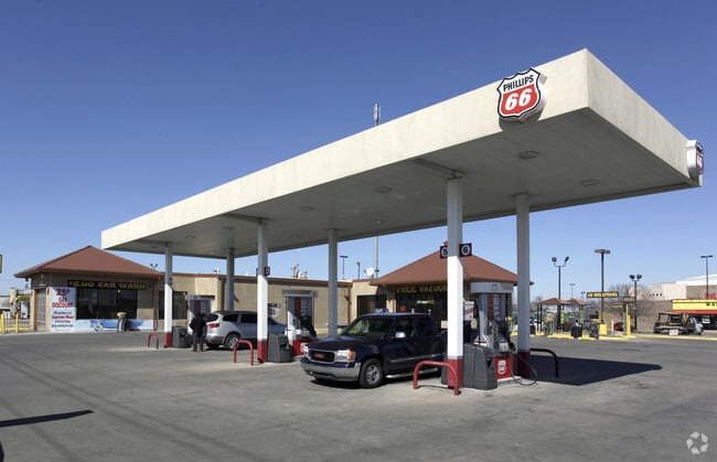
9637 E 71St St
76612-83-01-55800
LT 1 BLK 1
Restaurantbuilding
Tulsa
CS
Oklahoma
B and X Area of moderate flood hazard, usually the area between the limits of the 100-year and 500-year floods.
1
2025
0.72 AC
2025
South Central
007617
Tulsa
2,483 SF
Tulsa, OK
NEARBY LISTINGS FOR SALE OR LEASE
DEMOGRAPHICS near 9637 E 71St St
1 mile
3 mile
5 mile
2025 Total Population
12,125
86,464
245,699
2030 Population
12,455
88,642
252,168
Pop Growth 2025-2030
+ 2.72%
+ 2.52%
+ 2.63%
Average Age
37
39
39
2025 Total Households
5,727
36,627
99,418
HH Growth 2025-2030
+ 2.78%
+ 2.62%
+ 2.75%
Median Household Inc
$53,043
$68,091
$70,723
Avg Household Size
2.10
2.30
2.40
2025 Avg HH Vehicles
1.00
2.00
2.00
Median Home Value
$239,262
$257,540
$260,449
Median Year Built
1989
1985
1981
Nearby Places
Map Layers
Map Styles
 Street
 Aerial
Layers
 Traffic
 Biking
Places
Listings with unknown addresses are not visible on the map
- Restaurants
- Banks
- Shops
- Fitness
- Groceries
PUBLIC TRANSPORTATION
AIRPORT
Tulsa International
Drive
Walk
Distance
Tulsa International
21 min
14.4 mi
Freight Ports
Drive
Walk
Distance
25 min
18.1 mi
SALE & LEASE HISTORY
LISTING DATE
SALE/LEASE

Sep 24, 2016
For Sale
Nearby Properties
Address
Land Use
TOTAL SIZE
Lot Size
Zoning
Address
Land Use
TOTAL SIZE
Lot Size
Zoning
2,622,731 SF
26.90 AC
OH
Address
Land Use
TOTAL SIZE
Lot Size
Zoning
717,386 SF
49.74 AC
OL
Address
Land Use
TOTAL SIZE
Lot Size
Zoning
323,882 SF
20 AC
CO
Address
Land Use
TOTAL SIZE
Lot Size
Zoning
157,138 SF
9.28 AC
CO
Address
Land Use
TOTAL SIZE
Lot Size
Zoning
80,431 SF
9.51 AC
IL
Address
Land Use
TOTAL SIZE
Lot Size
Zoning
184,679 SF
33.97 AC
AG
Address
Land Use
TOTAL SIZE
Lot Size
Zoning
236,738 SF
11.56 AC
PUD
Address
Land Use
TOTAL SIZE
Lot Size
Zoning
304,789 SF
40.82 AC
CO
Address
Land Use
TOTAL SIZE
Lot Size
Zoning
139,648 SF
20.75 AC
RS3
Address
Land Use
TOTAL SIZE
Lot Size
Zoning
78,119 SF
11.11 AC
CO
Address
Land Use
TOTAL SIZE
Lot Size
Zoning
206,760 SF
78.45 AC
AG
Address
Land Use
TOTAL SIZE
Lot Size
Zoning
163,472 SF
29.92 AC
AG
Address
Land Use
TOTAL SIZE
Lot Size
Zoning
25,173 SF
155.93 AC
RS3
Address
Land Use
TOTAL SIZE
Lot Size
Zoning
72,042 SF
5.10 AC
RS3
Address
Land Use
TOTAL SIZE
Lot Size
Zoning
592,682 SF
30.42 AC
CO
Address
Land Use
TOTAL SIZE
Lot Size
Zoning
55,283 SF
39.50 AC
SR
Address
Land Use
TOTAL SIZE
Lot Size
Zoning
152,422 SF
44.60 AC
AG
Address
Land Use
TOTAL SIZE
Lot Size
Zoning
625 SF
78.96 AC
RS3
Address
Land Use
TOTAL SIZE
Lot Size
Zoning
33,668 SF
8.04 AC
CO
Address
Land Use
TOTAL SIZE
Lot Size
Zoning
86,747 SF
19.01 AC
RS3
Address
Land Use
TOTAL SIZE
Lot Size
Zoning
57,630 SF
35.09 AC
IL
Address
Land Use
TOTAL SIZE
Lot Size
Zoning
24,134 SF
7.47 AC
OM
Address
Land Use
TOTAL SIZE
Lot Size
Zoning
33,332 SF
2.92 AC
CO
Address
Land Use
TOTAL SIZE
Lot Size
Zoning
260,059 SF
19.99 AC
CO
Address
Land Use
TOTAL SIZE
Lot Size
Zoning
71,362 SF
14.08 AC
RD
Address
Land Use
TOTAL SIZE
Lot Size
Zoning
35,904 SF
4.08 AC
RM1
Address
Land Use
TOTAL SIZE
Lot Size
Zoning
22,594 SF
2.07 AC
ON
Address
Land Use
TOTAL SIZE
Lot Size
Zoning
59,175 SF
8.28 AC
RS3
Address
Land Use
TOTAL SIZE
Lot Size
Zoning
41,057 SF
5.45 AC
IL
Address
Land Use
TOTAL SIZE
Lot Size
Zoning
20,292 SF
48.11 AC
CO
The World's #1 Commercial Real Estate Marketplace
Connect with us
© 2026 CoStar Group
The information above has been obtained from sources believed reliable. While we do not doubt its accuracy we have not verified it and make no guarantee, warranty or representation about it. It is your responsibility to independently confirm its accuracy and completeness. Any projections, opinions, assumptions, or estimates used are for example only and do not represent the current or future performance of the property. The value of this transaction to you depends on tax and other factors which should be evaluated by your tax, financial, and legal advisors. You and your advisors should conduct a careful, independent investigation of the property to determine to your satisfaction the suitability of the property for your needs.