Property Record
9637 Highway 78, Ladson, SC 29456
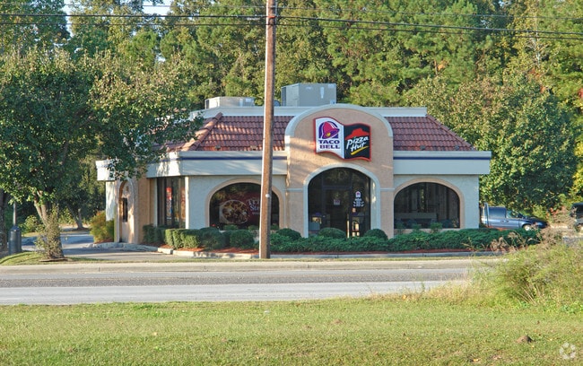

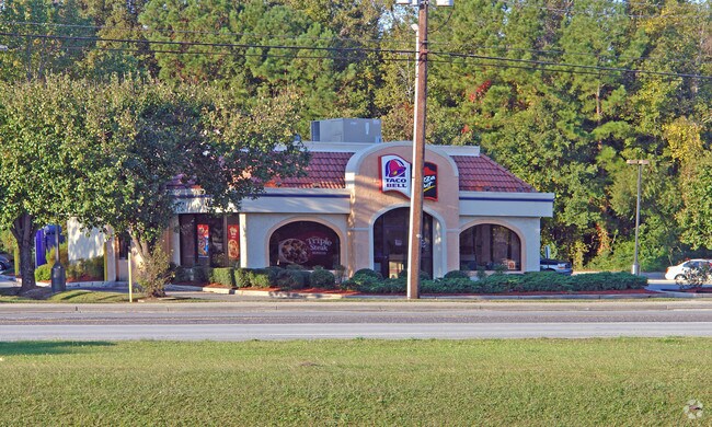
Property Detail
9637 Highway 78
390-00-00-004
SUBDIVISION NAME -LADSON DESCRIPTION -STORE #05-1196 SITE NAME -TACO BELL
Restaurantbuilding
Charleston
B and X Area of moderate flood hazard, usually the area between the limits of the 100-year and 500-year floods.
South Carolina
2025
0.75 AC
2024
North Charleston
003106
Charleston/N Charleston
1,902 SF
Charleston-North Charleston, SC
NEARBY LISTINGS FOR SALE OR LEASE
DEMOGRAPHICS near 9637 Highway 78
1 mile
3 mile
5 mile
2025 Total Population
2,707
55,753
185,156
2030 Population
2,910
60,503
201,449
Pop Growth 2025-2030
+ 7.50%
+ 8.52%
+ 8.80%
Average Age
36
38
38
2025 Total Households
1,188
21,116
71,518
HH Growth 2025-2030
+ 7.41%
+ 8.66%
+ 9.03%
Median Household Inc
$84,705
$84,681
$77,482
Avg Household Size
2.30
2.50
2.50
2025 Avg HH Vehicles
2.00
2.00
2.00
Median Home Value
$253,378
$301,712
$298,789
Median Year Built
2010
2001
1998
Nearby Places
Map Layers
Map Styles
 Street
 Aerial
Layers
 Traffic
 Biking
Places
Listings with unknown addresses are not visible on the map
- Restaurants
- Banks
- Shops
- Fitness
- Groceries
PUBLIC TRANSPORTATION
AIRPORT
Charleston AFB/International
Drive
Walk
Distance
Charleston AFB/International
19 min
11.1 mi
Freight Ports
North Charleston Terminal
Drive
Walk
Distance
North Charleston Terminal
16 min
10.3 mi
Nearby Properties
Address
Land Use
TOTAL SIZE
Lot Size
Zoning
Address
Land Use
TOTAL SIZE
Lot Size
Zoning
Address
Land Use
TOTAL SIZE
Lot Size
Zoning
1,520 SF
12 AC
BERKELEY C
Address
Land Use
TOTAL SIZE
Lot Size
Zoning
48.89 AC
Address
Land Use
TOTAL SIZE
Lot Size
Zoning
511,092 SF
53.35 AC
GOOSE CREE
Address
Land Use
TOTAL SIZE
Lot Size
Zoning
2,551 SF
12.96 AC
BERKELEY C
Address
Land Use
TOTAL SIZE
Lot Size
Zoning
1,430 SF
28.27 AC
Address
Land Use
TOTAL SIZE
Lot Size
Zoning
182,112 SF
38.64 AC
Address
Land Use
TOTAL SIZE
Lot Size
Zoning
152,460 SF
26.94 AC
Address
Land Use
TOTAL SIZE
Lot Size
Zoning
28,770 SF
15.53 AC
Address
Land Use
TOTAL SIZE
Lot Size
Zoning
14.75 AC
Address
Land Use
TOTAL SIZE
Lot Size
Zoning
16.40 AC
Address
Land Use
TOTAL SIZE
Lot Size
Zoning
16.53 AC
Address
Land Use
TOTAL SIZE
Lot Size
Zoning
1,272 SF
18.46 AC
Address
Land Use
TOTAL SIZE
Lot Size
Zoning
Address
Land Use
TOTAL SIZE
Lot Size
Zoning
33.62 AC
Address
Land Use
TOTAL SIZE
Lot Size
Zoning
14.33 AC
Address
Land Use
TOTAL SIZE
Lot Size
Zoning
33,666 SF
34.65 AC
BERKELEY C
Address
Land Use
TOTAL SIZE
Lot Size
Zoning
181,427 SF
16.47 AC
Address
Land Use
TOTAL SIZE
Lot Size
Zoning
167,144 SF
23.79 AC
GOOSE CREE
Address
Land Use
TOTAL SIZE
Lot Size
Zoning
30,716 SF
4.90 AC
GOOSE CREE
Address
Land Use
TOTAL SIZE
Lot Size
Zoning
194,515 SF
26.73 AC
Address
Land Use
TOTAL SIZE
Lot Size
Zoning
30,790 SF
7.59 AC
BERKELEY C
Address
Land Use
TOTAL SIZE
Lot Size
Zoning
1,592 SF
17.20 AC
BERKELEY C
Address
Land Use
TOTAL SIZE
Lot Size
Zoning
Address
Land Use
TOTAL SIZE
Lot Size
Zoning
22,910 SF
15.70 AC
BERKELEY C
Address
Land Use
TOTAL SIZE
Lot Size
Zoning
124,678 SF
65.93 AC
Address
Land Use
TOTAL SIZE
Lot Size
Zoning
14,725 SF
3.55 AC
Address
Land Use
TOTAL SIZE
Lot Size
Zoning
13,620 SF
9.44 AC
BERKELEY C
Address
Land Use
TOTAL SIZE
Lot Size
Zoning
11,036 SF
9.19 AC
BERKELEY C
Address
Land Use
TOTAL SIZE
Lot Size
Zoning
34,131 SF
0.89 AC
The World's #1 Commercial Real Estate Marketplace
Connect with us
© 2026 CoStar Group
The information above has been obtained from sources believed reliable. While we do not doubt its accuracy we have not verified it and make no guarantee, warranty or representation about it. It is your responsibility to independently confirm its accuracy and completeness. Any projections, opinions, assumptions, or estimates used are for example only and do not represent the current or future performance of the property. The value of this transaction to you depends on tax and other factors which should be evaluated by your tax, financial, and legal advisors. You and your advisors should conduct a careful, independent investigation of the property to determine to your satisfaction the suitability of the property for your needs.