Property Record
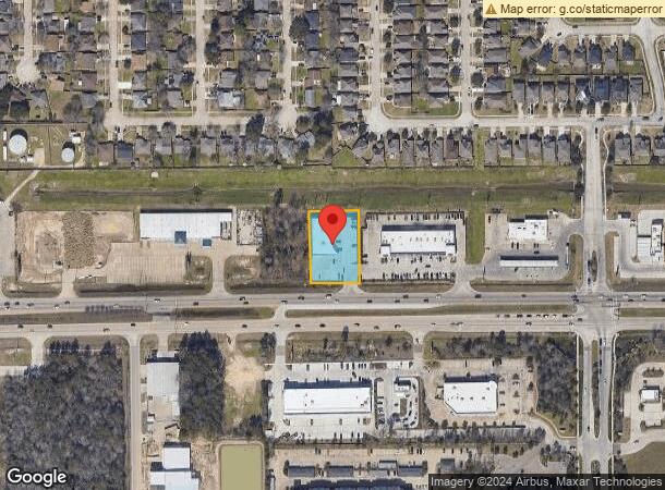
9639 Highway 242, Conroe, TX 77385

NEARBY LISTINGS FOR SALE OR LEASE
Property Detail
9639 Highway 242
0583-00-01407
Vince Richard
Commercialnec
A0583 - VINCE RICHARD, TRACT 14B-2, ACRES 0.7881
X
Montgomery
48339C0535G
Texas
2024
0.79 AC
2025
Montgomery County
692101
Houston
7,556 SF
Houston-Pasadena-The Woodlands, TX
DEMOGRAPHICS near 9639 Highway 242
1 mile
3 mile
5 mile
2024 Total Population
12,872
37,273
102,461
2029 Population
15,857
45,927
125,687
Pop Growth 2024-2029
+ 23.19%
+ 23.22%
+ 22.67%
Average Age
34
39
40
2024 Total Households
4,177
14,289
39,147
HH Growth 2024-2029
+ 23.65%
+ 23.54%
+ 23.05%
Median Household Inc
$95,598
$89,257
$105,170
Avg Household Size
3.00
2.60
2.60
2024 Avg HH Vehicles
2.00
2.00
2.00
Median Home Value
$274,077
$299,882
$326,009
Median Year Built
2010
2009
2005
Nearby Places
Map Layers
Map Styles
 Street
 Aerial
Transit
 Traffic
 Biking
Places
Listings with unknown addresses are not visible on the map
- Restaurants
- Banks
- Shops
- Fitness
- Groceries
PUBLIC TRANSPORTATION
AIRPORT
George Bush Intcntl/Houston
Drive
Walk
Distance
George Bush Intcntl/Houston
32 min
25.4 mi
Freight Ports
Port of Houston
Drive
Walk
Distance
Port of Houston
55 min
41.2 mi
SALE & LEASE HISTORY
LISTING DATE
SALE/LEASE

Nov 12, 2019
For Lease
Mar 28, 2017
For Lease
Jun 02, 2020
For Lease
Feb 04, 2020
For Lease
Dec 09, 2024
For Lease
Aug 22, 2017
For Lease
Nearby Properties
Address
Land Use
TOTAL SIZE
Lot Size
Zoning
Address
Land Use
TOTAL SIZE
Lot Size
Zoning
1,416,950 SF
21.80 AC
Address
Land Use
TOTAL SIZE
Lot Size
Zoning
743,246 SF
40.65 AC
Address
Land Use
TOTAL SIZE
Lot Size
Zoning
465,986 SF
21.55 AC
Address
Land Use
TOTAL SIZE
Lot Size
Zoning
813,318 SF
20.95 AC
Address
Land Use
TOTAL SIZE
Lot Size
Zoning
565,113 SF
4.52 AC
Address
Land Use
TOTAL SIZE
Lot Size
Zoning
370,039 SF
40.66 AC
Address
Land Use
TOTAL SIZE
Lot Size
Zoning
535,690 SF
15.89 AC
Address
Land Use
TOTAL SIZE
Lot Size
Zoning
109,842 SF
25.58 AC
Address
Land Use
TOTAL SIZE
Lot Size
Zoning
579,596 SF
1.32 AC
Address
Land Use
TOTAL SIZE
Lot Size
Zoning
880,985 SF
99.32 AC
6
Address
Land Use
TOTAL SIZE
Lot Size
Zoning
189,537 SF
13.52 AC
Address
Land Use
TOTAL SIZE
Lot Size
Zoning
315,885 SF
17.41 AC
Address
Land Use
TOTAL SIZE
Lot Size
Zoning
344,233 SF
15.24 AC
Address
Land Use
TOTAL SIZE
Lot Size
Zoning
477,509 SF
41.53 AC
Address
Land Use
TOTAL SIZE
Lot Size
Zoning
269,565 SF
14.58 AC
Address
Land Use
TOTAL SIZE
Lot Size
Zoning
427,151 SF
17.98 AC
Address
Land Use
TOTAL SIZE
Lot Size
Zoning
291,173 SF
17.77 AC
6
Address
Land Use
TOTAL SIZE
Lot Size
Zoning
221,485 SF
12.36 AC
Address
Land Use
TOTAL SIZE
Lot Size
Zoning
221,955 SF
7.71 AC
Address
Land Use
TOTAL SIZE
Lot Size
Zoning
261,490 SF
125.16 AC
6
Address
Land Use
TOTAL SIZE
Lot Size
Zoning
217,654 SF
9.81 AC
Address
Land Use
TOTAL SIZE
Lot Size
Zoning
158,093 SF
13.88 AC
Address
Land Use
TOTAL SIZE
Lot Size
Zoning
433,143 SF
42.01 AC
6
Address
Land Use
TOTAL SIZE
Lot Size
Zoning
124,616 SF
0.81 AC
Address
Land Use
TOTAL SIZE
Lot Size
Zoning
181,860 SF
22.85 AC
6
Address
Land Use
TOTAL SIZE
Lot Size
Zoning
311,767 SF
32 AC
Address
Land Use
TOTAL SIZE
Lot Size
Zoning
371,718 SF
3.43 AC
Address
Land Use
TOTAL SIZE
Lot Size
Zoning
106,524 SF
5.85 AC
Address
Land Use
TOTAL SIZE
Lot Size
Zoning
54,470 SF
9.02 AC
Address
Land Use
TOTAL SIZE
Lot Size
Zoning
56,150 SF
8.92 AC
6
The World's #1 Commercial Real Estate Marketplace
Connect with us
© 2026 CoStar Group
The information above has been obtained from sources believed reliable. While we do not doubt its accuracy we have not verified it and make no guarantee, warranty or representation about it. It is your responsibility to independently confirm its accuracy and completeness. Any projections, opinions, assumptions, or estimates used are for example only and do not represent the current or future performance of the property. The value of this transaction to you depends on tax and other factors which should be evaluated by your tax, financial, and legal advisors. You and your advisors should conduct a careful, independent investigation of the property to determine to your satisfaction the suitability of the property for your needs.