Property Record
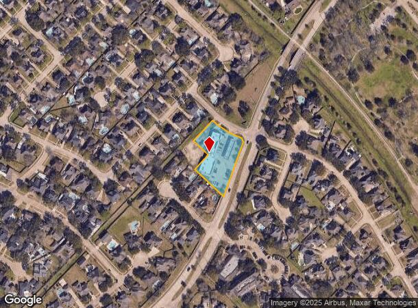
9639 Scarsdale Blvd, Pearland, TX 77581


NEARBY LISTINGS FOR SALE OR LEASE
Property Detail
9639 Scarsdale Blvd
1331510010001
Adam Center
Servicestationmarket
RES A BLK 1 ADAM CENTER
X
Harris
48167C0005G
Texas
2024
1.18 AC
2025
Southeast Outlier
350102
Houston
9,862 SF
Houston-The Woodlands-Sugar Land, TX
DEMOGRAPHICS near 9639 Scarsdale Blvd
1 Mile
3 Mile
5 Mile
2024 Total Population
14,256
90,522
209,423
2029 Population
14,379
93,920
216,958
Pop Growth 2024-2029
+ 0.86%
+ 3.75%
+ 3.60%
Average Age
41
38
37
2024 Total Households
4,554
30,238
71,439
HH Growth 2024-2029
+ 0.79%
+ 3.91%
+ 3.67%
Median Household Inc
$101,602
$92,300
$77,574
Avg Household Size
3.10
2.90
2.90
2024 Avg HH Vehicles
2.00
2.00
2.00
Median Home Value
$260,441
$246,602
$233,739
Median Year Built
2000
1990
1988
Nearby Places
Map Layers
Map Styles
 Street
 Aerial
- Restaurants
- Banks
- Shops
- Fitness
- Groceries
PUBLIC TRANSPORTATION
AIRPORT
William P Hobby
DRIVE
WALK
Distance
William P Hobby
17 min
7.2 mi
George Bush Intcntl/Houston
DRIVE
WALK
Distance
George Bush Intcntl/Houston
50 min
39.2 mi
Freight Ports
Port of Houston
DRIVE
WALK
Distance
Port of Houston
26 min
16.1 mi
SALE & LEASE HISTORY
LISTING DATE
SALE/LEASE

Sep 30, 2020
For Lease
Nearby Properties
Address
Land Use
TOTAL SIZE
Lot Size
Zoning
Address
Land Use
TOTAL SIZE
Lot Size
Zoning
236,642 SF
11.48 AC
Address
Land Use
TOTAL SIZE
Lot Size
Zoning
309,102 SF
16.81 AC
Address
Land Use
TOTAL SIZE
Lot Size
Zoning
334,780 SF
13.48 AC
Address
Land Use
TOTAL SIZE
Lot Size
Zoning
128,754 SF
14.83 AC
Address
Land Use
TOTAL SIZE
Lot Size
Zoning
97,736 SF
16.49 AC
Address
Land Use
TOTAL SIZE
Lot Size
Zoning
279,627 SF
15.98 AC
Address
Land Use
TOTAL SIZE
Lot Size
Zoning
72,543 SF
22.64 AC
Address
Land Use
TOTAL SIZE
Lot Size
Zoning
245,028 SF
12.44 AC
Address
Land Use
TOTAL SIZE
Lot Size
Zoning
102,056 SF
5.59 AC
Address
Land Use
TOTAL SIZE
Lot Size
Zoning
125,028 SF
5.59 AC
Address
Land Use
TOTAL SIZE
Lot Size
Zoning
144,879 SF
8.91 AC
Address
Land Use
TOTAL SIZE
Lot Size
Zoning
110,990 SF
18.25 AC
Address
Land Use
TOTAL SIZE
Lot Size
Zoning
242,528 SF
9.61 AC
Address
Land Use
TOTAL SIZE
Lot Size
Zoning
89.23 AC
Address
Land Use
TOTAL SIZE
Lot Size
Zoning
273,091 SF
10.75 AC
Address
Land Use
TOTAL SIZE
Lot Size
Zoning
155,524 SF
7.86 AC
Address
Land Use
TOTAL SIZE
Lot Size
Zoning
48,708 SF
3.73 AC
Address
Land Use
TOTAL SIZE
Lot Size
Zoning
233,622 SF
8.60 AC
Address
Land Use
TOTAL SIZE
Lot Size
Zoning
148,902 SF
11.40 AC
Address
Land Use
TOTAL SIZE
Lot Size
Zoning
111,642 SF
9.53 AC
Address
Land Use
TOTAL SIZE
Lot Size
Zoning
173,324 SF
7.09 AC
Address
Land Use
TOTAL SIZE
Lot Size
Zoning
134,596 SF
7.21 AC
Address
Land Use
TOTAL SIZE
Lot Size
Zoning
99,042 SF
13 AC
MFRM
Address
Land Use
TOTAL SIZE
Lot Size
Zoning
173,718 SF
7.74 AC
Address
Land Use
TOTAL SIZE
Lot Size
Zoning
229,097 SF
22.66 AC
Address
Land Use
TOTAL SIZE
Lot Size
Zoning
14.50 AC
Address
Land Use
TOTAL SIZE
Lot Size
Zoning
163,325 SF
10 AC
Address
Land Use
TOTAL SIZE
Lot Size
Zoning
67,595 SF
4.97 AC
Address
Land Use
TOTAL SIZE
Lot Size
Zoning
83,995 SF
21.74 AC
CSC
Address
Land Use
TOTAL SIZE
Lot Size
Zoning
112,800 SF
3.20 AC
The World's #1 Commercial Real Estate Marketplace
Connect with us
© 2025 CoStar Group
The information above has been obtained from sources believed reliable. While we do not doubt its accuracy we have not verified it and make no guarantee, warranty or representation about it. It is your responsibility to independently confirm its accuracy and completeness. Any projections, opinions, assumptions, or estimates used are for example only and do not represent the current or future performance of the property. The value of this transaction to you depends on tax and other factors which should be evaluated by your tax, financial, and legal advisors. You and your advisors should conduct a careful, independent investigation of the property to determine to your satisfaction the suitability of the property for your needs.