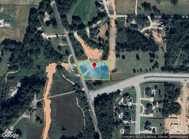
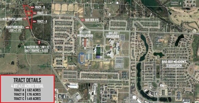
Property Record
964 N Maestri Rd, Tontitown, AR 72762

NEARBY LISTINGS FOR SALE OR LEASE
Property Detail
964 N Maestri Rd
Fayetteville-Springdale-Rogers, AR-MO
Springdale Outlots
815-30834-300
ANNEXED TO THE CITY OF SPRINGDALE FOR 2011 & FOLLOWING YEARS PER ANNEXATION ORDER NO. 4462 PT NE SE 1.50 AC FURTHER DESCRIBED
Residentialacreage
Washington
X
Arkansas
05143C0055G
1.50 AC
2025
Outlying Washington Cnty
2025
Fayetteville/Springdale/Rogers
010501
DEMOGRAPHICS near 964 N Maestri Rd
1 Mile
3 Mile
5 Mile
2024 Total Population
1,980
18,702
57,525
2029 Population
2,191
20,957
63,881
Pop Growth 2024-2029
+ 10.66%
+ 12.06%
+ 11.05%
Average Age
37
38
37
2024 Total Households
758
6,706
19,881
HH Growth 2024-2029
+ 10.82%
+ 12.38%
+ 11.34%
Median Household Inc
$83,680
$82,257
$76,967
Avg Household Size
2.60
2.70
2.80
2024 Avg HH Vehicles
2.00
2.00
2.00
Median Home Value
$347,500
$315,939
$254,758
Median Year Built
2010
2006
1996
Nearby Places
Map Layers
Map Styles
 Street
 Aerial
- Restaurants
- Banks
- Shops
- Fitness
- Groceries
PUBLIC TRANSPORTATION
AIRPORT
Northwest Arkansas Ntl
DRIVE
WALK
Distance
Northwest Arkansas Ntl
23 min
9.3 mi
Freight Ports
Tulsa Port of Inola
DRIVE
WALK
Distance
Tulsa Port of Inola
96 min
82.9 mi
SALE & LEASE HISTORY
LISTING DATE
SALE/LEASE

Sep 24, 2016
For Sale
Mar 29, 2023
For Sale
Apr 26, 2018
For Sale
Nearby Properties
Address
Land Use
TOTAL SIZE
Lot Size
Zoning
Address
Land Use
TOTAL SIZE
Lot Size
Zoning
54,448 SF
19.43 AC
Address
Land Use
TOTAL SIZE
Lot Size
Zoning
75,774 SF
16.49 AC
Address
Land Use
TOTAL SIZE
Lot Size
Zoning
181,734 SF
21.02 AC
Address
Land Use
TOTAL SIZE
Lot Size
Zoning
15,347 SF
6.27 AC
Address
Land Use
TOTAL SIZE
Lot Size
Zoning
81,000 SF
7.01 AC
Address
Land Use
TOTAL SIZE
Lot Size
Zoning
112,817 SF
9.57 AC
Address
Land Use
TOTAL SIZE
Lot Size
Zoning
196,657 SF
18.82 AC
Address
Land Use
TOTAL SIZE
Lot Size
Zoning
176,204 SF
7.57 AC
Address
Land Use
TOTAL SIZE
Lot Size
Zoning
89,280 SF
12.22 AC
Address
Land Use
TOTAL SIZE
Lot Size
Zoning
32,124 SF
6.58 AC
Address
Land Use
TOTAL SIZE
Lot Size
Zoning
140,755 SF
14.15 AC
Address
Land Use
TOTAL SIZE
Lot Size
Zoning
229,158 SF
21.23 AC
C2
Address
Land Use
TOTAL SIZE
Lot Size
Zoning
167,040 SF
19.98 AC
Address
Land Use
TOTAL SIZE
Lot Size
Zoning
21,208 SF
1.89 AC
C2
Address
Land Use
TOTAL SIZE
Lot Size
Zoning
85,874 SF
2.76 AC
Address
Land Use
TOTAL SIZE
Lot Size
Zoning
16,760 SF
2.96 AC
Address
Land Use
TOTAL SIZE
Lot Size
Zoning
31,150 SF
3.74 AC
C1
Address
Land Use
TOTAL SIZE
Lot Size
Zoning
100,690 SF
3.79 AC
C2
Address
Land Use
TOTAL SIZE
Lot Size
Zoning
51,336 SF
4.19 AC
Address
Land Use
TOTAL SIZE
Lot Size
Zoning
72,866 SF
7.14 AC
Address
Land Use
TOTAL SIZE
Lot Size
Zoning
Address
Land Use
TOTAL SIZE
Lot Size
Zoning
39,336 SF
5.03 AC
Address
Land Use
TOTAL SIZE
Lot Size
Zoning
47,780 SF
5.15 AC
PUD
Address
Land Use
TOTAL SIZE
Lot Size
Zoning
108,702 SF
5.36 AC
Address
Land Use
TOTAL SIZE
Lot Size
Zoning
165,271 SF
9.94 AC
Address
Land Use
TOTAL SIZE
Lot Size
Zoning
122,480 SF
7.26 AC
Address
Land Use
TOTAL SIZE
Lot Size
Zoning
58,500 SF
3.45 AC
Address
Land Use
TOTAL SIZE
Lot Size
Zoning
Address
Land Use
TOTAL SIZE
Lot Size
Zoning
64,567 SF
3.86 AC
C2
Address
Land Use
TOTAL SIZE
Lot Size
Zoning
90,582 SF
4.67 AC
The World's #1 Commercial Real Estate Marketplace
Connect with us
© 2025 CoStar Group
The information above has been obtained from sources believed reliable. While we do not doubt its accuracy we have not verified it and make no guarantee, warranty or representation about it. It is your responsibility to independently confirm its accuracy and completeness. Any projections, opinions, assumptions, or estimates used are for example only and do not represent the current or future performance of the property. The value of this transaction to you depends on tax and other factors which should be evaluated by your tax, financial, and legal advisors. You and your advisors should conduct a careful, independent investigation of the property to determine to your satisfaction the suitability of the property for your needs.