Property Record
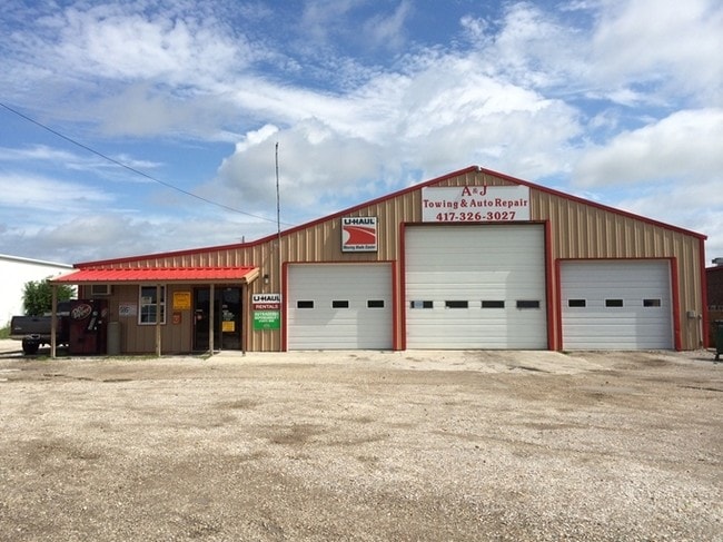
965 E Mt Gilead Rd, Bolivar, MO 65613


Property Detail
965 E Mt Gilead Rd
Springfield, MO
BOLIVAR- DCBC SUB LOT 2
8911061300000002710
Polk
Autorepair
Missouri
B and X Area of moderate flood hazard, usually the area between the limits of the 100-year and 500-year floods.
2
2024
0.61 AC
2024
Polk County
960401
Springfield
6,528 SF
NEARBY LISTINGS FOR SALE OR LEASE
-
-
View all Bolivar listings for sale on LoopNet.com
DEMOGRAPHICS near 965 E Mt Gilead Rd
1 mile
3 mile
5 mile
2025 Total Population
2,317
12,395
15,512
2030 Population
2,402
12,782
16,022
Pop Growth 2025-2030
+ 3.67%
+ 3.12%
+ 3.29%
Average Age
36
38
39
2025 Total Households
851
4,783
5,955
HH Growth 2025-2030
+ 3.88%
+ 3.22%
+ 3.39%
Median Household Inc
$48,055
$49,802
$52,848
Avg Household Size
2.30
2.40
2.40
2025 Avg HH Vehicles
2.00
2.00
2.00
Median Home Value
$252,898
$216,962
$223,467
Median Year Built
1992
1984
1985
Nearby Places
Map Layers
Map Styles
 Street
 Aerial
Transit
 Traffic
 Biking
Places
Listings with unknown addresses are not visible on the map
- Restaurants
- Banks
- Shops
- Fitness
- Groceries
PUBLIC TRANSPORTATION
AIRPORT
Springfield-Branson Ntl
Drive
Walk
Distance
Springfield-Branson Ntl
46 min
33.1 mi
SALE & LEASE HISTORY
LISTING DATE
SALE/LEASE

Sep 23, 2016
For Sale
Nearby Properties
Address
Land Use
TOTAL SIZE
Lot Size
Zoning
Address
Land Use
TOTAL SIZE
Lot Size
Zoning
51,549 SF
11.02 AC
Address
Land Use
TOTAL SIZE
Lot Size
Zoning
768 SF
10.88 AC
Address
Land Use
TOTAL SIZE
Lot Size
Zoning
127,417 SF
34.74 AC
Address
Land Use
TOTAL SIZE
Lot Size
Zoning
7,796 SF
10.88 AC
Address
Land Use
TOTAL SIZE
Lot Size
Zoning
6,000 SF
4.25 AC
Address
Land Use
TOTAL SIZE
Lot Size
Zoning
14,216 SF
2.79 AC
Address
Land Use
TOTAL SIZE
Lot Size
Zoning
999,999 SF
1.42 AC
Address
Land Use
TOTAL SIZE
Lot Size
Zoning
1,866 SF
3.13 AC
Address
Land Use
TOTAL SIZE
Lot Size
Zoning
9,000 SF
4.44 AC
Address
Land Use
TOTAL SIZE
Lot Size
Zoning
101,850 SF
7.38 AC
Address
Land Use
TOTAL SIZE
Lot Size
Zoning
20,233 SF
2.10 AC
Address
Land Use
TOTAL SIZE
Lot Size
Zoning
10,848 SF
1.77 AC
Address
Land Use
TOTAL SIZE
Lot Size
Zoning
12,116 SF
3.50 AC
Address
Land Use
TOTAL SIZE
Lot Size
Zoning
11,394 SF
14.21 AC
Address
Land Use
TOTAL SIZE
Lot Size
Zoning
7,523 SF
1.14 AC
Address
Land Use
TOTAL SIZE
Lot Size
Zoning
12,380 SF
1.86 AC
Address
Land Use
TOTAL SIZE
Lot Size
Zoning
6,893 SF
3.15 AC
Address
Land Use
TOTAL SIZE
Lot Size
Zoning
12,960 SF
1.39 AC
Address
Land Use
TOTAL SIZE
Lot Size
Zoning
5,760 SF
4.10 AC
Address
Land Use
TOTAL SIZE
Lot Size
Zoning
18,210 SF
1.86 AC
Address
Land Use
TOTAL SIZE
Lot Size
Zoning
20,944 SF
3.19 AC
Address
Land Use
TOTAL SIZE
Lot Size
Zoning
8,045 SF
1.54 AC
Address
Land Use
TOTAL SIZE
Lot Size
Zoning
800 SF
4.41 AC
Address
Land Use
TOTAL SIZE
Lot Size
Zoning
17,003 SF
0.83 AC
Address
Land Use
TOTAL SIZE
Lot Size
Zoning
10,130 SF
1.24 AC
Address
Land Use
TOTAL SIZE
Lot Size
Zoning
2,400 SF
2.26 AC
Address
Land Use
TOTAL SIZE
Lot Size
Zoning
23,100 SF
2.86 AC
Address
Land Use
TOTAL SIZE
Lot Size
Zoning
13,628 SF
1.68 AC
The World's #1 Commercial Real Estate Marketplace
Connect with us
© 2026 CoStar Group
The information above has been obtained from sources believed reliable. While we do not doubt its accuracy we have not verified it and make no guarantee, warranty or representation about it. It is your responsibility to independently confirm its accuracy and completeness. Any projections, opinions, assumptions, or estimates used are for example only and do not represent the current or future performance of the property. The value of this transaction to you depends on tax and other factors which should be evaluated by your tax, financial, and legal advisors. You and your advisors should conduct a careful, independent investigation of the property to determine to your satisfaction the suitability of the property for your needs.