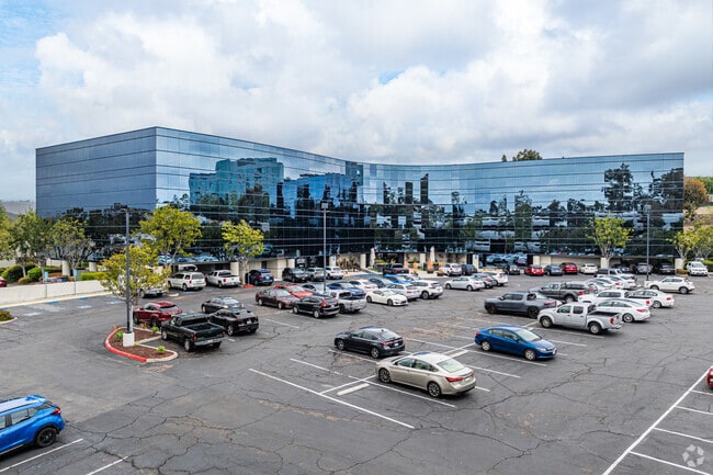
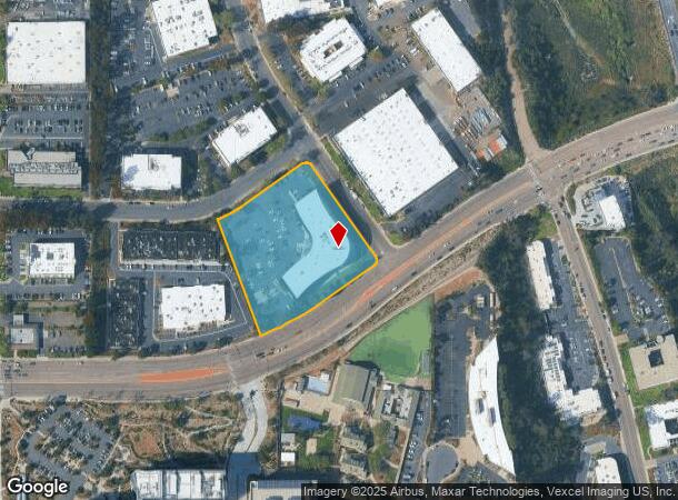
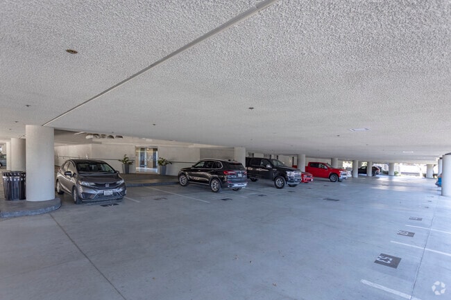
Property Record
9665 Chesapeake Dr, San Diego, CA 92123
Current Lease Availabilities
NEARBY LISTINGS FOR SALE OR LEASE
Property Detail
9665 Chesapeake Dr
San Diego-Carlsbad, CA
Hazard Comm Park
369-192-18
LOT 38 TR 008503
Storesoffices
San Diego
X
California
06073C1628H
38
2024
3.10 AC
2025
Kearny Mesa
008511
San Diego
93,535 SF
DEMOGRAPHICS near 9665 Chesapeake Dr
1 Mile
3 Mile
5 Mile
2024 Total Population
6,397
71,544
243,997
2029 Population
6,621
71,468
243,463
Pop Growth 2024-2029
+ 3.50%
(0.11%)
(0.22%)
Average Age
36
37
38
2024 Total Households
2,966
27,478
95,754
HH Growth 2024-2029
+ 3.51%
(0.15%)
(0.24%)
Median Household Inc
$109,046
$97,165
$96,119
Avg Household Size
2.10
2.50
2.40
2024 Avg HH Vehicles
2.00
2.00
2.00
Median Home Value
$689,800
$740,261
$753,954
Median Year Built
2006
1980
1975
Nearby Places
Map Layers
Map Styles
 Street
 Aerial
- Restaurants
- Banks
- Shops
- Fitness
- Groceries
PUBLIC TRANSPORTATION
COMMUTER RAIL
Old Town Transit Center (Coaster - San Diego North County Transit District (Coaster/Sprinter/Breeze))
DRIVE
WALK
Distance
Old Town Transit Center (Coaster - San Diego North County Transit District (Coaster/Sprinter/Breeze))
15 min
9.2 mi
Sorrento Valley (Coaster - San Diego North County Transit District (Coaster/Sprinter/Breeze))
DRIVE
WALK
Distance
Sorrento Valley (Coaster - San Diego North County Transit District (Coaster/Sprinter/Breeze))
15 min
9.8 mi
AIRPORT
San Diego International
DRIVE
WALK
Distance
San Diego International
17 min
10.0 mi
Nearby Properties
Address
Land Use
TOTAL SIZE
Lot Size
Zoning
Address
Land Use
TOTAL SIZE
Lot Size
Zoning
19.04 AC
IL-2-1
Address
Land Use
TOTAL SIZE
Lot Size
Zoning
4,774 SF
74.75 AC
RM-2-5
Address
Land Use
TOTAL SIZE
Lot Size
Zoning
189,644 SF
20.49 AC
CO-1-2
Address
Land Use
TOTAL SIZE
Lot Size
Zoning
17.88 AC
CO-1-2
Address
Land Use
TOTAL SIZE
Lot Size
Zoning
46.03 AC
IH-2-1
Address
Land Use
TOTAL SIZE
Lot Size
Zoning
5.93 AC
CC-1-3
Address
Land Use
TOTAL SIZE
Lot Size
Zoning
5.09 AC
CC-3-8
Address
Land Use
TOTAL SIZE
Lot Size
Zoning
9.90 AC
RM-3-7
Address
Land Use
TOTAL SIZE
Lot Size
Zoning
18.10 AC
RM-2-5
Address
Land Use
TOTAL SIZE
Lot Size
Zoning
7.48 AC
RM-3-9
Address
Land Use
TOTAL SIZE
Lot Size
Zoning
13.45 AC
IL-2-1
Address
Land Use
TOTAL SIZE
Lot Size
Zoning
5.39 AC
CO-1-2
Address
Land Use
TOTAL SIZE
Lot Size
Zoning
7.50 AC
IL-2-1
Address
Land Use
TOTAL SIZE
Lot Size
Zoning
94,500 SF
9.96 AC
IL-3-1
Address
Land Use
TOTAL SIZE
Lot Size
Zoning
11.78 AC
CC-1-3
Address
Land Use
TOTAL SIZE
Lot Size
Zoning
5.87 AC
IL-2-1
Address
Land Use
TOTAL SIZE
Lot Size
Zoning
14,940 SF
3.24 AC
CO-1-2
Address
Land Use
TOTAL SIZE
Lot Size
Zoning
2.63 AC
CC-3-8
Address
Land Use
TOTAL SIZE
Lot Size
Zoning
3.46 AC
CC-3-8
Address
Land Use
TOTAL SIZE
Lot Size
Zoning
15.06 AC
RM-1-3
Address
Land Use
TOTAL SIZE
Lot Size
Zoning
17.07 AC
IL-2-1
Address
Land Use
TOTAL SIZE
Lot Size
Zoning
19.56 AC
RM-2-5
Address
Land Use
TOTAL SIZE
Lot Size
Zoning
10 AC
IL-2-1
Address
Land Use
TOTAL SIZE
Lot Size
Zoning
1.13 AC
CC-1-3
Address
Land Use
TOTAL SIZE
Lot Size
Zoning
5.67 AC
IP-2-1
Address
Land Use
TOTAL SIZE
Lot Size
Zoning
19 AC
IL-2-1
Address
Land Use
TOTAL SIZE
Lot Size
Zoning
4.51 AC
CC-1-3
Address
Land Use
TOTAL SIZE
Lot Size
Zoning
13 AC
IL-2-1
Address
Land Use
TOTAL SIZE
Lot Size
Zoning
12.46 AC
IL-3-1
Address
Land Use
TOTAL SIZE
Lot Size
Zoning
91,959 SF
2.16 AC
CO-1-2
The World's #1 Commercial Real Estate Marketplace
Connect with us
© 2025 CoStar Group
The information above has been obtained from sources believed reliable. While we do not doubt its accuracy we have not verified it and make no guarantee, warranty or representation about it. It is your responsibility to independently confirm its accuracy and completeness. Any projections, opinions, assumptions, or estimates used are for example only and do not represent the current or future performance of the property. The value of this transaction to you depends on tax and other factors which should be evaluated by your tax, financial, and legal advisors. You and your advisors should conduct a careful, independent investigation of the property to determine to your satisfaction the suitability of the property for your needs.