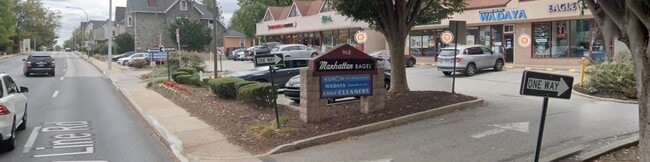
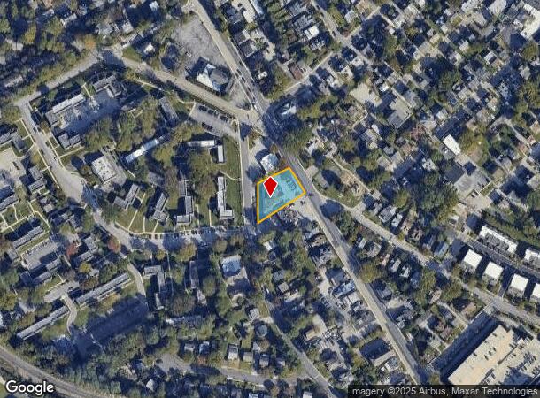
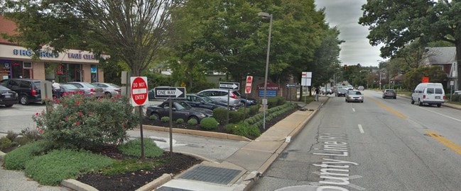
Property Record
0 County Line Rd, Bryn Mawr, PA 19010

Current Lease Availabilities
NEARBY LISTINGS FOR SALE OR LEASE
Property Detail
0 County Line Rd
36-05-02984-00
GRD 60 X 231 IRR
Restaurantbuilding
Delaware
X
Pennsylvania
42029C0175G
0.32 AC
2024
Main Line
2025
Philadelphia
205000
Philadelphia-Camden-Wilmington, PA-NJ-DE-MD
6,002 SF
DEMOGRAPHICS near 0 County Line Rd
1 Mile
3 Mile
5 Mile
2024 Total Population
15,688
77,555
256,960
2029 Population
15,770
78,034
257,935
Pop Growth 2024-2029
+ 0.52%
+ 0.62%
+ 0.38%
Average Age
36
40
40
2024 Total Households
5,237
27,331
95,653
HH Growth 2024-2029
+ 0.31%
+ 0.68%
+ 0.44%
Median Household Inc
$111,145
$137,295
$118,232
Avg Household Size
2.30
2.50
2.50
2024 Avg HH Vehicles
2.00
2.00
2.00
Median Home Value
$654,781
$620,427
$455,085
Median Year Built
1955
1955
1955
Nearby Places
- Restaurants
- Banks
- Shops
- Fitness
- Groceries
PUBLIC TRANSPORTATION
TRANSIT/SUBWAY
Bryn Mawr (Route 100 - Southeastern Pennsylvania Transportation Authority Rapid Transit (SEPTA Subway & Trolley))
DRIVE
WALK
Distance
Bryn Mawr (Route 100 - Southeastern Pennsylvania Transportation Authority Rapid Transit (SEPTA Subway & Trolley))
1 min
6 min
0.3 mi
Rosemont (Norristown High Speed Line - SEPTA, Route 100 - SEPTA)
DRIVE
WALK
Distance
Rosemont (Norristown High Speed Line - SEPTA, Route 100 - SEPTA)
1 min
6 min
0.3 mi
Bryn Mawr - Nhsl (Norristown High Speed Line - SEPTA)
DRIVE
WALK
Distance
Bryn Mawr - Nhsl (Norristown High Speed Line - SEPTA)
1 min
6 min
0.3 mi
Garrett Hill Station (Route 100 - Southeastern Pennsylvania Transportation Authority Rapid Transit (SEPTA Subway & Trolley))
DRIVE
WALK
Distance
Garrett Hill Station (Route 100 - Southeastern Pennsylvania Transportation Authority Rapid Transit (SEPTA Subway & Trolley))
3 min
18 min
1.0 mi
Garrett Hill (Norristown High Speed Line - SEPTA)
DRIVE
WALK
Distance
Garrett Hill (Norristown High Speed Line - SEPTA)
3 min
19 min
1.0 mi
COMMUTER RAIL
Rosemont (R5 - Southeastern Pennsylvania Transportation Authority Regional Rail (SEPTA Regional Rail))
DRIVE
WALK
Distance
Rosemont (R5 - Southeastern Pennsylvania Transportation Authority Regional Rail (SEPTA Regional Rail))
2 min
10 min
0.5 mi
Bryn Mawr (R5 - Southeastern Pennsylvania Transportation Authority Regional Rail (SEPTA Regional Rail))
DRIVE
WALK
Distance
Bryn Mawr (R5 - Southeastern Pennsylvania Transportation Authority Regional Rail (SEPTA Regional Rail))
2 min
13 min
0.7 mi
AIRPORT
Philadelphia International
DRIVE
WALK
Distance
Philadelphia International
35 min
19.5 mi
Freight Ports
South Jersey Port
DRIVE
WALK
Distance
South Jersey Port
32 min
15.5 mi
Nearby Properties
Address
Land Use
TOTAL SIZE
Lot Size
Zoning
Address
Land Use
TOTAL SIZE
Lot Size
Zoning
703,572 SF
159 AC
Address
Land Use
TOTAL SIZE
Lot Size
Zoning
10.50 AC
Address
Land Use
TOTAL SIZE
Lot Size
Zoning
222,980 SF
57.68 AC
Address
Land Use
TOTAL SIZE
Lot Size
Zoning
48,900 SF
20 AC
Address
Land Use
TOTAL SIZE
Lot Size
Zoning
398,844 SF
21.89 AC
Address
Land Use
TOTAL SIZE
Lot Size
Zoning
59,126 SF
84.57 AC
Address
Land Use
TOTAL SIZE
Lot Size
Zoning
1,174,127 SF
2 AC
C1
Address
Land Use
TOTAL SIZE
Lot Size
Zoning
1,037,806 SF
73.69 AC
R2
Address
Land Use
TOTAL SIZE
Lot Size
Zoning
350,807 SF
50 AC
R1
Address
Land Use
TOTAL SIZE
Lot Size
Zoning
479,520 SF
21.26 AC
R1
Address
Land Use
TOTAL SIZE
Lot Size
Zoning
377,851 SF
19.18 AC
R4
Address
Land Use
TOTAL SIZE
Lot Size
Zoning
112,268 SF
28.27 AC
Address
Land Use
TOTAL SIZE
Lot Size
Zoning
254,781 SF
14.62 AC
Address
Land Use
TOTAL SIZE
Lot Size
Zoning
137,282 SF
14.33 AC
Address
Land Use
TOTAL SIZE
Lot Size
Zoning
73,193 SF
37.01 AC
Address
Land Use
TOTAL SIZE
Lot Size
Zoning
92,337 SF
7.30 AC
Address
Land Use
TOTAL SIZE
Lot Size
Zoning
257,405 SF
4.26 AC
C2
Address
Land Use
TOTAL SIZE
Lot Size
Zoning
561,359 SF
48.06 AC
R1
Address
Land Use
TOTAL SIZE
Lot Size
Zoning
214,714 SF
22.23 AC
R1
Address
Land Use
TOTAL SIZE
Lot Size
Zoning
443,289 SF
41.78 AC
R2
Address
Land Use
TOTAL SIZE
Lot Size
Zoning
322,236 SF
50.80 AC
Address
Land Use
TOTAL SIZE
Lot Size
Zoning
193,290 SF
8.34 AC
Address
Land Use
TOTAL SIZE
Lot Size
Zoning
33,000 SF
1 AC
Address
Land Use
TOTAL SIZE
Lot Size
Zoning
78,250 SF
34.50 AC
Address
Land Use
TOTAL SIZE
Lot Size
Zoning
4,350 SF
20 AC
Address
Land Use
TOTAL SIZE
Lot Size
Zoning
159,248 SF
23.13 AC
Address
Land Use
TOTAL SIZE
Lot Size
Zoning
114,058 SF
3.20 AC
Address
Land Use
TOTAL SIZE
Lot Size
Zoning
342,407 SF
44 AC
Address
Land Use
TOTAL SIZE
Lot Size
Zoning
149,040 SF
7.78 AC
Address
Land Use
TOTAL SIZE
Lot Size
Zoning
112,597 SF
6.47 AC
C2
The World's #1 Commercial Real Estate Marketplace
Connect with us
© 2025 CoStar Group
The information above has been obtained from sources believed reliable. While we do not doubt its accuracy we have not verified it and make no guarantee, warranty or representation about it. It is your responsibility to independently confirm its accuracy and completeness. Any projections, opinions, assumptions, or estimates used are for example only and do not represent the current or future performance of the property. The value of this transaction to you depends on tax and other factors which should be evaluated by your tax, financial, and legal advisors. You and your advisors should conduct a careful, independent investigation of the property to determine to your satisfaction the suitability of the property for your needs.