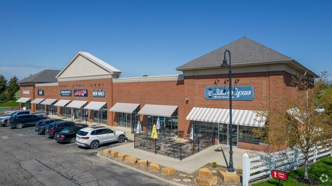
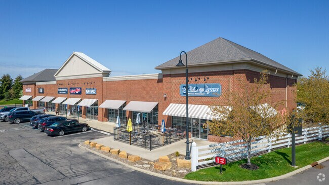
Property Record
0 Walton Pw, New Albany, OH 43054
NEARBY LISTINGS FOR SALE OR LEASE
Property Detail
0 Walton Pw
Columbus, OH
Village Of New Albany
222-004178
BEVELHYMER RD R16 T2 1/4T1 0.481 ACRE
Regionalshoppingcenterormallwithanchorstore
Franklin
2024
Ohio
2024
0.48 AC
007212
Westerville
15,582 SF
Columbus
DEMOGRAPHICS near 0 Walton Pw
1 Mile
3 Mile
5 Mile
2024 Total Population
4,208
27,570
74,020
2029 Population
4,235
27,651
74,923
Pop Growth 2024-2029
+ 0.64%
+ 0.29%
+ 1.22%
Average Age
38
38
40
2024 Total Households
1,417
11,481
31,932
HH Growth 2024-2029
+ 0.64%
+ 0.15%
+ 0.98%
Median Household Inc
$161,489
$120,611
$101,499
Avg Household Size
2.90
2.40
2.30
2024 Avg HH Vehicles
2.00
2.00
2.00
Median Home Value
$429,257
$391,940
$335,683
Median Year Built
2006
2005
2002
Nearby Places
Map Layers
Map Styles
 Street
 Aerial
- Restaurants
- Banks
- Shops
- Fitness
- Groceries
PUBLIC TRANSPORTATION
AIRPORT
John Glenn Columbus International
DRIVE
WALK
Distance
John Glenn Columbus International
18 min
10.9 mi
Rickenbacker International
DRIVE
WALK
Distance
Rickenbacker International
34 min
23.7 mi
Freight Ports
Port of Toledo
DRIVE
WALK
Distance
Port of Toledo
180 min
144.8 mi
SALE & LEASE HISTORY
LISTING DATE
SALE/LEASE

Sep 25, 2016
For Lease
Nov 07, 2019
For Lease
Jan 07, 2019
For Lease
Aug 21, 2018
For Lease
Nearby Properties
Address
Land Use
TOTAL SIZE
Lot Size
Zoning
Address
Land Use
TOTAL SIZE
Lot Size
Zoning
46,000 SF
214.46 AC
Address
Land Use
TOTAL SIZE
Lot Size
Zoning
624,564 SF
104.45 AC
Address
Land Use
TOTAL SIZE
Lot Size
Zoning
159,232 SF
66.44 AC
Address
Land Use
TOTAL SIZE
Lot Size
Zoning
696,736 SF
76.73 AC
Address
Land Use
TOTAL SIZE
Lot Size
Zoning
772,217 SF
98.64 AC
Address
Land Use
TOTAL SIZE
Lot Size
Zoning
672,706 SF
222.09 AC
Address
Land Use
TOTAL SIZE
Lot Size
Zoning
271,758 SF
63.69 AC
Address
Land Use
TOTAL SIZE
Lot Size
Zoning
1,435,497 SF
234.05 AC
Address
Land Use
TOTAL SIZE
Lot Size
Zoning
163,020 SF
35 AC
Address
Land Use
TOTAL SIZE
Lot Size
Zoning
253,127 SF
31.59 AC
Address
Land Use
TOTAL SIZE
Lot Size
Zoning
112,126 SF
19.09 AC
Address
Land Use
TOTAL SIZE
Lot Size
Zoning
67,754 SF
37.90 AC
Address
Land Use
TOTAL SIZE
Lot Size
Zoning
260,944 SF
17.30 AC
Address
Land Use
TOTAL SIZE
Lot Size
Zoning
122,941 SF
28.56 AC
Address
Land Use
TOTAL SIZE
Lot Size
Zoning
454,348 SF
33.34 AC
Address
Land Use
TOTAL SIZE
Lot Size
Zoning
541,500 SF
41.30 AC
Address
Land Use
TOTAL SIZE
Lot Size
Zoning
173,661 SF
40.94 AC
Address
Land Use
TOTAL SIZE
Lot Size
Zoning
506,879 SF
142.43 AC
Address
Land Use
TOTAL SIZE
Lot Size
Zoning
132,276 SF
36.17 AC
Address
Land Use
TOTAL SIZE
Lot Size
Zoning
62,660 SF
41.24 AC
Address
Land Use
TOTAL SIZE
Lot Size
Zoning
195,837 SF
31.48 AC
Address
Land Use
TOTAL SIZE
Lot Size
Zoning
754,614 SF
63.55 AC
Address
Land Use
TOTAL SIZE
Lot Size
Zoning
217.82 AC
Address
Land Use
TOTAL SIZE
Lot Size
Zoning
250,496 SF
15.13 AC
Address
Land Use
TOTAL SIZE
Lot Size
Zoning
315,599 SF
25.76 AC
Address
Land Use
TOTAL SIZE
Lot Size
Zoning
74,620 SF
9.03 AC
Address
Land Use
TOTAL SIZE
Lot Size
Zoning
45,849 SF
29.64 AC
Address
Land Use
TOTAL SIZE
Lot Size
Zoning
1,469 SF
197.34 AC
Address
Land Use
TOTAL SIZE
Lot Size
Zoning
416,945 SF
15.01 AC
Address
Land Use
TOTAL SIZE
Lot Size
Zoning
100,116 SF
18.80 AC
The World's #1 Commercial Real Estate Marketplace
Connect with us
© 2025 CoStar Group
The information above has been obtained from sources believed reliable. While we do not doubt its accuracy we have not verified it and make no guarantee, warranty or representation about it. It is your responsibility to independently confirm its accuracy and completeness. Any projections, opinions, assumptions, or estimates used are for example only and do not represent the current or future performance of the property. The value of this transaction to you depends on tax and other factors which should be evaluated by your tax, financial, and legal advisors. You and your advisors should conduct a careful, independent investigation of the property to determine to your satisfaction the suitability of the property for your needs.