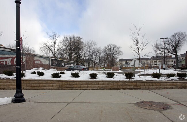
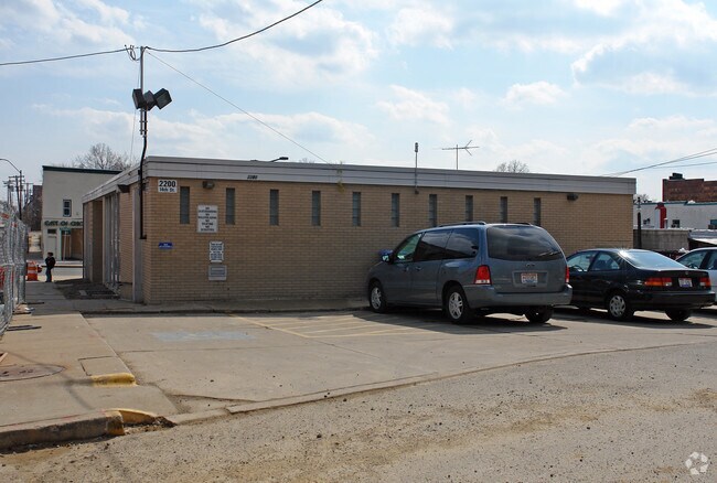
Property Record
969 Kenmore Blvd, Akron, OH 44314

Property Detail
969 Kenmore Blvd
Akron, OH
KENMORE LOT 609 610 ALL & VAC PARCEL AUD#10655
67-02012
SUMMIT
Countyproperty
Ohio
B and X Area of moderate flood hazard, usually the area between the limits of the 100-year and 500-year floods.
609
2023
0.21 AC
2025
Akron
505400
Cleveland
7,482 SF
NEARBY LISTINGS FOR SALE OR LEASE
-
-
View all Akron listings for sale on LoopNet.com
DEMOGRAPHICS near 969 Kenmore Blvd
1 mile
3 mile
5 mile
2025 Total Population
11,661
75,559
175,977
2030 Population
11,684
75,953
176,894
Pop Growth 2025-2030
+ 0.20%
+ 0.52%
+ 0.52%
Average Age
39
40
40
2025 Total Households
4,880
32,801
75,954
HH Growth 2025-2030
+ 0.12%
+ 0.46%
+ 0.48%
Median Household Inc
$43,871
$45,191
$46,980
Avg Household Size
2.30
2.20
2.20
2025 Avg HH Vehicles
2.00
1.00
2.00
Median Home Value
$74,574
$110,098
$137,638
Median Year Built
1948
1952
1953
Nearby Places
Map Layers
Map Styles
 Street
 Aerial
Transit
 Traffic
 Biking
Places
Listings with unknown addresses are not visible on the map
- Restaurants
- Banks
- Shops
- Fitness
- Groceries
PUBLIC TRANSPORTATION
COMMUTER RAIL
Drive
Walk
Distance
11 min
5.0 mi
Drive
Walk
Distance
17 min
7.6 mi
AIRPORT
Akron-Canton Regional
Drive
Walk
Distance
Akron-Canton Regional
21 min
13.7 mi
Cleveland-Hopkins International
Drive
Walk
Distance
Cleveland-Hopkins International
57 min
40.2 mi
Nearby Properties
Address
Land Use
TOTAL SIZE
Lot Size
Zoning
Address
Land Use
TOTAL SIZE
Lot Size
Zoning
1,397,532 SF
92.95 AC
Address
Land Use
TOTAL SIZE
Lot Size
Zoning
148,212 SF
2.84 AC
Address
Land Use
TOTAL SIZE
Lot Size
Zoning
348,519 SF
7.45 AC
Address
Land Use
TOTAL SIZE
Lot Size
Zoning
472,380 SF
4.55 AC
Address
Land Use
TOTAL SIZE
Lot Size
Zoning
252,222 SF
12.65 AC
Address
Land Use
TOTAL SIZE
Lot Size
Zoning
203,458 SF
10.41 AC
Address
Land Use
TOTAL SIZE
Lot Size
Zoning
9.19 AC
Address
Land Use
TOTAL SIZE
Lot Size
Zoning
92,152 SF
1.69 AC
Address
Land Use
TOTAL SIZE
Lot Size
Zoning
121,738 SF
1.60 AC
Address
Land Use
TOTAL SIZE
Lot Size
Zoning
246,312 SF
17.50 AC
Address
Land Use
TOTAL SIZE
Lot Size
Zoning
132,611 SF
3.56 AC
Address
Land Use
TOTAL SIZE
Lot Size
Zoning
257,958 SF
4.64 AC
Address
Land Use
TOTAL SIZE
Lot Size
Zoning
91,678 SF
5.24 AC
Address
Land Use
TOTAL SIZE
Lot Size
Zoning
423,125 SF
5.57 AC
Address
Land Use
TOTAL SIZE
Lot Size
Zoning
166,625 SF
11.37 AC
Address
Land Use
TOTAL SIZE
Lot Size
Zoning
3.16 AC
Address
Land Use
TOTAL SIZE
Lot Size
Zoning
227,634 SF
21.46 AC
Address
Land Use
TOTAL SIZE
Lot Size
Zoning
233,762 SF
3.56 AC
Address
Land Use
TOTAL SIZE
Lot Size
Zoning
2.20 AC
Address
Land Use
TOTAL SIZE
Lot Size
Zoning
184,791 SF
3.25 AC
Address
Land Use
TOTAL SIZE
Lot Size
Zoning
154,926 SF
12.38 AC
Address
Land Use
TOTAL SIZE
Lot Size
Zoning
127,297 SF
6.03 AC
Address
Land Use
TOTAL SIZE
Lot Size
Zoning
Address
Land Use
TOTAL SIZE
Lot Size
Zoning
121,006 SF
6.09 AC
Address
Land Use
TOTAL SIZE
Lot Size
Zoning
97,322 SF
1.42 AC
Address
Land Use
TOTAL SIZE
Lot Size
Zoning
57,180 SF
6.67 AC
Address
Land Use
TOTAL SIZE
Lot Size
Zoning
49,278 SF
1.25 AC
Address
Land Use
TOTAL SIZE
Lot Size
Zoning
123,800 SF
76.50 AC
Address
Land Use
TOTAL SIZE
Lot Size
Zoning
54,398 SF
8.10 AC
Address
Land Use
TOTAL SIZE
Lot Size
Zoning
The World's #1 Commercial Real Estate Marketplace
Connect with us
© 2026 CoStar Group
The information above has been obtained from sources believed reliable. While we do not doubt its accuracy we have not verified it and make no guarantee, warranty or representation about it. It is your responsibility to independently confirm its accuracy and completeness. Any projections, opinions, assumptions, or estimates used are for example only and do not represent the current or future performance of the property. The value of this transaction to you depends on tax and other factors which should be evaluated by your tax, financial, and legal advisors. You and your advisors should conduct a careful, independent investigation of the property to determine to your satisfaction the suitability of the property for your needs.