Property Record
969 Rancheros Dr, San Marcos, CA 92069


NEARBY LISTINGS FOR SALE OR LEASE
Property Detail
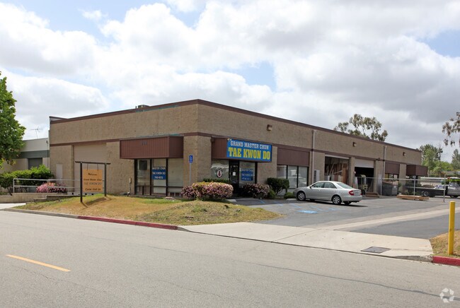
969 Rancheros Dr
San Diego-Carlsbad, CA
Dolphin Indust Park
226-692-11
LOT 22 TR 008881
Lightindustrial
San Diego
X
California
06073C0794G
22
2024
0.50 AC
2025
San Marcos
020025
San Diego
DEMOGRAPHICS near 969 Rancheros Dr
1 Mile
3 Mile
5 Mile
2024 Total Population
11,477
98,733
237,620
2029 Population
11,371
98,033
235,128
Pop Growth 2024-2029
(0.92%)
(0.71%)
(1.05%)
Average Age
41
38
38
2024 Total Households
4,041
33,027
76,192
HH Growth 2024-2029
(0.99%)
(0.90%)
(1.19%)
Median Household Inc
$80,054
$83,697
$81,609
Avg Household Size
2.70
2.90
3.00
2024 Avg HH Vehicles
2.00
2.00
2.00
Median Home Value
$655,676
$666,807
$691,522
Median Year Built
1980
1984
1982
Nearby Places
Map Layers
Map Styles
 Street
 Aerial
- Restaurants
- Banks
- Shops
- Fitness
- Groceries
PUBLIC TRANSPORTATION
TRANSIT/SUBWAY
Nordahl Road (Sprinter - San Diego North County Transit District (Coaster/Sprinter/Breeze))
DRIVE
WALK
Distance
Nordahl Road (Sprinter - San Diego North County Transit District (Coaster/Sprinter/Breeze))
1 min
13 min
0.7 mi
AIRPORT
San Diego International
DRIVE
WALK
Distance
San Diego International
43 min
32.6 mi
Freight Ports
Port of San Diego
DRIVE
WALK
Distance
Port of San Diego
46 min
34.8 mi
SALE & LEASE HISTORY
LISTING DATE
SALE/LEASE

Jul 06, 2020
For Lease
Aug 30, 2023
For Lease
Nearby Properties
Address
Land Use
TOTAL SIZE
Lot Size
Zoning
Address
Land Use
TOTAL SIZE
Lot Size
Zoning
27.98 AC
SPA
Address
Land Use
TOTAL SIZE
Lot Size
Zoning
14.98 AC
R-1-10
Address
Land Use
TOTAL SIZE
Lot Size
Zoning
9.77 AC
PD-R-18
Address
Land Use
TOTAL SIZE
Lot Size
Zoning
15.37 AC
SPA
Address
Land Use
TOTAL SIZE
Lot Size
Zoning
10.82 AC
SPA
Address
Land Use
TOTAL SIZE
Lot Size
Zoning
Address
Land Use
TOTAL SIZE
Lot Size
Zoning
71,656 SF
S-P
Address
Land Use
TOTAL SIZE
Lot Size
Zoning
Address
Land Use
TOTAL SIZE
Lot Size
Zoning
9.88 AC
R-3-10
Address
Land Use
TOTAL SIZE
Lot Size
Zoning
SPECIFIC P
Address
Land Use
TOTAL SIZE
Lot Size
Zoning
75,138 SF
C
Address
Land Use
TOTAL SIZE
Lot Size
Zoning
80,064 SF
1.53 AC
S-P
Address
Land Use
TOTAL SIZE
Lot Size
Zoning
7.90 AC
PD-C
Address
Land Use
TOTAL SIZE
Lot Size
Zoning
Address
Land Use
TOTAL SIZE
Lot Size
Zoning
5.94 AC
PD-R-24
Address
Land Use
TOTAL SIZE
Lot Size
Zoning
99,461 SF
4.89 AC
SPA
Address
Land Use
TOTAL SIZE
Lot Size
Zoning
10.80 AC
SPA
Address
Land Use
TOTAL SIZE
Lot Size
Zoning
1.94 AC
C
Address
Land Use
TOTAL SIZE
Lot Size
Zoning
8.30 AC
R-2-12
Address
Land Use
TOTAL SIZE
Lot Size
Zoning
Address
Land Use
TOTAL SIZE
Lot Size
Zoning
97,874 SF
8.47 AC
R-2-12
Address
Land Use
TOTAL SIZE
Lot Size
Zoning
1.49 AC
SPA
Address
Land Use
TOTAL SIZE
Lot Size
Zoning
13.99 AC
PD-C
Address
Land Use
TOTAL SIZE
Lot Size
Zoning
7.06 AC
SR
Address
Land Use
TOTAL SIZE
Lot Size
Zoning
6.24 AC
R-3-18
Address
Land Use
TOTAL SIZE
Lot Size
Zoning
95,713 SF
0.51 AC
C
Address
Land Use
TOTAL SIZE
Lot Size
Zoning
97,090 SF
5.38 AC
R-3-18
Address
Land Use
TOTAL SIZE
Lot Size
Zoning
10.69 AC
R-3-10
Address
Land Use
TOTAL SIZE
Lot Size
Zoning
16.12 AC
SPA
Address
Land Use
TOTAL SIZE
Lot Size
Zoning
10.83 AC
SPA
The World's #1 Commercial Real Estate Marketplace
Connect with us
© 2025 CoStar Group
The information above has been obtained from sources believed reliable. While we do not doubt its accuracy we have not verified it and make no guarantee, warranty or representation about it. It is your responsibility to independently confirm its accuracy and completeness. Any projections, opinions, assumptions, or estimates used are for example only and do not represent the current or future performance of the property. The value of this transaction to you depends on tax and other factors which should be evaluated by your tax, financial, and legal advisors. You and your advisors should conduct a careful, independent investigation of the property to determine to your satisfaction the suitability of the property for your needs.