Property Record
9697 Ne Jacksonville Rd, Anthony, FL 32617


Current Lease Availabilities
NEARBY LISTINGS FOR SALE OR LEASE
-
-
View all Anthony listings for lease on LoopNet.com
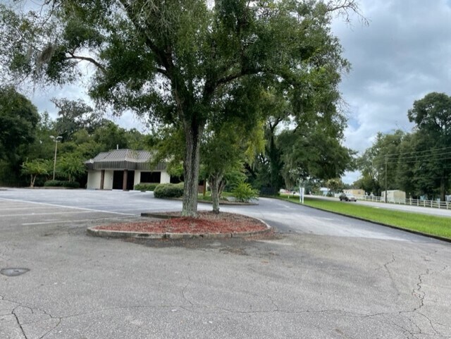
Property Detail
9697 Ne Jacksonville Rd
14179-001-00
Egress Park
Financialbuilding
SEC 09 TWP 14 RGE 22 COM AT THE SE COR OF NW 1/4 OF SEC 9 TH N 805 FT TH W 15 FT TH CONT W 161.40 FT TO THE POB TH CONT W 101.23 FT TH N 33-02-25 W 163.69 FT TH S 89-38-08 E 159.26 FT TH S 44-02-32 E 54.05 FT TO THE PT OF CURVATURE OF A 25 FT RADIUS
X
Marion
12083C0340D
Florida
2025
0.49 AC
2025
Outlying Marion County
000303
Ocala
2,314 SF
Ocala, FL
DEMOGRAPHICS near 9697 Ne Jacksonville Rd
1 Mile
3 Mile
5 Mile
2024 Total Population
1,207
6,787
23,914
2029 Population
1,338
7,570
26,741
Pop Growth 2024-2029
+ 10.85%
+ 11.54%
+ 11.82%
Average Age
39
41
41
2024 Total Households
455
2,499
8,853
HH Growth 2024-2029
+ 10.99%
+ 11.72%
+ 12.02%
Median Household Inc
$49,666
$55,000
$55,164
Avg Household Size
2.60
2.50
2.50
2024 Avg HH Vehicles
2.00
2.00
2.00
Median Home Value
$229,824
$244,743
$201,977
Median Year Built
1985
1986
1985
Nearby Places
Map Layers
Map Styles
 Street
 Aerial
- Restaurants
- Banks
- Shops
- Fitness
- Groceries
PUBLIC TRANSPORTATION
AIRPORT
Gainesville Regional
DRIVE
WALK
Distance
Gainesville Regional
57 min
37.0 mi
Freight Ports
Jacksonville Port
DRIVE
WALK
Distance
Jacksonville Port
127 min
97.2 mi
Nearby Properties
Address
Land Use
TOTAL SIZE
Lot Size
Zoning
Address
Land Use
TOTAL SIZE
Lot Size
Zoning
47,984 SF
486.37 AC
PUD
Address
Land Use
TOTAL SIZE
Lot Size
Zoning
115,909 SF
11.09 AC
RPUD
Address
Land Use
TOTAL SIZE
Lot Size
Zoning
41,195 SF
4 AC
B5
Address
Land Use
TOTAL SIZE
Lot Size
Zoning
16,430 SF
59.07 AC
A3
Address
Land Use
TOTAL SIZE
Lot Size
Zoning
27,776 SF
6.18 AC
A1
Address
Land Use
TOTAL SIZE
Lot Size
Zoning
46,609 SF
8.35 AC
B2
Address
Land Use
TOTAL SIZE
Lot Size
Zoning
79,087 SF
11.02 AC
M1
Address
Land Use
TOTAL SIZE
Lot Size
Zoning
19,802 SF
10 AC
A1
Address
Land Use
TOTAL SIZE
Lot Size
Zoning
25,250 SF
14.96 AC
A1
Address
Land Use
TOTAL SIZE
Lot Size
Zoning
13,494 SF
40.14 AC
A1
Address
Land Use
TOTAL SIZE
Lot Size
Zoning
13,973 SF
163.67 AC
A1
Address
Land Use
TOTAL SIZE
Lot Size
Zoning
21,585 SF
7.12 AC
B4
Address
Land Use
TOTAL SIZE
Lot Size
Zoning
8,479 SF
52.72 AC
A1
Address
Land Use
TOTAL SIZE
Lot Size
Zoning
16,227 SF
5.46 AC
A1
Address
Land Use
TOTAL SIZE
Lot Size
Zoning
23,303 SF
2.08 AC
B5
Address
Land Use
TOTAL SIZE
Lot Size
Zoning
29,900 SF
2.49 AC
B2
Address
Land Use
TOTAL SIZE
Lot Size
Zoning
7,013 SF
46.85 AC
A1
Address
Land Use
TOTAL SIZE
Lot Size
Zoning
27,409 SF
4.65 AC
B2
Address
Land Use
TOTAL SIZE
Lot Size
Zoning
2,832 SF
36.46 AC
GU
Address
Land Use
TOTAL SIZE
Lot Size
Zoning
13,439 SF
6.61 AC
R1
Address
Land Use
TOTAL SIZE
Lot Size
Zoning
24,540 SF
2.10 AC
B2
Address
Land Use
TOTAL SIZE
Lot Size
Zoning
12,910 SF
16.21 AC
A1
Address
Land Use
TOTAL SIZE
Lot Size
Zoning
69.91 AC
A1
Address
Land Use
TOTAL SIZE
Lot Size
Zoning
6,797 SF
69.56 AC
A1
Address
Land Use
TOTAL SIZE
Lot Size
Zoning
4,070 SF
5.08 AC
A1
Address
Land Use
TOTAL SIZE
Lot Size
Zoning
3,839 SF
4.33 AC
A1
Address
Land Use
TOTAL SIZE
Lot Size
Zoning
9,432 SF
1.03 AC
B2
Address
Land Use
TOTAL SIZE
Lot Size
Zoning
9,230 SF
1.93 AC
B4
Address
Land Use
TOTAL SIZE
Lot Size
Zoning
2.49 AC
GU
The World's #1 Commercial Real Estate Marketplace
Connect with us
© 2026 CoStar Group
The information above has been obtained from sources believed reliable. While we do not doubt its accuracy we have not verified it and make no guarantee, warranty or representation about it. It is your responsibility to independently confirm its accuracy and completeness. Any projections, opinions, assumptions, or estimates used are for example only and do not represent the current or future performance of the property. The value of this transaction to you depends on tax and other factors which should be evaluated by your tax, financial, and legal advisors. You and your advisors should conduct a careful, independent investigation of the property to determine to your satisfaction the suitability of the property for your needs.