Property Record
97 Industrial Dr, North Smithfield, RI 02896


NEARBY LISTINGS FOR SALE OR LEASE
Property Detail
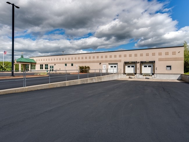
97 Industrial Dr
NSMI-000005-000073-A000000
Providence
Industrialgeneral
Rhode Island
X
73
44007C0152G
3 AC
2024
Woonsocket
2024
Providence
012803
Providence-Warwick, RI-MA
19,630 SF
DEMOGRAPHICS near 97 Industrial Dr
1 Mile
3 Mile
5 Mile
2024 Total Population
2,954
35,897
78,203
2029 Population
2,963
35,611
77,621
Pop Growth 2024-2029
+ 0.30%
(0.80%)
(0.74%)
Average Age
43
41
40
2024 Total Households
1,213
14,745
31,344
HH Growth 2024-2029
+ 0.16%
(0.92%)
(0.85%)
Median Household Inc
$95,874
$65,101
$67,542
Avg Household Size
2.40
2.40
2.40
2024 Avg HH Vehicles
2.00
2.00
2.00
Median Home Value
$379,447
$340,749
$334,835
Median Year Built
1974
1951
1957
Nearby Places
Map Layers
Map Styles
 Street
 Aerial
- Restaurants
- Banks
- Shops
- Fitness
- Groceries
PUBLIC TRANSPORTATION
AIRPORT
Rhode Island Tf Green International
DRIVE
WALK
Distance
Rhode Island Tf Green International
35 min
23.9 mi
Worcester Regional
DRIVE
WALK
Distance
Worcester Regional
42 min
29.2 mi
Freight Ports
Port of Davisville, RI
DRIVE
WALK
Distance
Port of Davisville, RI
49 min
35.8 mi
SALE & LEASE HISTORY
LISTING DATE
SALE/LEASE

Sep 24, 2016
For Sale
Aug 29, 2017
For Sale
Nearby Properties
Address
Land Use
TOTAL SIZE
Lot Size
Zoning
Address
Land Use
TOTAL SIZE
Lot Size
Zoning
602,336 SF
204.50 AC
B
Address
Land Use
TOTAL SIZE
Lot Size
Zoning
31.45 AC
M
Address
Land Use
TOTAL SIZE
Lot Size
Zoning
118,550 SF
31.97 AC
Address
Land Use
TOTAL SIZE
Lot Size
Zoning
8,930 SF
31.56 AC
R4
Address
Land Use
TOTAL SIZE
Lot Size
Zoning
150,385 SF
27.10 AC
Address
Land Use
TOTAL SIZE
Lot Size
Zoning
123,821 SF
12.40 AC
RA
Address
Land Use
TOTAL SIZE
Lot Size
Zoning
46,267 SF
1.89 AC
R4
Address
Land Use
TOTAL SIZE
Lot Size
Zoning
105,802 SF
0.94 AC
Address
Land Use
TOTAL SIZE
Lot Size
Zoning
23.36 AC
Address
Land Use
TOTAL SIZE
Lot Size
Zoning
72,880 SF
4.30 AC
BH
Address
Land Use
TOTAL SIZE
Lot Size
Zoning
115,203 SF
15.52 AC
RA
Address
Land Use
TOTAL SIZE
Lot Size
Zoning
34.30 AC
M
Address
Land Use
TOTAL SIZE
Lot Size
Zoning
28.39 AC
F5
Address
Land Use
TOTAL SIZE
Lot Size
Zoning
27,720 SF
4.36 AC
I
Address
Land Use
TOTAL SIZE
Lot Size
Zoning
96,714 SF
2.11 AC
R4
Address
Land Use
TOTAL SIZE
Lot Size
Zoning
17,748 SF
10.50 AC
REA
Address
Land Use
TOTAL SIZE
Lot Size
Zoning
60,999 SF
6.01 AC
R3
Address
Land Use
TOTAL SIZE
Lot Size
Zoning
109,351 SF
2.35 AC
MU2
Address
Land Use
TOTAL SIZE
Lot Size
Zoning
45,156 SF
0.71 AC
C1
Address
Land Use
TOTAL SIZE
Lot Size
Zoning
65,809 SF
17.66 AC
BN
Address
Land Use
TOTAL SIZE
Lot Size
Zoning
91,077 SF
2.03 AC
PR1
Address
Land Use
TOTAL SIZE
Lot Size
Zoning
36,434 SF
0.28 AC
C1
Address
Land Use
TOTAL SIZE
Lot Size
Zoning
7.45 AC
R3
Address
Land Use
TOTAL SIZE
Lot Size
Zoning
72,024 SF
3.53 AC
I1
Address
Land Use
TOTAL SIZE
Lot Size
Zoning
42,837 SF
11.32 AC
RS
Address
Land Use
TOTAL SIZE
Lot Size
Zoning
42,966 SF
5.08 AC
R2
Address
Land Use
TOTAL SIZE
Lot Size
Zoning
70,948 SF
0.86 AC
R4
Address
Land Use
TOTAL SIZE
Lot Size
Zoning
68,604 SF
8.62 AC
RA
Address
Land Use
TOTAL SIZE
Lot Size
Zoning
18.32 AC
M
Address
Land Use
TOTAL SIZE
Lot Size
Zoning
21,080 SF
34.04 AC
RA
The World's #1 Commercial Real Estate Marketplace
Connect with us
© 2026 CoStar Group
The information above has been obtained from sources believed reliable. While we do not doubt its accuracy we have not verified it and make no guarantee, warranty or representation about it. It is your responsibility to independently confirm its accuracy and completeness. Any projections, opinions, assumptions, or estimates used are for example only and do not represent the current or future performance of the property. The value of this transaction to you depends on tax and other factors which should be evaluated by your tax, financial, and legal advisors. You and your advisors should conduct a careful, independent investigation of the property to determine to your satisfaction the suitability of the property for your needs.