Property Record
97 Libbey Industrial Pkwy, East Weymouth, MA 02189


NEARBY LISTINGS FOR SALE OR LEASE
Property Detail
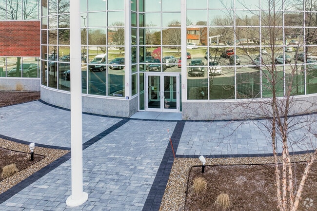
97 Libbey Industrial Pkwy
WEYM-000033-000432-000002
Norfolk
Officebuilding
Massachusetts
AE
2
25021C0229F
13.02 AC
2025
Route 3 Corridor
2025
Boston
422303
Boston-Cambridge-Newton, MA-NH
103,128 SF
DEMOGRAPHICS near 97 Libbey Industrial Pkwy
1 Mile
3 Mile
5 Mile
2024 Total Population
10,199
74,834
188,246
2029 Population
10,140
74,571
187,692
Pop Growth 2024-2029
(0.58%)
(0.35%)
(0.29%)
Average Age
41
43
42
2024 Total Households
4,602
30,913
77,221
HH Growth 2024-2029
(0.50%)
(0.35%)
(0.27%)
Median Household Inc
$89,007
$106,229
$99,347
Avg Household Size
2.10
2.40
2.40
2024 Avg HH Vehicles
2.00
2.00
2.00
Median Home Value
$433,333
$520,533
$534,728
Median Year Built
1972
1964
1963
Nearby Places
Map Layers
Map Styles
 Street
 Aerial
- Restaurants
- Banks
- Shops
- Fitness
- Groceries
PUBLIC TRANSPORTATION
COMMUTER RAIL
DRIVE
WALK
Distance
6 min
2.8 mi
East Weymouth (Greenbush Line - Massachusetts Bay Transportation Authority Commuter Rail (Purple Line))
DRIVE
WALK
Distance
East Weymouth (Greenbush Line - Massachusetts Bay Transportation Authority Commuter Rail (Purple Line))
7 min
3.2 mi
AIRPORT
General Edward Lawrence Logan International
DRIVE
WALK
Distance
General Edward Lawrence Logan International
30 min
18.6 mi
SALE & LEASE HISTORY
LISTING DATE
SALE/LEASE

Sep 14, 2020
For Lease
Sep 12, 2017
For Lease
Oct 25, 2021
For Lease
Oct 19, 2021
For Lease
Nearby Properties
Address
Land Use
TOTAL SIZE
Lot Size
Zoning
Address
Land Use
TOTAL SIZE
Lot Size
Zoning
48.16 AC
Address
Land Use
TOTAL SIZE
Lot Size
Zoning
50.61 AC
IND
Address
Land Use
TOTAL SIZE
Lot Size
Zoning
31.29 AC
100
Address
Land Use
TOTAL SIZE
Lot Size
Zoning
40,396 SF
5.56 AC
100
Address
Land Use
TOTAL SIZE
Lot Size
Zoning
Address
Land Use
TOTAL SIZE
Lot Size
Zoning
32.04 AC
Address
Land Use
TOTAL SIZE
Lot Size
Zoning
3.65 AC
100
Address
Land Use
TOTAL SIZE
Lot Size
Zoning
33.81 AC
A3
Address
Land Use
TOTAL SIZE
Lot Size
Zoning
7.62 AC
A2
Address
Land Use
TOTAL SIZE
Lot Size
Zoning
240,481 SF
25.23 AC
CL2
Address
Land Use
TOTAL SIZE
Lot Size
Zoning
168,801 SF
2.75 AC
100
Address
Land Use
TOTAL SIZE
Lot Size
Zoning
0.42 AC
A1
Address
Land Use
TOTAL SIZE
Lot Size
Zoning
172,027 SF
3.73 AC
100
Address
Land Use
TOTAL SIZE
Lot Size
Zoning
144,377 SF
9.39 AC
Address
Land Use
TOTAL SIZE
Lot Size
Zoning
170,035 SF
1.64 AC
100
Address
Land Use
TOTAL SIZE
Lot Size
Zoning
395,130 SF
6.50 AC
IND
Address
Land Use
TOTAL SIZE
Lot Size
Zoning
18.76 AC
GBD
Address
Land Use
TOTAL SIZE
Lot Size
Zoning
11.39 AC
100
Address
Land Use
TOTAL SIZE
Lot Size
Zoning
9.78 AC
M-1
Address
Land Use
TOTAL SIZE
Lot Size
Zoning
0.23 AC
A2
Address
Land Use
TOTAL SIZE
Lot Size
Zoning
80,226 SF
6.60 AC
RES
Address
Land Use
TOTAL SIZE
Lot Size
Zoning
0.16 AC
Address
Land Use
TOTAL SIZE
Lot Size
Zoning
147,069 SF
1.90 AC
Address
Land Use
TOTAL SIZE
Lot Size
Zoning
3.92 AC
R-4
Address
Land Use
TOTAL SIZE
Lot Size
Zoning
8.54 AC
100
Address
Land Use
TOTAL SIZE
Lot Size
Zoning
79,687 SF
3.52 AC
75
Address
Land Use
TOTAL SIZE
Lot Size
Zoning
2.56 AC
100
Address
Land Use
TOTAL SIZE
Lot Size
Zoning
107,410 SF
1.22 AC
85
Address
Land Use
TOTAL SIZE
Lot Size
Zoning
1.48 AC
100
Address
Land Use
TOTAL SIZE
Lot Size
Zoning
34.28 AC
85
The World's #1 Commercial Real Estate Marketplace
Connect with us
© 2025 CoStar Group
The information above has been obtained from sources believed reliable. While we do not doubt its accuracy we have not verified it and make no guarantee, warranty or representation about it. It is your responsibility to independently confirm its accuracy and completeness. Any projections, opinions, assumptions, or estimates used are for example only and do not represent the current or future performance of the property. The value of this transaction to you depends on tax and other factors which should be evaluated by your tax, financial, and legal advisors. You and your advisors should conduct a careful, independent investigation of the property to determine to your satisfaction the suitability of the property for your needs.