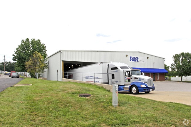
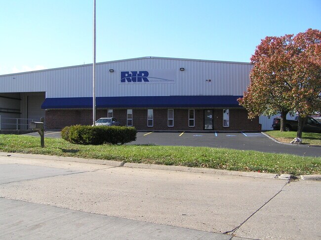
Property Record
97 N Central Dr, O Fallon, MO 63366

NEARBY LISTINGS FOR SALE OR LEASE
Property Detail
97 N Central Dr
St. Louis
North Central Ind Pk Resub Lots 8 & 9
St. Louis, MO-IL
NORTH CENTRAL IND PK RESUB LOT 8&9 BDRY ADJ LOT 8A
2-0057-A585-00-008A.0000000
St. Charles
Commercialnec
Missouri
2024
8a
2025
2.25 AC
311802
St Charles County
29,824 SF
DEMOGRAPHICS near 97 N Central Dr
1 mile
3 mile
5 mile
2024 Total Population
6,901
68,329
141,021
2029 Population
7,364
72,342
149,545
Pop Growth 2024-2029
+ 6.71%
+ 5.87%
+ 6.04%
Average Age
42
40
40
2024 Total Households
2,915
25,933
52,554
HH Growth 2024-2029
+ 6.72%
+ 5.92%
+ 6.09%
Median Household Inc
$75,602
$91,442
$99,048
Avg Household Size
2.30
2.60
2.60
2024 Avg HH Vehicles
2.00
2.00
2.00
Median Home Value
$276,670
$268,702
$284,193
Median Year Built
2001
1997
1998
Nearby Places
Map Layers
Map Styles
 Street
 Aerial
Transit
 Traffic
 Biking
Places
Listings with unknown addresses are not visible on the map
- Restaurants
- Banks
- Shops
- Fitness
- Groceries
PUBLIC TRANSPORTATION
AIRPORT
St Louis Lambert International
Drive
Walk
Distance
St Louis Lambert International
34 min
24.3 mi
Freight Ports
Tulsa Port of Inola
Drive
Walk
Distance
Tulsa Port of Inola
431 min
377.5 mi
SALE & LEASE HISTORY
LISTING DATE
SALE/LEASE

Nov 15, 2021
For Sale
Nearby Properties
Address
Land Use
TOTAL SIZE
Lot Size
Zoning
Address
Land Use
TOTAL SIZE
Lot Size
Zoning
482.60 AC
AC7
Address
Land Use
TOTAL SIZE
Lot Size
Zoning
163,438 SF
5.76 AC
Address
Land Use
TOTAL SIZE
Lot Size
Zoning
420,705 SF
37.21 AC
Address
Land Use
TOTAL SIZE
Lot Size
Zoning
254,435 SF
16.57 AC
Address
Land Use
TOTAL SIZE
Lot Size
Zoning
235,876 SF
11.35 AC
Address
Land Use
TOTAL SIZE
Lot Size
Zoning
35,670 SF
1.12 AC
Address
Land Use
TOTAL SIZE
Lot Size
Zoning
32.19 AC
AA1
Address
Land Use
TOTAL SIZE
Lot Size
Zoning
36,438 SF
2.08 AC
AC4
Address
Land Use
TOTAL SIZE
Lot Size
Zoning
167,090 SF
19.85 AC
Address
Land Use
TOTAL SIZE
Lot Size
Zoning
35,112 SF
0.88 AC
Address
Land Use
TOTAL SIZE
Lot Size
Zoning
251,169 SF
20.19 AC
Address
Land Use
TOTAL SIZE
Lot Size
Zoning
111,573 SF
19.11 AC
Address
Land Use
TOTAL SIZE
Lot Size
Zoning
210,095 SF
12.29 AC
AE9
Address
Land Use
TOTAL SIZE
Lot Size
Zoning
53,636 SF
Address
Land Use
TOTAL SIZE
Lot Size
Zoning
48.76 AC
AF0
Address
Land Use
TOTAL SIZE
Lot Size
Zoning
197,791 SF
18.58 AC
Address
Land Use
TOTAL SIZE
Lot Size
Zoning
129,472 SF
22 AC
AC2
Address
Land Use
TOTAL SIZE
Lot Size
Zoning
147,526 SF
7.51 AC
AE8
Address
Land Use
TOTAL SIZE
Lot Size
Zoning
40,804 SF
7.98 AC
Address
Land Use
TOTAL SIZE
Lot Size
Zoning
57.96 AC
Address
Land Use
TOTAL SIZE
Lot Size
Zoning
49,680 SF
1.15 AC
Address
Land Use
TOTAL SIZE
Lot Size
Zoning
9,890 SF
1.51 AC
Address
Land Use
TOTAL SIZE
Lot Size
Zoning
124,076 SF
11.47 AC
Address
Land Use
TOTAL SIZE
Lot Size
Zoning
Address
Land Use
TOTAL SIZE
Lot Size
Zoning
139,792 SF
16.47 AC
AB2
Address
Land Use
TOTAL SIZE
Lot Size
Zoning
109,821 SF
5 AC
AC7
Address
Land Use
TOTAL SIZE
Lot Size
Zoning
41.41 AC
AD9
Address
Land Use
TOTAL SIZE
Lot Size
Zoning
10.41 AC
Address
Land Use
TOTAL SIZE
Lot Size
Zoning
35.34 AC
Address
Land Use
TOTAL SIZE
Lot Size
Zoning
69,500 SF
9.39 AC
The World's #1 Commercial Real Estate Marketplace
Connect with us
© 2026 CoStar Group
The information above has been obtained from sources believed reliable. While we do not doubt its accuracy we have not verified it and make no guarantee, warranty or representation about it. It is your responsibility to independently confirm its accuracy and completeness. Any projections, opinions, assumptions, or estimates used are for example only and do not represent the current or future performance of the property. The value of this transaction to you depends on tax and other factors which should be evaluated by your tax, financial, and legal advisors. You and your advisors should conduct a careful, independent investigation of the property to determine to your satisfaction the suitability of the property for your needs.