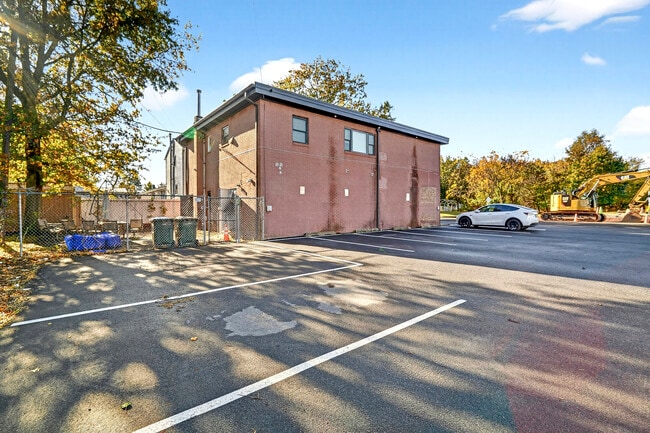
Property Record
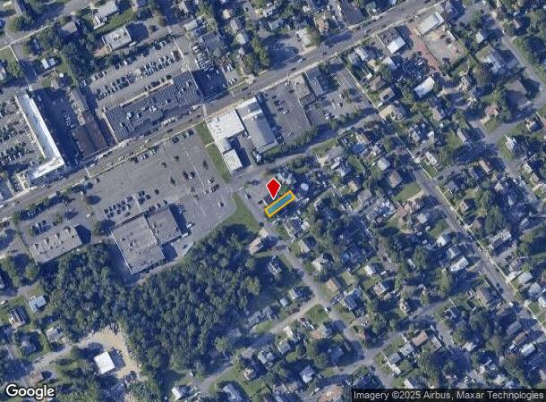
97 Newport Ave, Somerset, NJ 08873
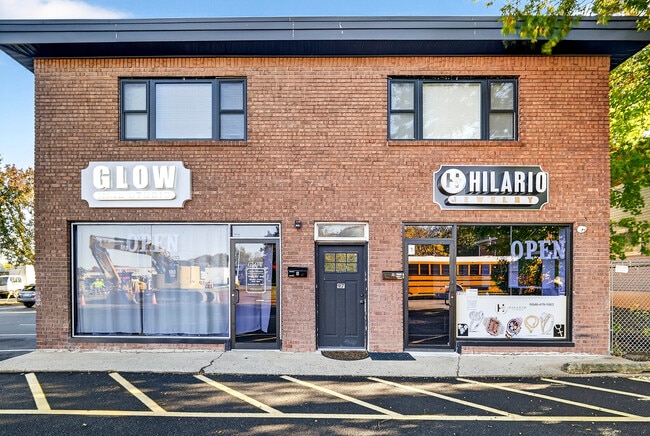
This Property Is For Sale
NEARBY LISTINGS FOR SALE OR LEASE
Property Detail
97 Newport Ave
Newark, NJ-PA
Brookside Terrace
08-00156-0000-00047
Somerset
Sfr
New Jersey
X
0.28 AC
34023C0126F
Somerset
3,290 SF
Northern New Jersey
DEMOGRAPHICS near 97 Newport Ave
1 Mile
3 Mile
5 Mile
2024 Total Population
24,002
134,143
254,164
2029 Population
23,704
133,331
253,004
Pop Growth 2024-2029
(1.24%)
(0.61%)
(0.46%)
Average Age
35
36
38
2024 Total Households
6,989
43,505
85,062
HH Growth 2024-2029
(1.20%)
(0.35%)
(0.35%)
Median Household Inc
$68,787
$82,419
$97,606
Avg Household Size
3.10
2.70
2.70
2024 Avg HH Vehicles
1.00
2.00
2.00
Median Home Value
$305,369
$371,641
$390,982
Median Year Built
1964
1972
1974
Nearby Places
- Restaurants
- Banks
- Shops
- Fitness
- Groceries
PUBLIC TRANSPORTATION
COMMUTER RAIL
Jersey Avenue (Northeast Corridor Line - NJ Transit Commuter Rail (NJ Transit))
DRIVE
WALK
Distance
Jersey Avenue (Northeast Corridor Line - NJ Transit Commuter Rail (NJ Transit))
8 min
1.6 mi
New Brunswick (Northeast Corridor Line - NJ Transit Commuter Rail (NJ Transit))
DRIVE
WALK
Distance
New Brunswick (Northeast Corridor Line - NJ Transit Commuter Rail (NJ Transit))
5 min
1.6 mi
AIRPORT
Trenton Mercer
DRIVE
WALK
Distance
Trenton Mercer
45 min
27.4 mi
Newark Liberty International
DRIVE
WALK
Distance
Newark Liberty International
44 min
29.6 mi
LaGuardia
DRIVE
WALK
Distance
LaGuardia
75 min
46.9 mi
Freight Ports
New York Container Terminal
DRIVE
WALK
Distance
New York Container Terminal
38 min
24.6 mi
Nearby Properties
Address
Land Use
TOTAL SIZE
Lot Size
Zoning
Address
Land Use
TOTAL SIZE
Lot Size
Zoning
8.25 AC
D-HI
Address
Land Use
TOTAL SIZE
Lot Size
Zoning
Address
Land Use
TOTAL SIZE
Lot Size
Zoning
38,536 SF
149.61 AC
IN-2
Address
Land Use
TOTAL SIZE
Lot Size
Zoning
145,522 SF
97.30 AC
E
Address
Land Use
TOTAL SIZE
Lot Size
Zoning
25.77 AC
C-6
Address
Land Use
TOTAL SIZE
Lot Size
Zoning
11.50 AC
HI
Address
Land Use
TOTAL SIZE
Lot Size
Zoning
37.80 AC
IN-2
Address
Land Use
TOTAL SIZE
Lot Size
Zoning
99.79 AC
B-I
Address
Land Use
TOTAL SIZE
Lot Size
Zoning
77.04 AC
I2
Address
Land Use
TOTAL SIZE
Lot Size
Zoning
78.71 AC
ER
Address
Land Use
TOTAL SIZE
Lot Size
Zoning
17 AC
O-1
Address
Land Use
TOTAL SIZE
Lot Size
Zoning
21.30 AC
IN-1
Address
Land Use
TOTAL SIZE
Lot Size
Zoning
48.30 AC
GB
Address
Land Use
TOTAL SIZE
Lot Size
Zoning
16,397 SF
41.98 AC
R20
Address
Land Use
TOTAL SIZE
Lot Size
Zoning
543,945 SF
48.46 AC
B-I
Address
Land Use
TOTAL SIZE
Lot Size
Zoning
Address
Land Use
TOTAL SIZE
Lot Size
Zoning
52,074 SF
68.14 AC
E
Address
Land Use
TOTAL SIZE
Lot Size
Zoning
1.15 AC
C-4
Address
Land Use
TOTAL SIZE
Lot Size
Zoning
0.25 AC
C-4
Address
Land Use
TOTAL SIZE
Lot Size
Zoning
18.21 AC
E
Address
Land Use
TOTAL SIZE
Lot Size
Zoning
0.92 AC
D-HI
Address
Land Use
TOTAL SIZE
Lot Size
Zoning
6,495 SF
5.74 AC
IN-1
Address
Land Use
TOTAL SIZE
Lot Size
Zoning
1.81 AC
D-HI
Address
Land Use
TOTAL SIZE
Lot Size
Zoning
53,900 SF
4.69 AC
IN-1
Address
Land Use
TOTAL SIZE
Lot Size
Zoning
11.35 AC
R20
Address
Land Use
TOTAL SIZE
Lot Size
Zoning
83,080 SF
12.40 AC
E
Address
Land Use
TOTAL SIZE
Lot Size
Zoning
111,911 SF
126 AC
E
Address
Land Use
TOTAL SIZE
Lot Size
Zoning
5.54 AC
C-5
Address
Land Use
TOTAL SIZE
Lot Size
Zoning
Address
Land Use
TOTAL SIZE
Lot Size
Zoning
The World's #1 Commercial Real Estate Marketplace
Connect with us
© 2025 CoStar Group
The information above has been obtained from sources believed reliable. While we do not doubt its accuracy we have not verified it and make no guarantee, warranty or representation about it. It is your responsibility to independently confirm its accuracy and completeness. Any projections, opinions, assumptions, or estimates used are for example only and do not represent the current or future performance of the property. The value of this transaction to you depends on tax and other factors which should be evaluated by your tax, financial, and legal advisors. You and your advisors should conduct a careful, independent investigation of the property to determine to your satisfaction the suitability of the property for your needs.