Property Record
97 Solon Rd, Bedford, OH 44146
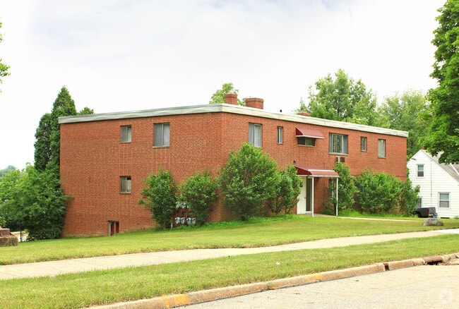

Property Detail
97 Solon Rd
813-20-002
46 EP 661.29FT E OF WASHINGTON ST
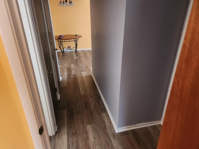
Apartment
CUYAHOGA
R-3
Ohio
B and X Area of moderate flood hazard, usually the area between the limits of the 100-year and 500-year floods.
46
2025
2.27 AC
2025
Bedford
132200
Cleveland
30,549 SF
Cleveland-Elyria, OH
NEARBY LISTINGS FOR SALE OR LEASE
-
-
View all Bedford listings for sale on LoopNet.com
DEMOGRAPHICS near 97 Solon Rd
1 mile
3 mile
5 mile
2025 Total Population
6,130
54,401
148,241
2030 Population
6,089
54,199
147,535
Pop Growth 2025-2030
(0.67%)
(0.37%)
(0.48%)
Average Age
42
43
43
2025 Total Households
2,885
24,590
63,222
HH Growth 2025-2030
(0.76%)
(0.48%)
(0.59%)
Median Household Inc
$59,940
$55,845
$62,538
Avg Household Size
2.10
2.10
2.30
2025 Avg HH Vehicles
2.00
2.00
2.00
Median Home Value
$146,500
$139,407
$168,711
Median Year Built
1953
1959
1960
Nearby Places
Map Layers
Map Styles
 Street
 Aerial
Transit
 Traffic
 Biking
Places
Listings with unknown addresses are not visible on the map
- Restaurants
- Banks
- Shops
- Fitness
- Groceries
PUBLIC TRANSPORTATION
COMMUTER RAIL
Canal Exploration Center (National Park Scenic Railway - Cuyahoga Valley Scenic Railroad)
Drive
Walk
Distance
Canal Exploration Center (National Park Scenic Railway - Cuyahoga Valley Scenic Railroad)
14 min
5.9 mi
Rockside (National Park Scenic Railway - Cuyahoga Valley Scenic Railroad)
Drive
Walk
Distance
Rockside (National Park Scenic Railway - Cuyahoga Valley Scenic Railroad)
14 min
6.2 mi
AIRPORT
Cleveland-Hopkins International
Drive
Walk
Distance
Cleveland-Hopkins International
33 min
19.2 mi
Freight Ports
Port of Toledo
Drive
Walk
Distance
Port of Toledo
147 min
120.1 mi
SALE & LEASE HISTORY
LISTING DATE
SALE/LEASE

Nov 17, 2022
For Sale
Apr 04, 2018
For Sale
Nearby Properties
Address
Land Use
TOTAL SIZE
Lot Size
Zoning
Address
Land Use
TOTAL SIZE
Lot Size
Zoning
130,621 SF
67.21 AC
I-2
Address
Land Use
TOTAL SIZE
Lot Size
Zoning
49.31 AC
Address
Land Use
TOTAL SIZE
Lot Size
Zoning
68.97 AC
C-1
Address
Land Use
TOTAL SIZE
Lot Size
Zoning
289,009 SF
25.27 AC
I/O
Address
Land Use
TOTAL SIZE
Lot Size
Zoning
11,808 SF
900.50 AC
1F-2
Address
Land Use
TOTAL SIZE
Lot Size
Zoning
109.65 AC
MUD
Address
Land Use
TOTAL SIZE
Lot Size
Zoning
18.38 AC
R2
Address
Land Use
TOTAL SIZE
Lot Size
Zoning
120,722 SF
20.55 AC
I/O
Address
Land Use
TOTAL SIZE
Lot Size
Zoning
32,400 SF
89.36 AC
IG
Address
Land Use
TOTAL SIZE
Lot Size
Zoning
14.95 AC
I-1
Address
Land Use
TOTAL SIZE
Lot Size
Zoning
838,521 SF
5.70 AC
I
Address
Land Use
TOTAL SIZE
Lot Size
Zoning
137,795 SF
37.09 AC
R-4
Address
Land Use
TOTAL SIZE
Lot Size
Zoning
324,644 SF
15.13 AC
I
Address
Land Use
TOTAL SIZE
Lot Size
Zoning
347,218 SF
0.23 AC
O/I
Address
Land Use
TOTAL SIZE
Lot Size
Zoning
65,108 SF
24.93 AC
I/O
Address
Land Use
TOTAL SIZE
Lot Size
Zoning
69,033 SF
8.85 AC
R-3
Address
Land Use
TOTAL SIZE
Lot Size
Zoning
247,000 SF
18.44 AC
IG
Address
Land Use
TOTAL SIZE
Lot Size
Zoning
350,592 SF
25.29 AC
O/I
Address
Land Use
TOTAL SIZE
Lot Size
Zoning
146,006 SF
8.38 AC
R-1
Address
Land Use
TOTAL SIZE
Lot Size
Zoning
14.67 AC
I-2
Address
Land Use
TOTAL SIZE
Lot Size
Zoning
15.46 AC
Address
Land Use
TOTAL SIZE
Lot Size
Zoning
164,157 SF
6.29 AC
BP
Address
Land Use
TOTAL SIZE
Lot Size
Zoning
268,672 SF
25.07 AC
R-3
Address
Land Use
TOTAL SIZE
Lot Size
Zoning
155,974 SF
5.33 AC
R-3
Address
Land Use
TOTAL SIZE
Lot Size
Zoning
373,099 SF
6.83 AC
R-3
Address
Land Use
TOTAL SIZE
Lot Size
Zoning
192,371 SF
22.06 AC
B3
Address
Land Use
TOTAL SIZE
Lot Size
Zoning
210,600 SF
12.69 AC
I-2
Address
Land Use
TOTAL SIZE
Lot Size
Zoning
596,578 SF
18.75 AC
O/I
Address
Land Use
TOTAL SIZE
Lot Size
Zoning
41,566 SF
13.01 AC
R-1-D
Address
Land Use
TOTAL SIZE
Lot Size
Zoning
201,034 SF
21.07 AC
I-2
The World's #1 Commercial Real Estate Marketplace
Connect with us
© 2026 CoStar Group
The information above has been obtained from sources believed reliable. While we do not doubt its accuracy we have not verified it and make no guarantee, warranty or representation about it. It is your responsibility to independently confirm its accuracy and completeness. Any projections, opinions, assumptions, or estimates used are for example only and do not represent the current or future performance of the property. The value of this transaction to you depends on tax and other factors which should be evaluated by your tax, financial, and legal advisors. You and your advisors should conduct a careful, independent investigation of the property to determine to your satisfaction the suitability of the property for your needs.