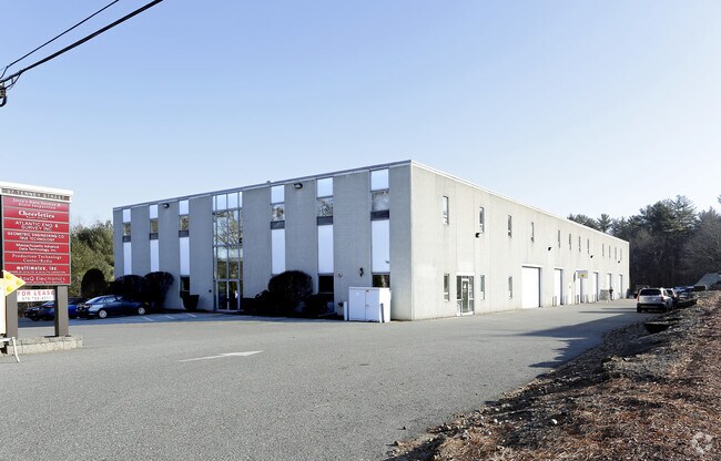
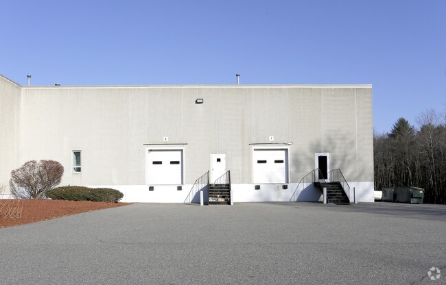
Property Record
97 Tenney St, Georgetown, MA 01833

Property Detail
97 Tenney St
GEOR-000015-000000-000000-000138-000138
Essex
Manufacturinglight
Massachusetts
B and X Area of moderate flood hazard, usually the area between the limits of the 100-year and 500-year floods.
138
2025
2.72 AC
2025
Amesbury/Ipswich
265102
Boston
27,000 SF
Boston-Cambridge-Newton, MA-NH
NEARBY LISTINGS FOR SALE OR LEASE
DEMOGRAPHICS near 97 Tenney St
1 mile
3 mile
5 mile
2025 Total Population
1,932
16,161
37,095
2030 Population
1,989
16,683
38,195
Pop Growth 2025-2030
+ 2.95%
+ 3.23%
+ 2.97%
Average Age
41
43
44
2025 Total Households
680
5,869
13,434
HH Growth 2025-2030
+ 2.79%
+ 3.14%
+ 2.88%
Median Household Inc
$155,412
$145,285
$146,452
Avg Household Size
2.80
2.70
2.70
2025 Avg HH Vehicles
2.00
2.00
2.00
Median Home Value
$750,000
$722,633
$737,827
Median Year Built
1991
1979
1976
Nearby Places
Map Layers
Map Styles
 Street
 Aerial
Layers
 Traffic
 Biking
Places
Listings with unknown addresses are not visible on the map
- Restaurants
- Banks
- Shops
- Fitness
- Groceries
PUBLIC TRANSPORTATION
COMMUTER RAIL
Rowley (Newburyport/Rockport Line - Massachusetts Bay Transportation Authority Commuter Rail (Purple Line))
Drive
Walk
Distance
Rowley (Newburyport/Rockport Line - Massachusetts Bay Transportation Authority Commuter Rail (Purple Line))
16 min
6.6 mi
Newburyport (Newburyport/Rockport Line - Massachusetts Bay Transportation Authority Commuter Rail (Purple Line))
Drive
Walk
Distance
Newburyport (Newburyport/Rockport Line - Massachusetts Bay Transportation Authority Commuter Rail (Purple Line))
16 min
9.9 mi
AIRPORT
General Edward Lawrence Logan International
Drive
Walk
Distance
General Edward Lawrence Logan International
44 min
29.0 mi
Portsmouth International at Pease
Drive
Walk
Distance
Portsmouth International at Pease
41 min
30.1 mi
Manchester Boston Regional
Drive
Walk
Distance
Manchester Boston Regional
64 min
40.1 mi
Freight Ports
Port of Boston
Drive
Walk
Distance
Port of Boston
47 min
31.9 mi
SALE & LEASE HISTORY
LISTING DATE
SALE/LEASE

Apr 25, 2018
For Lease
Nearby Properties
Address
Land Use
TOTAL SIZE
Lot Size
Zoning
Address
Land Use
TOTAL SIZE
Lot Size
Zoning
Address
Land Use
TOTAL SIZE
Lot Size
Zoning
140,624 SF
26.21 AC
Address
Land Use
TOTAL SIZE
Lot Size
Zoning
374,714 SF
98 AC
AR4
Address
Land Use
TOTAL SIZE
Lot Size
Zoning
86,812 SF
27.80 AC
Address
Land Use
TOTAL SIZE
Lot Size
Zoning
385,746 SF
7.79 AC
Address
Land Use
TOTAL SIZE
Lot Size
Zoning
64,162 SF
47.95 AC
Address
Land Use
TOTAL SIZE
Lot Size
Zoning
4,818 SF
12.90 AC
Address
Land Use
TOTAL SIZE
Lot Size
Zoning
106,342 SF
22.38 AC
Address
Land Use
TOTAL SIZE
Lot Size
Zoning
2,394 SF
63.04 AC
Address
Land Use
TOTAL SIZE
Lot Size
Zoning
130,204 SF
40.90 AC
Address
Land Use
TOTAL SIZE
Lot Size
Zoning
55,946 SF
20.50 AC
Address
Land Use
TOTAL SIZE
Lot Size
Zoning
46,280 SF
7.80 AC
Address
Land Use
TOTAL SIZE
Lot Size
Zoning
65,044 SF
10.74 AC
Address
Land Use
TOTAL SIZE
Lot Size
Zoning
163.54 AC
Address
Land Use
TOTAL SIZE
Lot Size
Zoning
78,740 SF
14.54 AC
Address
Land Use
TOTAL SIZE
Lot Size
Zoning
53,709 SF
5.81 AC
Address
Land Use
TOTAL SIZE
Lot Size
Zoning
10,255 SF
6.39 AC
Address
Land Use
TOTAL SIZE
Lot Size
Zoning
120,500 SF
10.19 AC
COM
Address
Land Use
TOTAL SIZE
Lot Size
Zoning
118.81 AC
Address
Land Use
TOTAL SIZE
Lot Size
Zoning
14,240 SF
51.38 AC
PC
Address
Land Use
TOTAL SIZE
Lot Size
Zoning
59,440 SF
8.65 AC
Address
Land Use
TOTAL SIZE
Lot Size
Zoning
21,245 SF
1.81 AC
Address
Land Use
TOTAL SIZE
Lot Size
Zoning
25,371 SF
3.54 AC
Address
Land Use
TOTAL SIZE
Lot Size
Zoning
83,743 SF
6 AC
Address
Land Use
TOTAL SIZE
Lot Size
Zoning
49,730 SF
6.61 AC
Address
Land Use
TOTAL SIZE
Lot Size
Zoning
5.10 AC
Address
Land Use
TOTAL SIZE
Lot Size
Zoning
19,665 SF
17.01 AC
PC
Address
Land Use
TOTAL SIZE
Lot Size
Zoning
476.30 AC
RA
Address
Land Use
TOTAL SIZE
Lot Size
Zoning
2.16 AC
Address
Land Use
TOTAL SIZE
Lot Size
Zoning
24,965 SF
2.68 AC
The World's #1 Commercial Real Estate Marketplace
Connect with us
© 2026 CoStar Group
The information above has been obtained from sources believed reliable. While we do not doubt its accuracy we have not verified it and make no guarantee, warranty or representation about it. It is your responsibility to independently confirm its accuracy and completeness. Any projections, opinions, assumptions, or estimates used are for example only and do not represent the current or future performance of the property. The value of this transaction to you depends on tax and other factors which should be evaluated by your tax, financial, and legal advisors. You and your advisors should conduct a careful, independent investigation of the property to determine to your satisfaction the suitability of the property for your needs.