Property Record
970 Caughlin Xing, Reno, NV 89519
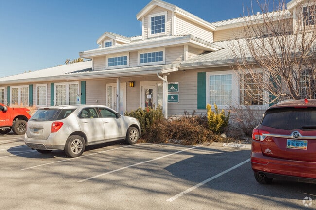


Property Detail
970 Caughlin Xing
214-020-02
PM 2620 LT 4
Officebuilding
Washoe
PD
Nevada
B and X Area of moderate flood hazard, usually the area between the limits of the 100-year and 500-year floods.
4
2025
0.69 AC
2026
West Reno
001103
Reno/Sparks
7,200 SF
Reno, NV
NEARBY LISTINGS FOR SALE OR LEASE
DEMOGRAPHICS near 970 Caughlin Xing
1 mile
3 mile
5 mile
2024 Total Population
7,027
81,324
170,448
2029 Population
7,417
85,706
179,391
Pop Growth 2024-2029
+ 5.55%
+ 5.39%
+ 5.25%
Average Age
46
42
40
2024 Total Households
2,843
37,183
72,428
HH Growth 2024-2029
+ 5.70%
+ 5.44%
+ 5.35%
Median Household Inc
$123,037
$72,204
$64,787
Avg Household Size
2.40
2.10
2.20
2024 Avg HH Vehicles
2.00
2.00
2.00
Median Home Value
$725,216
$523,394
$487,343
Median Year Built
1986
1983
1982
Nearby Places
Map Layers
Map Styles
 Street
 Aerial
Transit
 Traffic
 Biking
Places
Listings with unknown addresses are not visible on the map
- Restaurants
- Banks
- Shops
- Fitness
- Groceries
PUBLIC TRANSPORTATION
COMMUTER RAIL
Drive
Walk
Distance
9 min
4.0 mi
AIRPORT
Reno/Tahoe International
Drive
Walk
Distance
Reno/Tahoe International
16 min
9.4 mi
Nearby Properties
Address
Land Use
TOTAL SIZE
Lot Size
Zoning
Address
Land Use
TOTAL SIZE
Lot Size
Zoning
55,187 SF
116.12 AC
GC
Address
Land Use
TOTAL SIZE
Lot Size
Zoning
477,926 SF
54.37 AC
MF14
Address
Land Use
TOTAL SIZE
Lot Size
Zoning
189,861 SF
1.69 AC
MD-NWQ
Address
Land Use
TOTAL SIZE
Lot Size
Zoning
306,626 SF
17.61 AC
MF14 44% /
Address
Land Use
TOTAL SIZE
Lot Size
Zoning
331,462 SF
20.10 AC
PD
Address
Land Use
TOTAL SIZE
Lot Size
Zoning
304,344 SF
10.24 AC
GC
Address
Land Use
TOTAL SIZE
Lot Size
Zoning
109,936 SF
1.80 AC
MD-RD
Address
Land Use
TOTAL SIZE
Lot Size
Zoning
125,324 SF
2.06 AC
MD-NWQ
Address
Land Use
TOTAL SIZE
Lot Size
Zoning
317,507 SF
19.43 AC
MF14
Address
Land Use
TOTAL SIZE
Lot Size
Zoning
573,331 SF
6.52 AC
MD-ED
Address
Land Use
TOTAL SIZE
Lot Size
Zoning
272,580 SF
18.90 AC
MF21
Address
Land Use
TOTAL SIZE
Lot Size
Zoning
260,382 SF
18.77 AC
PD
Address
Land Use
TOTAL SIZE
Lot Size
Zoning
303,512 SF
20.60 AC
MF30
Address
Land Use
TOTAL SIZE
Lot Size
Zoning
293,364 SF
21.87 AC
MF14
Address
Land Use
TOTAL SIZE
Lot Size
Zoning
182,838 SF
8.02 AC
MS
Address
Land Use
TOTAL SIZE
Lot Size
Zoning
254,180 SF
15.99 AC
MF14
Address
Land Use
TOTAL SIZE
Lot Size
Zoning
154,655 SF
2.08 AC
MD-NWQ
Address
Land Use
TOTAL SIZE
Lot Size
Zoning
159,803 SF
0.60 AC
MD-RD
Address
Land Use
TOTAL SIZE
Lot Size
Zoning
259,461 SF
16.24 AC
MF30
Address
Land Use
TOTAL SIZE
Lot Size
Zoning
253,751 SF
1.02 AC
MD-RD
Address
Land Use
TOTAL SIZE
Lot Size
Zoning
213,835 SF
12.53 AC
MF21
Address
Land Use
TOTAL SIZE
Lot Size
Zoning
342,672 SF
18.39 AC
MS
Address
Land Use
TOTAL SIZE
Lot Size
Zoning
248,542 SF
0.49 AC
MD-ED
Address
Land Use
TOTAL SIZE
Lot Size
Zoning
92,930 SF
2.68 AC
MF21
Address
Land Use
TOTAL SIZE
Lot Size
Zoning
68,132 SF
1.80 AC
MD-RD
Address
Land Use
TOTAL SIZE
Lot Size
Zoning
205,916 SF
22.44 AC
GC
Address
Land Use
TOTAL SIZE
Lot Size
Zoning
205,936 SF
6.93 AC
MF30
Address
Land Use
TOTAL SIZE
Lot Size
Zoning
273,109 SF
17.93 AC
MU
Address
Land Use
TOTAL SIZE
Lot Size
Zoning
147,039 SF
0.69 AC
MD-ED
Address
Land Use
TOTAL SIZE
Lot Size
Zoning
247,315 SF
20.74 AC
MF14
The World's #1 Commercial Real Estate Marketplace
Connect with us
© 2026 CoStar Group
The information above has been obtained from sources believed reliable. While we do not doubt its accuracy we have not verified it and make no guarantee, warranty or representation about it. It is your responsibility to independently confirm its accuracy and completeness. Any projections, opinions, assumptions, or estimates used are for example only and do not represent the current or future performance of the property. The value of this transaction to you depends on tax and other factors which should be evaluated by your tax, financial, and legal advisors. You and your advisors should conduct a careful, independent investigation of the property to determine to your satisfaction the suitability of the property for your needs.