Property Record
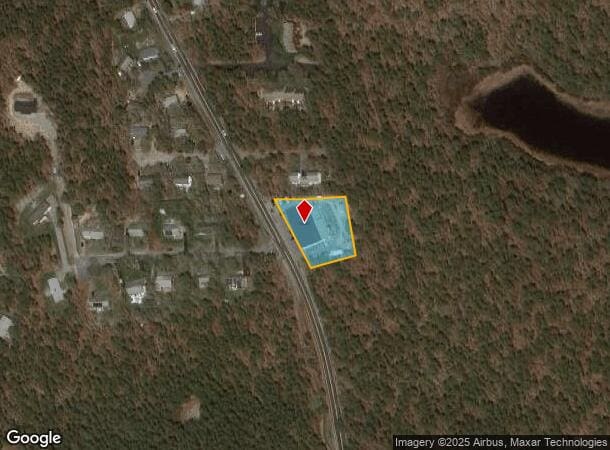
970 Route 134, South Dennis, MA 02660
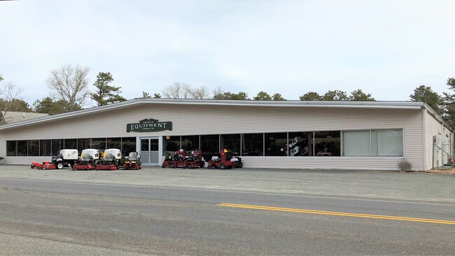
This Property Is For Sale
NEARBY LISTINGS FOR SALE OR LEASE
Property Detail
970 Route 134
Autorepair
Barnstable
X
Massachusetts
25001C0582J
0.87 AC
2025
Cape Cod
2025
Other Market Areas
011400
Barnstable Town, MA
10,100 SF
DENN-000233-000000-000009
DEMOGRAPHICS near 970 Route 134
1 Mile
3 Mile
5 Mile
2024 Total Population
2,098
16,669
44,309
2029 Population
2,094
17,019
45,936
Pop Growth 2024-2029
(0.19%)
+ 2.10%
+ 3.67%
Average Age
53
53
52
2024 Total Households
1,021
7,836
20,938
HH Growth 2024-2029
(0.88%)
+ 1.63%
+ 3.54%
Median Household Inc
$86,283
$90,388
$81,467
Avg Household Size
2.00
2.10
2.00
2024 Avg HH Vehicles
2.00
2.00
2.00
Median Home Value
$442,289
$481,110
$482,154
Median Year Built
1976
1977
1974
Nearby Places
Map Layers
Map Styles
 Street
 Aerial
- Restaurants
- Banks
- Shops
- Fitness
- Groceries
PUBLIC TRANSPORTATION
COMMUTER RAIL
Hyannis (CapeFLYER - Cape Cod Regional Transit Authority)
DRIVE
WALK
Distance
Hyannis (CapeFLYER - Cape Cod Regional Transit Authority)
15 min
9.2 mi
Freight Ports
Port of New Bedford Harbor
DRIVE
WALK
Distance
Port of New Bedford Harbor
77 min
55.7 mi
Nearby Properties
Address
Land Use
TOTAL SIZE
Lot Size
Zoning
Address
Land Use
TOTAL SIZE
Lot Size
Zoning
138,804 SF
15.94 AC
Address
Land Use
TOTAL SIZE
Lot Size
Zoning
12.72 AC
R-60
Address
Land Use
TOTAL SIZE
Lot Size
Zoning
34.40 AC
Address
Land Use
TOTAL SIZE
Lot Size
Zoning
3.71 AC
Address
Land Use
TOTAL SIZE
Lot Size
Zoning
6,517 SF
0.14 AC
DCPC
Address
Land Use
TOTAL SIZE
Lot Size
Zoning
5.11 AC
R-60
Address
Land Use
TOTAL SIZE
Lot Size
Zoning
2.93 AC
R-60
Address
Land Use
TOTAL SIZE
Lot Size
Zoning
320 SF
9.01 AC
Address
Land Use
TOTAL SIZE
Lot Size
Zoning
5.42 AC
Address
Land Use
TOTAL SIZE
Lot Size
Zoning
14.54 AC
Address
Land Use
TOTAL SIZE
Lot Size
Zoning
45.75 AC
R
Address
Land Use
TOTAL SIZE
Lot Size
Zoning
163.08 AC
Address
Land Use
TOTAL SIZE
Lot Size
Zoning
Address
Land Use
TOTAL SIZE
Lot Size
Zoning
38,518 SF
5.09 AC
Address
Land Use
TOTAL SIZE
Lot Size
Zoning
18.49 AC
Address
Land Use
TOTAL SIZE
Lot Size
Zoning
6.12 AC
R-60
Address
Land Use
TOTAL SIZE
Lot Size
Zoning
0.69 AC
R-40
Address
Land Use
TOTAL SIZE
Lot Size
Zoning
4 AC
R-60
Address
Land Use
TOTAL SIZE
Lot Size
Zoning
0.95 AC
Address
Land Use
TOTAL SIZE
Lot Size
Zoning
1,636 SF
10.60 AC
Address
Land Use
TOTAL SIZE
Lot Size
Zoning
162.60 AC
Address
Land Use
TOTAL SIZE
Lot Size
Zoning
3,180 SF
2.05 AC
Address
Land Use
TOTAL SIZE
Lot Size
Zoning
35,131 SF
4.22 AC
Address
Land Use
TOTAL SIZE
Lot Size
Zoning
6.70 AC
R-60
Address
Land Use
TOTAL SIZE
Lot Size
Zoning
Address
Land Use
TOTAL SIZE
Lot Size
Zoning
Address
Land Use
TOTAL SIZE
Lot Size
Zoning
6,401 SF
7.07 AC
RESD.
Address
Land Use
TOTAL SIZE
Lot Size
Zoning
1,938 SF
5.50 AC
Address
Land Use
TOTAL SIZE
Lot Size
Zoning
Address
Land Use
TOTAL SIZE
Lot Size
Zoning
72,240 SF
The World's #1 Commercial Real Estate Marketplace
Connect with us
© 2026 CoStar Group
The information above has been obtained from sources believed reliable. While we do not doubt its accuracy we have not verified it and make no guarantee, warranty or representation about it. It is your responsibility to independently confirm its accuracy and completeness. Any projections, opinions, assumptions, or estimates used are for example only and do not represent the current or future performance of the property. The value of this transaction to you depends on tax and other factors which should be evaluated by your tax, financial, and legal advisors. You and your advisors should conduct a careful, independent investigation of the property to determine to your satisfaction the suitability of the property for your needs.