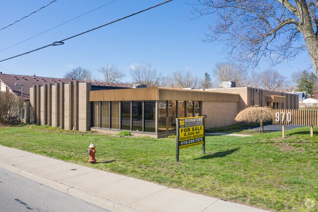
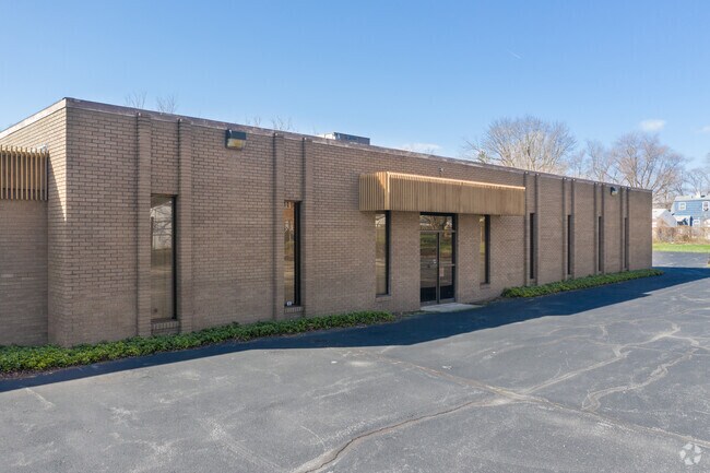
Property Record
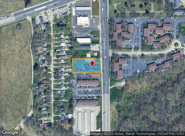
970 S Byrne Rd, Toledo, OH 43609
NEARBY LISTINGS FOR SALE OR LEASE
Property Detail
970 S Byrne Rd
20-02017
3 18 NE 1/4 133 FT S & ADJ N 391.57 FTE 327.10 FT EXC BYRN
Officebuilding
Lucas
X
Ohio
39173C0010D
0.84 AC
2024
South/Southwest
2024
Toledo
007307
Toledo, OH
8,524 SF
DEMOGRAPHICS near 970 S Byrne Rd
1 Mile
3 Mile
5 Mile
2024 Total Population
8,076
82,221
200,106
2029 Population
8,016
80,917
198,510
Pop Growth 2024-2029
(0.74%)
(1.59%)
(0.80%)
Average Age
36
39
40
2024 Total Households
4,198
35,740
88,459
HH Growth 2024-2029
(0.55%)
(1.64%)
(0.80%)
Median Household Inc
$27,488
$45,702
$50,829
Avg Household Size
1.80
2.10
2.10
2024 Avg HH Vehicles
1.00
2.00
2.00
Median Home Value
$110,791
$117,009
$138,886
Median Year Built
1976
1964
1964
Nearby Places
Map Layers
Map Styles
 Street
 Aerial
- Restaurants
- Banks
- Shops
- Fitness
- Groceries
PUBLIC TRANSPORTATION
COMMUTER RAIL
DRIVE
WALK
Distance
8 min
4.8 mi
AIRPORT
Eugene F Kranz Toledo Express
DRIVE
WALK
Distance
Eugene F Kranz Toledo Express
28 min
14.4 mi
SALE & LEASE HISTORY
LISTING DATE
SALE/LEASE

Aug 28, 2019
For Sale
Nearby Properties
Address
Land Use
TOTAL SIZE
Lot Size
Zoning
Address
Land Use
TOTAL SIZE
Lot Size
Zoning
3,076,310 SF
127.88 AC
10-MX
Address
Land Use
TOTAL SIZE
Lot Size
Zoning
1,237,446 SF
193.94 AC
10-RS12
Address
Land Use
TOTAL SIZE
Lot Size
Zoning
513,157 SF
39.38 AC
10-MX
Address
Land Use
TOTAL SIZE
Lot Size
Zoning
436,094 SF
30.06 AC
10-RS6
Address
Land Use
TOTAL SIZE
Lot Size
Zoning
323,421 SF
134.98 AC
10-MX
Address
Land Use
TOTAL SIZE
Lot Size
Zoning
329,064 SF
69.74 AC
10-RS6
Address
Land Use
TOTAL SIZE
Lot Size
Zoning
202,563 SF
6.19 AC
10-IG
Address
Land Use
TOTAL SIZE
Lot Size
Zoning
245,237 SF
31.72 AC
10-MX
Address
Land Use
TOTAL SIZE
Lot Size
Zoning
11.16 AC
10-RM24
Address
Land Use
TOTAL SIZE
Lot Size
Zoning
393,343 SF
62.48 AC
10-IC
Address
Land Use
TOTAL SIZE
Lot Size
Zoning
148,842 SF
9.84 AC
10-IL
Address
Land Use
TOTAL SIZE
Lot Size
Zoning
246,438 SF
8.22 AC
10-RM36
Address
Land Use
TOTAL SIZE
Lot Size
Zoning
173,943 SF
59.70 AC
10-IP
Address
Land Use
TOTAL SIZE
Lot Size
Zoning
123,064 SF
10 AC
10-RS6
Address
Land Use
TOTAL SIZE
Lot Size
Zoning
196,149 SF
18.69 AC
10-RD6
Address
Land Use
TOTAL SIZE
Lot Size
Zoning
170,960 SF
4 AC
10-RS6
Address
Land Use
TOTAL SIZE
Lot Size
Zoning
275,113 SF
21 AC
10-MX
Address
Land Use
TOTAL SIZE
Lot Size
Zoning
211,140 SF
28.92 AC
10-IC
Address
Land Use
TOTAL SIZE
Lot Size
Zoning
90,340 SF
2.18 AC
10-IL
Address
Land Use
TOTAL SIZE
Lot Size
Zoning
269,263 SF
55.93 AC
16-R2
Address
Land Use
TOTAL SIZE
Lot Size
Zoning
94,439 SF
9 AC
10-CO
Address
Land Use
TOTAL SIZE
Lot Size
Zoning
316,351 SF
30.65 AC
10-IC
Address
Land Use
TOTAL SIZE
Lot Size
Zoning
138,607 SF
21.30 AC
10-RS12
Address
Land Use
TOTAL SIZE
Lot Size
Zoning
94,891 SF
18.80 AC
10-RS6
Address
Land Use
TOTAL SIZE
Lot Size
Zoning
59 AC
10-IP
Address
Land Use
TOTAL SIZE
Lot Size
Zoning
200,978 SF
13.15 AC
10-RD6
Address
Land Use
TOTAL SIZE
Lot Size
Zoning
81,672 SF
14.93 AC
10-RS9
Address
Land Use
TOTAL SIZE
Lot Size
Zoning
122,277 SF
7 AC
10-IL
Address
Land Use
TOTAL SIZE
Lot Size
Zoning
210,996 SF
22.18 AC
10-CRSO
Address
Land Use
TOTAL SIZE
Lot Size
Zoning
172,739 SF
10.93 AC
10-IL
The World's #1 Commercial Real Estate Marketplace
Connect with us
© 2025 CoStar Group
The information above has been obtained from sources believed reliable. While we do not doubt its accuracy we have not verified it and make no guarantee, warranty or representation about it. It is your responsibility to independently confirm its accuracy and completeness. Any projections, opinions, assumptions, or estimates used are for example only and do not represent the current or future performance of the property. The value of this transaction to you depends on tax and other factors which should be evaluated by your tax, financial, and legal advisors. You and your advisors should conduct a careful, independent investigation of the property to determine to your satisfaction the suitability of the property for your needs.