Property Record
9700 S Central Ave, Phoenix, AZ 85042


Property Detail
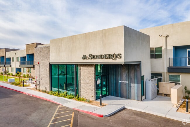
9700 S Central Ave
300-65-119
SENDEROS AT SOUTH MOUNTAIN MCR 1396-31
Apartment
Maricopa
R3
Arizona
C and X Area of minimal flood hazard, usually depicted on FIRMs as above the 500-year flood level.
1
2025
5.10 AC
2025
South Mountain
116732
Phoenix
118,842 SF
Phoenix-Mesa-Chandler, AZ
NEARBY LISTINGS FOR SALE OR LEASE
DEMOGRAPHICS near 9700 S Central Ave
1 mile
3 mile
5 mile
2025 Total Population
12,759
75,036
184,069
2030 Population
13,384
78,350
191,864
Pop Growth 2025-2030
+ 4.90%
+ 4.42%
+ 4.23%
Average Age
37
36
37
2025 Total Households
3,863
22,682
58,149
HH Growth 2025-2030
+ 4.92%
+ 4.44%
+ 4.24%
Median Household Inc
$70,811
$77,325
$88,791
Avg Household Size
3.10
3.20
3.10
2025 Avg HH Vehicles
2.00
2.00
2.00
Median Home Value
$388,503
$401,545
$445,778
Median Year Built
1987
1997
1996
Nearby Places
Map Layers
Map Styles
 Street
 Aerial
Layers
 Traffic
 Biking
Places
Listings with unknown addresses are not visible on the map
- Restaurants
- Banks
- Shops
- Fitness
- Groceries
PUBLIC TRANSPORTATION
AIRPORT
Phoenix Sky Harbor International
Drive
Walk
Distance
Phoenix Sky Harbor International
21 min
10.0 mi
Phoenix-Mesa Gateway
Drive
Walk
Distance
Phoenix-Mesa Gateway
48 min
31.9 mi
Nearby Properties
Address
Land Use
TOTAL SIZE
Lot Size
Zoning
Address
Land Use
TOTAL SIZE
Lot Size
Zoning
10,776 SF
10.14 AC
C-C
Address
Land Use
TOTAL SIZE
Lot Size
Zoning
359,401 SF
96.70 AC
R-6
Address
Land Use
TOTAL SIZE
Lot Size
Zoning
10 SF
644.14 AC
R-35
Address
Land Use
TOTAL SIZE
Lot Size
Zoning
1.28 AC
R-35
Address
Land Use
TOTAL SIZE
Lot Size
Zoning
369,723 SF
19.41 AC
R3
Address
Land Use
TOTAL SIZE
Lot Size
Zoning
398,815 SF
12.72 AC
C2
Address
Land Use
TOTAL SIZE
Lot Size
Zoning
205,550 SF
27.37 AC
R-6
Address
Land Use
TOTAL SIZE
Lot Size
Zoning
70,152 SF
180.34 AC
RE35
Address
Land Use
TOTAL SIZE
Lot Size
Zoning
87,690 SF
9.31 AC
R-6
Address
Land Use
TOTAL SIZE
Lot Size
Zoning
91,063 SF
12 AC
R-43AG
Address
Land Use
TOTAL SIZE
Lot Size
Zoning
186,437 SF
17.85 AC
PAD-HD
Address
Land Use
TOTAL SIZE
Lot Size
Zoning
81,942 SF
10.32 AC
R-6
Address
Land Use
TOTAL SIZE
Lot Size
Zoning
139,410 SF
14.41 AC
C-C
Address
Land Use
TOTAL SIZE
Lot Size
Zoning
58,603 SF
12.15 AC
R-43AG
Address
Land Use
TOTAL SIZE
Lot Size
Zoning
3.16 AC
Address
Land Use
TOTAL SIZE
Lot Size
Zoning
64,031 SF
14.68 AC
R-43AG
Address
Land Use
TOTAL SIZE
Lot Size
Zoning
63,002 SF
11.61 AC
R-6
Address
Land Use
TOTAL SIZE
Lot Size
Zoning
78,576 SF
8.69 AC
R-10
Address
Land Use
TOTAL SIZE
Lot Size
Zoning
8,029 SF
2.19 AC
R-4
Address
Land Use
TOTAL SIZE
Lot Size
Zoning
55,493 SF
8.01 AC
R-6
Address
Land Use
TOTAL SIZE
Lot Size
Zoning
45,000 SF
4.96 AC
R-14
Address
Land Use
TOTAL SIZE
Lot Size
Zoning
75,757 SF
5.28 AC
R-10
Address
Land Use
TOTAL SIZE
Lot Size
Zoning
52,948 SF
7.98 AC
R-43AG
Address
Land Use
TOTAL SIZE
Lot Size
Zoning
76,254 SF
8.71 AC
C-C
Address
Land Use
TOTAL SIZE
Lot Size
Zoning
153 SF
640 AC
R-35
Address
Land Use
TOTAL SIZE
Lot Size
Zoning
60,207 SF
8.68 AC
C-C
Address
Land Use
TOTAL SIZE
Lot Size
Zoning
48,155 SF
9.36 AC
R-6
Address
Land Use
TOTAL SIZE
Lot Size
Zoning
78,785 SF
6.68 AC
R-14
Address
Land Use
TOTAL SIZE
Lot Size
Zoning
128,448 SF
10.85 AC
C-C
The World's #1 Commercial Real Estate Marketplace
Connect with us
© 2026 CoStar Group
The information above has been obtained from sources believed reliable. While we do not doubt its accuracy we have not verified it and make no guarantee, warranty or representation about it. It is your responsibility to independently confirm its accuracy and completeness. Any projections, opinions, assumptions, or estimates used are for example only and do not represent the current or future performance of the property. The value of this transaction to you depends on tax and other factors which should be evaluated by your tax, financial, and legal advisors. You and your advisors should conduct a careful, independent investigation of the property to determine to your satisfaction the suitability of the property for your needs.