Property Record
9701 Belvedere Rd, West Palm Beach, FL 33411


NEARBY LISTINGS FOR SALE OR LEASE
Property Detail
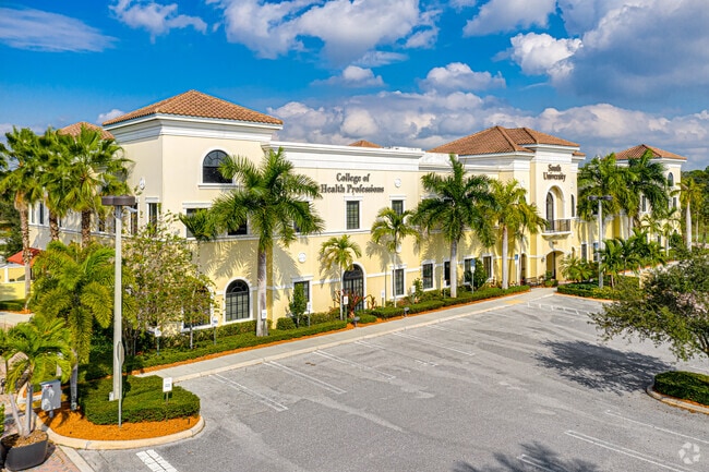
9701 Belvedere Rd
West Palm Beach-Boca Raton-Delray Beach, FL
University Centre
72-42-43-31-13-003-0000
UNIVERSITY CENTRE PAR 2
Commercialacreage
Palm Beach
AE
Florida
12099C0554F
3.24 AC
2024
Royal Palm Bch/Wellington
2024
South Florida
007818
DEMOGRAPHICS near 9701 Belvedere Rd
1 Mile
3 Mile
5 Mile
2024 Total Population
4,720
62,649
172,357
2029 Population
4,787
63,921
176,511
Pop Growth 2024-2029
+ 1.42%
+ 2.03%
+ 2.41%
Average Age
40
41
41
2024 Total Households
1,441
22,508
62,198
HH Growth 2024-2029
+ 0.49%
+ 1.32%
+ 2.03%
Median Household Inc
$97,863
$80,617
$73,813
Avg Household Size
3.00
2.60
2.60
2024 Avg HH Vehicles
2.00
2.00
2.00
Median Home Value
$395,667
$354,474
$347,901
Median Year Built
1989
1994
1989
Nearby Places
- Restaurants
- Banks
- Shops
- Fitness
- Groceries
PUBLIC TRANSPORTATION
AIRPORT
Palm Beach International
DRIVE
WALK
Distance
Palm Beach International
15 min
8.1 mi
Freight Ports
Port of Palm Beach
DRIVE
WALK
Distance
Port of Palm Beach
27 min
14.4 mi
SALE & LEASE HISTORY
LISTING DATE
SALE/LEASE

Jan 05, 2021
For Sale
Feb 09, 2022
For Lease
Dec 17, 2019
For Sale
Nearby Properties
Address
Land Use
TOTAL SIZE
Lot Size
Zoning
Address
Land Use
TOTAL SIZE
Lot Size
Zoning
590,128 SF
19.55 AC
MUPD
Address
Land Use
TOTAL SIZE
Lot Size
Zoning
398,622 SF
21.61 AC
RM-18
Address
Land Use
TOTAL SIZE
Lot Size
Zoning
669,818 SF
42.79 AC
IL
Address
Land Use
TOTAL SIZE
Lot Size
Zoning
535,508 SF
19.17 AC
PUD
Address
Land Use
TOTAL SIZE
Lot Size
Zoning
435,320 SF
13.75 AC
MCPD
Address
Land Use
TOTAL SIZE
Lot Size
Zoning
349,929 SF
49.95 AC
CG
Address
Land Use
TOTAL SIZE
Lot Size
Zoning
314,116 SF
10.25 AC
MF20
Address
Land Use
TOTAL SIZE
Lot Size
Zoning
318,687 SF
29.98 AC
RM-9
Address
Land Use
TOTAL SIZE
Lot Size
Zoning
294,321 SF
109.37 AC
PO
Address
Land Use
TOTAL SIZE
Lot Size
Zoning
178,614 SF
10.42 AC
PUD
Address
Land Use
TOTAL SIZE
Lot Size
Zoning
302,692 SF
55 AC
PO
Address
Land Use
TOTAL SIZE
Lot Size
Zoning
324,453 SF
25.47 AC
IL
Address
Land Use
TOTAL SIZE
Lot Size
Zoning
243,076 SF
15.47 AC
RM-18
Address
Land Use
TOTAL SIZE
Lot Size
Zoning
250,665 SF
58.77 AC
IPF
Address
Land Use
TOTAL SIZE
Lot Size
Zoning
196,683 SF
8.97 AC
RPD
Address
Land Use
TOTAL SIZE
Lot Size
Zoning
180,153 SF
19.22 AC
MUPD
Address
Land Use
TOTAL SIZE
Lot Size
Zoning
225,393 SF
22.54 AC
MUPD
Address
Land Use
TOTAL SIZE
Lot Size
Zoning
192,622 SF
17.97 AC
MUPD
Address
Land Use
TOTAL SIZE
Lot Size
Zoning
159,433 SF
38.65 AC
PO
Address
Land Use
TOTAL SIZE
Lot Size
Zoning
116,601 SF
13.94 AC
CG
Address
Land Use
TOTAL SIZE
Lot Size
Zoning
165,236 SF
10.91 AC
PIPD
Address
Land Use
TOTAL SIZE
Lot Size
Zoning
229,274 SF
24.34 AC
CG
Address
Land Use
TOTAL SIZE
Lot Size
Zoning
149,934 SF
3.47 AC
CG
Address
Land Use
TOTAL SIZE
Lot Size
Zoning
68,094 SF
39.77 AC
MUPD
Address
Land Use
TOTAL SIZE
Lot Size
Zoning
114,658 SF
14.99 AC
CG
Address
Land Use
TOTAL SIZE
Lot Size
Zoning
129,117 SF
12.62 AC
CG
Address
Land Use
TOTAL SIZE
Lot Size
Zoning
91,993 SF
10.53 AC
CG
Address
Land Use
TOTAL SIZE
Lot Size
Zoning
145,905 SF
12 AC
CS
Address
Land Use
TOTAL SIZE
Lot Size
Zoning
180,760 SF
30 AC
PO
Address
Land Use
TOTAL SIZE
Lot Size
Zoning
124,356 SF
11.56 AC
MUPD
The World's #1 Commercial Real Estate Marketplace
Connect with us
© 2025 CoStar Group
The information above has been obtained from sources believed reliable. While we do not doubt its accuracy we have not verified it and make no guarantee, warranty or representation about it. It is your responsibility to independently confirm its accuracy and completeness. Any projections, opinions, assumptions, or estimates used are for example only and do not represent the current or future performance of the property. The value of this transaction to you depends on tax and other factors which should be evaluated by your tax, financial, and legal advisors. You and your advisors should conduct a careful, independent investigation of the property to determine to your satisfaction the suitability of the property for your needs.