Property Record
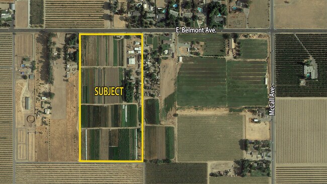
9695 E Belmont Ave, Sanger, CA 93657

NEARBY LISTINGS FOR SALE OR LEASE
-
-
View all Sanger listings for sale on LoopNet.com
Property Detail
9695 E Belmont Ave
314-021-19
19.78 AC IN E1/2 OF NW1/4 OF NE1/4 SEC 6 T14R22
Farms
Fresno
X
California
06019C2155H
19.78 AC
2025
E Outlying Fresno County
2025
Fresno
005904
Fresno, CA
910 SF
DEMOGRAPHICS near 9695 E Belmont Ave
1 Mile
3 Mile
5 Mile
2024 Total Population
428
7,535
109,744
2029 Population
440
7,832
113,137
Pop Growth 2024-2029
+ 2.80%
+ 3.94%
+ 3.09%
Average Age
39
37
35
2024 Total Households
131
2,296
32,533
HH Growth 2024-2029
+ 3.05%
+ 3.92%
+ 3.05%
Median Household Inc
$128,125
$118,277
$96,221
Avg Household Size
3.10
3.20
3.30
2024 Avg HH Vehicles
3.00
2.00
2.00
Median Home Value
$493,999
$477,872
$390,134
Median Year Built
1978
1999
2001
Nearby Places
Map Layers
Map Styles
 Street
 Aerial
- Restaurants
- Banks
- Shops
- Fitness
- Groceries
PUBLIC TRANSPORTATION
AIRPORT
Fresno Yosemite International
DRIVE
WALK
Distance
Fresno Yosemite International
14 min
9.2 mi
Freight Ports
Port of Stockton
DRIVE
WALK
Distance
Port of Stockton
165 min
139.2 mi
SALE & LEASE HISTORY
LISTING DATE
SALE/LEASE

Oct 26, 2020
For Sale
Nearby Properties
Address
Land Use
TOTAL SIZE
Lot Size
Zoning
Address
Land Use
TOTAL SIZE
Lot Size
Zoning
158.81 AC
AE20
Address
Land Use
TOTAL SIZE
Lot Size
Zoning
924 SF
154 AC
AE20
Address
Land Use
TOTAL SIZE
Lot Size
Zoning
12,527 SF
3.97 AC
C2
Address
Land Use
TOTAL SIZE
Lot Size
Zoning
156.04 AC
AE20
Address
Land Use
TOTAL SIZE
Lot Size
Zoning
32,070 SF
109.34 AC
RR
Address
Land Use
TOTAL SIZE
Lot Size
Zoning
73,577 SF
25.18 AC
AE20
Address
Land Use
TOTAL SIZE
Lot Size
Zoning
5,088 SF
31.46 AC
AE20
Address
Land Use
TOTAL SIZE
Lot Size
Zoning
1,058 SF
77.22 AC
AE20
Address
Land Use
TOTAL SIZE
Lot Size
Zoning
890 SF
39.26 AC
AE20
Address
Land Use
TOTAL SIZE
Lot Size
Zoning
4,828 SF
29.30 AC
AE20
Address
Land Use
TOTAL SIZE
Lot Size
Zoning
94,589 SF
20.81 AC
AE20
Address
Land Use
TOTAL SIZE
Lot Size
Zoning
40 AC
AE20
Address
Land Use
TOTAL SIZE
Lot Size
Zoning
1,820 SF
49.08 AC
AE20
Address
Land Use
TOTAL SIZE
Lot Size
Zoning
39.55 AC
AE20
Address
Land Use
TOTAL SIZE
Lot Size
Zoning
2,516 SF
49.97 AC
AE20
Address
Land Use
TOTAL SIZE
Lot Size
Zoning
1,070 SF
221.11 AC
AE20
Address
Land Use
TOTAL SIZE
Lot Size
Zoning
1,886 SF
56.46 AC
AE20
Address
Land Use
TOTAL SIZE
Lot Size
Zoning
16,676 SF
14.03 AC
C6
Address
Land Use
TOTAL SIZE
Lot Size
Zoning
2,412 SF
38.50 AC
AE20
Address
Land Use
TOTAL SIZE
Lot Size
Zoning
55.77 AC
AE20
Address
Land Use
TOTAL SIZE
Lot Size
Zoning
3,468 SF
35.66 AC
RR
Address
Land Use
TOTAL SIZE
Lot Size
Zoning
3,318 SF
54 AC
AE20
Address
Land Use
TOTAL SIZE
Lot Size
Zoning
5,000 SF
18.95 AC
AE20
Address
Land Use
TOTAL SIZE
Lot Size
Zoning
2,014 SF
39.67 AC
AE20
Address
Land Use
TOTAL SIZE
Lot Size
Zoning
3,960 SF
37.25 AC
AE20
Address
Land Use
TOTAL SIZE
Lot Size
Zoning
34.56 AC
AE20
Address
Land Use
TOTAL SIZE
Lot Size
Zoning
60 AC
AE20
Address
Land Use
TOTAL SIZE
Lot Size
Zoning
100.44 AC
AE20
The World's #1 Commercial Real Estate Marketplace
Connect with us
© 2026 CoStar Group
The information above has been obtained from sources believed reliable. While we do not doubt its accuracy we have not verified it and make no guarantee, warranty or representation about it. It is your responsibility to independently confirm its accuracy and completeness. Any projections, opinions, assumptions, or estimates used are for example only and do not represent the current or future performance of the property. The value of this transaction to you depends on tax and other factors which should be evaluated by your tax, financial, and legal advisors. You and your advisors should conduct a careful, independent investigation of the property to determine to your satisfaction the suitability of the property for your needs.