Property Record
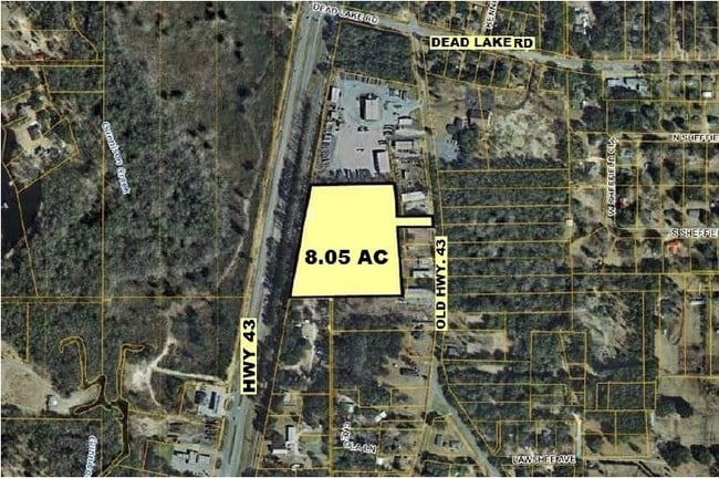
9701 Old Highway 43, Creola, AL 36525

Property Detail
9701 Old Highway 43
19-01-12-2-000-014
COM AT THE NW COR OF SEC 12 T2S R1W TH S 00 DEG 13 MIN 21 SEC E ALG SD SEC/L 1356.68 FT TO PT ON E RWL OF SOUTHERN RR TH S 78
Autorepair
MOBILE
B and X Area of moderate flood hazard, usually the area between the limits of the 100-year and 500-year floods.
Alabama
2025
6.72 AC
2025
Outlying Mobile County
005702
Mobile
7,500 SF
Mobile, AL
NEARBY LISTINGS FOR SALE OR LEASE
DEMOGRAPHICS near 9701 Old Highway 43
1 mile
3 mile
5 mile
2025 Total Population
1,582
6,981
12,273
2030 Population
1,593
6,925
12,202
Pop Growth 2025-2030
+ 0.70%
(0.80%)
(0.58%)
Average Age
42
42
41
2025 Total Households
622
2,676
4,684
HH Growth 2025-2030
+ 0.80%
(0.75%)
(0.58%)
Median Household Inc
$70,249
$90,498
$85,466
Avg Household Size
2.50
2.60
2.60
2025 Avg HH Vehicles
2.00
2.00
2.00
Median Home Value
$257,339
$246,292
$223,985
Median Year Built
1984
1983
1979
Nearby Places
Map Layers
Map Styles
 Street
 Aerial
Layers
 Traffic
 Biking
Places
Listings with unknown addresses are not visible on the map
- Restaurants
- Banks
- Shops
- Fitness
- Groceries
PUBLIC TRANSPORTATION
AIRPORT
Mobile International
Drive
Walk
Distance
Mobile International
30 min
21.8 mi
Mobile Regional
Drive
Walk
Distance
Mobile Regional
39 min
24.4 mi
Freight Ports
Port of Mobile
Drive
Walk
Distance
Port of Mobile
20 min
16.6 mi
Nearby Properties
Address
Land Use
TOTAL SIZE
Lot Size
Zoning
Address
Land Use
TOTAL SIZE
Lot Size
Zoning
6,233 SF
27 AC
Address
Land Use
TOTAL SIZE
Lot Size
Zoning
6,150 SF
46.96 AC
Address
Land Use
TOTAL SIZE
Lot Size
Zoning
55,927 SF
5.87 AC
Address
Land Use
TOTAL SIZE
Lot Size
Zoning
41,607 SF
2.96 AC
Address
Land Use
TOTAL SIZE
Lot Size
Zoning
10,356 SF
8.20 AC
Address
Land Use
TOTAL SIZE
Lot Size
Zoning
82,000 SF
14.50 AC
Address
Land Use
TOTAL SIZE
Lot Size
Zoning
9,317 SF
1.64 AC
Address
Land Use
TOTAL SIZE
Lot Size
Zoning
77,083 SF
10.23 AC
Address
Land Use
TOTAL SIZE
Lot Size
Zoning
262.30 AC
Address
Land Use
TOTAL SIZE
Lot Size
Zoning
16,000 SF
8.73 AC
Address
Land Use
TOTAL SIZE
Lot Size
Zoning
8,350 SF
6.81 AC
Address
Land Use
TOTAL SIZE
Lot Size
Zoning
12,400 SF
10.11 AC
Address
Land Use
TOTAL SIZE
Lot Size
Zoning
50,000 SF
13 AC
Address
Land Use
TOTAL SIZE
Lot Size
Zoning
7,433 SF
1.21 AC
Address
Land Use
TOTAL SIZE
Lot Size
Zoning
8,150 SF
3.12 AC
Address
Land Use
TOTAL SIZE
Lot Size
Zoning
652 AC
Address
Land Use
TOTAL SIZE
Lot Size
Zoning
9,600 SF
4.75 AC
Address
Land Use
TOTAL SIZE
Lot Size
Zoning
30,000 SF
20.40 AC
Address
Land Use
TOTAL SIZE
Lot Size
Zoning
11,100 SF
7 AC
Address
Land Use
TOTAL SIZE
Lot Size
Zoning
9,552 SF
6.58 AC
Address
Land Use
TOTAL SIZE
Lot Size
Zoning
10,660 SF
1.80 AC
Address
Land Use
TOTAL SIZE
Lot Size
Zoning
32.35 AC
Address
Land Use
TOTAL SIZE
Lot Size
Zoning
3,626 SF
1.23 AC
Address
Land Use
TOTAL SIZE
Lot Size
Zoning
9,951 SF
2.76 AC
Address
Land Use
TOTAL SIZE
Lot Size
Zoning
8,000 SF
5.94 AC
Address
Land Use
TOTAL SIZE
Lot Size
Zoning
1.84 AC
Address
Land Use
TOTAL SIZE
Lot Size
Zoning
19,500 SF
2.25 AC
Address
Land Use
TOTAL SIZE
Lot Size
Zoning
10,000 SF
6.40 AC
Address
Land Use
TOTAL SIZE
Lot Size
Zoning
2,640 SF
1.53 AC
The World's #1 Commercial Real Estate Marketplace
Connect with us
© 2026 CoStar Group
The information above has been obtained from sources believed reliable. While we do not doubt its accuracy we have not verified it and make no guarantee, warranty or representation about it. It is your responsibility to independently confirm its accuracy and completeness. Any projections, opinions, assumptions, or estimates used are for example only and do not represent the current or future performance of the property. The value of this transaction to you depends on tax and other factors which should be evaluated by your tax, financial, and legal advisors. You and your advisors should conduct a careful, independent investigation of the property to determine to your satisfaction the suitability of the property for your needs.