Property Record
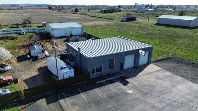
9705 W Trails Rd, Spokane, WA 99224


NEARBY LISTINGS FOR SALE OR LEASE
Property Detail
9705 W Trails Rd
25181.0216
Balmers Garden 1St Add
Commercialnec
BALMERS GARDEN 1ST ADD: BLK 2 EXC E 12.00 FT OF N 190.00 FT
X
Spokane
53063C0525D
Washington
2025
10.04 AC
2025
West Plains
013700
Spokane
5,880 SF
Spokane-Spokane Valley, WA
DEMOGRAPHICS near 9705 W Trails Rd
1 Mile
3 Mile
5 Mile
2024 Total Population
171
14,505
53,325
2029 Population
182
15,639
56,971
Pop Growth 2024-2029
+ 6.43%
+ 7.82%
+ 6.84%
Average Age
40
37
39
2024 Total Households
71
4,814
20,873
HH Growth 2024-2029
+ 7.04%
+ 8.21%
+ 7.12%
Median Household Inc
$69,999
$61,326
$65,333
Avg Household Size
2.40
2.50
2.40
2024 Avg HH Vehicles
2.00
2.00
2.00
Median Home Value
$513,158
$339,309
$310,730
Median Year Built
1994
1997
1972
Nearby Places
Map Layers
Map Styles
 Street
 Aerial
- Restaurants
- Banks
- Shops
- Fitness
- Groceries
PUBLIC TRANSPORTATION
COMMUTER RAIL
DRIVE
WALK
Distance
17 min
7.7 mi
AIRPORT
Spokane International
DRIVE
WALK
Distance
Spokane International
14 min
5.9 mi
SALE & LEASE HISTORY
LISTING DATE
SALE/LEASE

Apr 11, 2024
For Lease
Nearby Properties
Address
Land Use
TOTAL SIZE
Lot Size
Zoning
Address
Land Use
TOTAL SIZE
Lot Size
Zoning
884,262 SF
152.68 AC
PUBLIC
Address
Land Use
TOTAL SIZE
Lot Size
Zoning
1,180,186 SF
22.94 AC
TRIBAL
Address
Land Use
TOTAL SIZE
Lot Size
Zoning
534,093 SF
113 AC
TRIBAL
Address
Land Use
TOTAL SIZE
Lot Size
Zoning
375,237 SF
138.63 AC
TRIBAL
Address
Land Use
TOTAL SIZE
Lot Size
Zoning
118,996 SF
8.21 AC
LI
Address
Land Use
TOTAL SIZE
Lot Size
Zoning
274,308 SF
13 AC
R-3
Address
Land Use
TOTAL SIZE
Lot Size
Zoning
191,286 SF
10.81 AC
R-3
Address
Land Use
TOTAL SIZE
Lot Size
Zoning
314,707 SF
16 AC
LI
Address
Land Use
TOTAL SIZE
Lot Size
Zoning
122,949 SF
11.07 AC
LI
Address
Land Use
TOTAL SIZE
Lot Size
Zoning
149,942 SF
8.27 AC
R-3
Address
Land Use
TOTAL SIZE
Lot Size
Zoning
164,522 SF
19.37 AC
Address
Land Use
TOTAL SIZE
Lot Size
Zoning
59,171 SF
10.12 AC
Address
Land Use
TOTAL SIZE
Lot Size
Zoning
104,889 SF
21.60 AC
LI
Address
Land Use
TOTAL SIZE
Lot Size
Zoning
387,963 SF
49.93 AC
LI
Address
Land Use
TOTAL SIZE
Lot Size
Zoning
46,520 SF
70 AC
I-1
Address
Land Use
TOTAL SIZE
Lot Size
Zoning
101,970 SF
7.88 AC
LI
Address
Land Use
TOTAL SIZE
Lot Size
Zoning
112,672 SF
4.43 AC
Address
Land Use
TOTAL SIZE
Lot Size
Zoning
77,515 SF
4.70 AC
Address
Land Use
TOTAL SIZE
Lot Size
Zoning
86,361 SF
4.85 AC
R-3
Address
Land Use
TOTAL SIZE
Lot Size
Zoning
70,404 SF
61.69 AC
Address
Land Use
TOTAL SIZE
Lot Size
Zoning
53,793 SF
5.59 AC
LI
Address
Land Use
TOTAL SIZE
Lot Size
Zoning
51,074 SF
Address
Land Use
TOTAL SIZE
Lot Size
Zoning
41,340 SF
6.88 AC
Address
Land Use
TOTAL SIZE
Lot Size
Zoning
38,832 SF
6.75 AC
Address
Land Use
TOTAL SIZE
Lot Size
Zoning
67,500 SF
5.11 AC
Address
Land Use
TOTAL SIZE
Lot Size
Zoning
58,086 SF
6.27 AC
LI
Address
Land Use
TOTAL SIZE
Lot Size
Zoning
239,541 SF
38.09 AC
C-2
Address
Land Use
TOTAL SIZE
Lot Size
Zoning
24,449 SF
3.70 AC
LI
Address
Land Use
TOTAL SIZE
Lot Size
Zoning
127,180 SF
13.72 AC
I-2
Address
Land Use
TOTAL SIZE
Lot Size
Zoning
102,800 SF
9.11 AC
I-1
The World's #1 Commercial Real Estate Marketplace
Connect with us
© 2025 CoStar Group
The information above has been obtained from sources believed reliable. While we do not doubt its accuracy we have not verified it and make no guarantee, warranty or representation about it. It is your responsibility to independently confirm its accuracy and completeness. Any projections, opinions, assumptions, or estimates used are for example only and do not represent the current or future performance of the property. The value of this transaction to you depends on tax and other factors which should be evaluated by your tax, financial, and legal advisors. You and your advisors should conduct a careful, independent investigation of the property to determine to your satisfaction the suitability of the property for your needs.