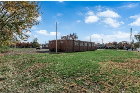
Property Record
9605 Primmgarden Ct, Saint Louis, MO 63132


NEARBY LISTINGS FOR SALE OR LEASE
Property Detail
9605 Primmgarden Ct
16L-51-0457
Elmwood Park
Apartment
ELMWOOD PARK
X
St. Louis
29189C0211K
Missouri
0
4.34 AC
2025
Creve Coeur/Hwy-67
215600
St. Louis
53,720 SF
St. Louis, MO-IL
DEMOGRAPHICS near 9605 Primmgarden Ct
1 Mile
3 Mile
5 Mile
2024 Total Population
11,378
91,683
234,824
2029 Population
11,327
91,303
234,430
Pop Growth 2024-2029
(0.45%)
(0.41%)
(0.17%)
Average Age
39
41
40
2024 Total Households
4,548
39,515
99,752
HH Growth 2024-2029
(0.53%)
(0.44%)
(0.20%)
Median Household Inc
$67,522
$71,129
$75,272
Avg Household Size
2.40
2.20
2.20
2024 Avg HH Vehicles
2.00
2.00
2.00
Median Home Value
$169,620
$195,041
$256,759
Median Year Built
1957
1957
1958
Nearby Places
Map Layers
Map Styles
 Street
 Aerial
- Restaurants
- Banks
- Shops
- Fitness
- Groceries
PUBLIC TRANSPORTATION
COMMUTER RAIL
Clayton (Shrewsbury-Lansdowne I-44 Emerson Park - St. Louis MetroLink (MetroLink))
DRIVE
WALK
Distance
Clayton (Shrewsbury-Lansdowne I-44 Emerson Park - St. Louis MetroLink (MetroLink))
8 min
4.1 mi
Forsyth (Shrewsbury-Lansdowne I-44 Emerson Park - St. Louis MetroLink (MetroLink))
DRIVE
WALK
Distance
Forsyth (Shrewsbury-Lansdowne I-44 Emerson Park - St. Louis MetroLink (MetroLink))
11 min
5.7 mi
AIRPORT
St Louis Lambert International
DRIVE
WALK
Distance
St Louis Lambert International
13 min
7.4 mi
Freight Ports
Port Milwaukee
DRIVE
WALK
Distance
Port Milwaukee
434 min
381.9 mi
Nearby Properties
Address
Land Use
TOTAL SIZE
Lot Size
Zoning
Address
Land Use
TOTAL SIZE
Lot Size
Zoning
1,053,686 SF
31.40 AC
43M-1
Address
Land Use
TOTAL SIZE
Lot Size
Zoning
5,898 SF
21.62 AC
R2
Address
Land Use
TOTAL SIZE
Lot Size
Zoning
52.13 AC
42PA
Address
Land Use
TOTAL SIZE
Lot Size
Zoning
201,879 SF
29.52 AC
82RO
Address
Land Use
TOTAL SIZE
Lot Size
Zoning
272,933 SF
0.82 AC
14PUD
Address
Land Use
TOTAL SIZE
Lot Size
Zoning
1,280,539 SF
151.20 AC
H
Address
Land Use
TOTAL SIZE
Lot Size
Zoning
544,556 SF
95.75 AC
H
Address
Land Use
TOTAL SIZE
Lot Size
Zoning
272,940 SF
0.87 AC
14PUD
Address
Land Use
TOTAL SIZE
Lot Size
Zoning
1.33 AC
C4
Address
Land Use
TOTAL SIZE
Lot Size
Zoning
262,446 SF
1.97 AC
14S-1
Address
Land Use
TOTAL SIZE
Lot Size
Zoning
233,748 SF
0.67 AC
14PUD
Address
Land Use
TOTAL SIZE
Lot Size
Zoning
642,298 SF
1.78 AC
14PUD
Address
Land Use
TOTAL SIZE
Lot Size
Zoning
212,613 SF
1 AC
C4
Address
Land Use
TOTAL SIZE
Lot Size
Zoning
222,517 SF
6.77 AC
C2
Address
Land Use
TOTAL SIZE
Lot Size
Zoning
134,716 SF
15.56 AC
33G
Address
Land Use
TOTAL SIZE
Lot Size
Zoning
19.40 AC
57PA
Address
Land Use
TOTAL SIZE
Lot Size
Zoning
386,784 SF
6.50 AC
57HDR/O
Address
Land Use
TOTAL SIZE
Lot Size
Zoning
288,322 SF
19.72 AC
104PDM
Address
Land Use
TOTAL SIZE
Lot Size
Zoning
249,369 SF
6 AC
57HDR/O
Address
Land Use
TOTAL SIZE
Lot Size
Zoning
160,628 SF
1.47 AC
82R0
Address
Land Use
TOTAL SIZE
Lot Size
Zoning
57,010 SF
2.42 AC
57GC
Address
Land Use
TOTAL SIZE
Lot Size
Zoning
3,154 SF
38.36 AC
33C
Address
Land Use
TOTAL SIZE
Lot Size
Zoning
35,240 SF
0.52 AC
14PUD
Address
Land Use
TOTAL SIZE
Lot Size
Zoning
55.75 AC
33C
Address
Land Use
TOTAL SIZE
Lot Size
Zoning
193,158 SF
3.60 AC
82GC
Address
Land Use
TOTAL SIZE
Lot Size
Zoning
14,371 SF
22.26 AC
84R-2
Address
Land Use
TOTAL SIZE
Lot Size
Zoning
172,059 SF
25.52 AC
R1
Address
Land Use
TOTAL SIZE
Lot Size
Zoning
84,072 SF
0.64 AC
14PUD
Address
Land Use
TOTAL SIZE
Lot Size
Zoning
2.89 AC
F
Address
Land Use
TOTAL SIZE
Lot Size
Zoning
116,090 SF
1.05 AC
82RO
The World's #1 Commercial Real Estate Marketplace
Connect with us
© 2026 CoStar Group
The information above has been obtained from sources believed reliable. While we do not doubt its accuracy we have not verified it and make no guarantee, warranty or representation about it. It is your responsibility to independently confirm its accuracy and completeness. Any projections, opinions, assumptions, or estimates used are for example only and do not represent the current or future performance of the property. The value of this transaction to you depends on tax and other factors which should be evaluated by your tax, financial, and legal advisors. You and your advisors should conduct a careful, independent investigation of the property to determine to your satisfaction the suitability of the property for your needs.