Property Record
9707 Highway 36 Cir, Orchard, TX 77464
NEARBY LISTINGS FOR SALE OR LEASE
-
-
View all Orchard listings for sale on LoopNet.com
Property Detail
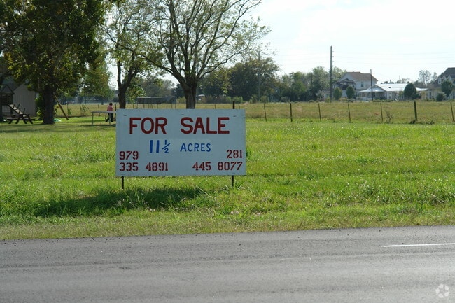
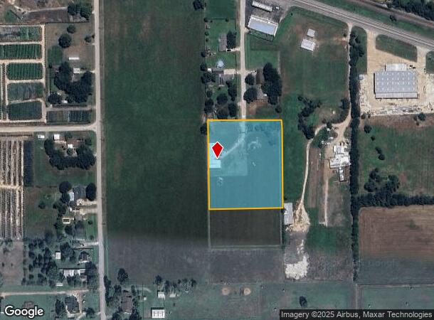
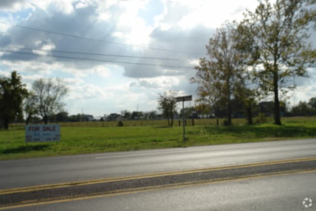
9707 Highway 36 Cir
0338-14-000-0200-903
P Mcgreal
Commercialnec
0338 P MCGREAL, ACRES 3.1799, BLOCK 14 (PT), ORCHARD FARMS S/D, (PT OF A 4.9726 AC TRACT)
X
Fort Bend
48157C0225L
Texas
2024
3.18 AC
2025
Southwest Outlier
675800
Houston
1,391 SF
Houston-The Woodlands-Sugar Land, TX
DEMOGRAPHICS near 9707 Highway 36 Cir
1 Mile
3 Mile
5 Mile
2024 Total Population
41
446
3,496
2029 Population
46
515
4,148
Pop Growth 2024-2029
+ 12.20%
+ 15.47%
+ 18.65%
Average Age
41
42
44
2024 Total Households
14
167
1,283
HH Growth 2024-2029
+ 14.29%
+ 16.17%
+ 19.25%
Median Household Inc
$34,999
$50,577
$104,750
Avg Household Size
2.70
2.70
2.70
2024 Avg HH Vehicles
2.00
2.00
2.00
Median Home Value
$199,999
$375,925
$449,719
Median Year Built
1977
1979
2000
Nearby Places
Map Layers
Map Styles
 Street
 Aerial
- Restaurants
- Banks
- Shops
- Fitness
- Groceries
Nearby Properties
Address
Land Use
TOTAL SIZE
Lot Size
Zoning
Address
Land Use
TOTAL SIZE
Lot Size
Zoning
64,399 SF
16.49 AC
Address
Land Use
TOTAL SIZE
Lot Size
Zoning
2,400 SF
9.11 AC
Address
Land Use
TOTAL SIZE
Lot Size
Zoning
840 SF
2.85 AC
OY
Address
Land Use
TOTAL SIZE
Lot Size
Zoning
24,000 SF
7 AC
Address
Land Use
TOTAL SIZE
Lot Size
Zoning
37,700 SF
3.54 AC
Address
Land Use
TOTAL SIZE
Lot Size
Zoning
12.10 AC
Address
Land Use
TOTAL SIZE
Lot Size
Zoning
4,260 SF
7.95 AC
Address
Land Use
TOTAL SIZE
Lot Size
Zoning
10,975 SF
3.14 AC
NS
Address
Land Use
TOTAL SIZE
Lot Size
Zoning
307.18 AC
Address
Land Use
TOTAL SIZE
Lot Size
Zoning
8.63 AC
Address
Land Use
TOTAL SIZE
Lot Size
Zoning
2,738 SF
10.95 AC
OQY
Address
Land Use
TOTAL SIZE
Lot Size
Zoning
38.67 AC
OY
Address
Land Use
TOTAL SIZE
Lot Size
Zoning
8.58 AC
Address
Land Use
TOTAL SIZE
Lot Size
Zoning
41.75 AC
RQO
Address
Land Use
TOTAL SIZE
Lot Size
Zoning
3,389 SF
0.74 AC
Address
Land Use
TOTAL SIZE
Lot Size
Zoning
Address
Land Use
TOTAL SIZE
Lot Size
Zoning
3,712 SF
0.41 AC
R
Address
Land Use
TOTAL SIZE
Lot Size
Zoning
814 SF
29.68 AC
PR
Address
Land Use
TOTAL SIZE
Lot Size
Zoning
26.25 AC
Address
Land Use
TOTAL SIZE
Lot Size
Zoning
99.27 AC
SY
Address
Land Use
TOTAL SIZE
Lot Size
Zoning
3,741 SF
4.43 AC
Address
Land Use
TOTAL SIZE
Lot Size
Zoning
6,500 SF
0.69 AC
X
Address
Land Use
TOTAL SIZE
Lot Size
Zoning
139.69 AC
YQS
Address
Land Use
TOTAL SIZE
Lot Size
Zoning
26.35 AC
Address
Land Use
TOTAL SIZE
Lot Size
Zoning
61.17 AC
STOY
Address
Land Use
TOTAL SIZE
Lot Size
Zoning
984 SF
13.52 AC
O,S
Address
Land Use
TOTAL SIZE
Lot Size
Zoning
27.40 AC
OSY
Address
Land Use
TOTAL SIZE
Lot Size
Zoning
3,292 SF
7.73 AC
SQ
Address
Land Use
TOTAL SIZE
Lot Size
Zoning
38.27 AC
The World's #1 Commercial Real Estate Marketplace
Connect with us
© 2026 CoStar Group
The information above has been obtained from sources believed reliable. While we do not doubt its accuracy we have not verified it and make no guarantee, warranty or representation about it. It is your responsibility to independently confirm its accuracy and completeness. Any projections, opinions, assumptions, or estimates used are for example only and do not represent the current or future performance of the property. The value of this transaction to you depends on tax and other factors which should be evaluated by your tax, financial, and legal advisors. You and your advisors should conduct a careful, independent investigation of the property to determine to your satisfaction the suitability of the property for your needs.