Property Record
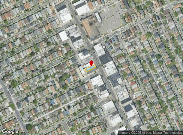
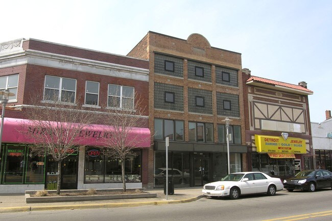
9709 Joseph Campau St, Hamtramck, MI 48212

NEARBY LISTINGS FOR SALE OR LEASE
Property Detail
9709 Joseph Campau St
Detroit-Warren-Dearborn, MI
Whitney's
41-003-04-0250-000
LOT 250 WHITNEY'S SUB BLOCK 4 1/4 SEC 39-42 10,000 A.T. L25 P77WCR
Commercialofficeresidentialmixeduse
Wayne
X
Michigan
26163C0125E
250
2025
0.07 AC
2025
Detroit E of Woodward
552200
Detroit
9,360 SF
DEMOGRAPHICS near 9709 Joseph Campau St
1 Mile
3 Mile
5 Mile
2024 Total Population
30,227
127,542
373,252
2029 Population
28,670
127,204
375,966
Pop Growth 2024-2029
(5.15%)
(0.27%)
+ 0.73%
Average Age
32
37
38
2024 Total Households
8,565
48,802
155,833
HH Growth 2024-2029
(5.18%)
+ 0.12%
+ 0.72%
Median Household Inc
$35,044
$33,740
$35,881
Avg Household Size
3.40
2.50
2.30
2024 Avg HH Vehicles
1.00
1.00
1.00
Median Home Value
$103,895
$81,377
$83,329
Median Year Built
1946
1948
1949
Nearby Places
Map Layers
Map Styles
 Street
 Aerial
- Restaurants
- Banks
- Shops
- Fitness
- Groceries
SALE & LEASE HISTORY
LISTING DATE
SALE/LEASE

Sep 25, 2016
For Lease
Nearby Properties
Address
Land Use
TOTAL SIZE
Lot Size
Zoning
Address
Land Use
TOTAL SIZE
Lot Size
Zoning
3,793,609 SF
265.70 AC
M4
Address
Land Use
TOTAL SIZE
Lot Size
Zoning
334,904 SF
B5
Address
Land Use
TOTAL SIZE
Lot Size
Zoning
627,489 SF
5.82 AC
B4
Address
Land Use
TOTAL SIZE
Lot Size
Zoning
506,450 SF
3.84 AC
B5
Address
Land Use
TOTAL SIZE
Lot Size
Zoning
266,016 SF
7.76 AC
PD
Address
Land Use
TOTAL SIZE
Lot Size
Zoning
167,000 SF
1.83 AC
PD
Address
Land Use
TOTAL SIZE
Lot Size
Zoning
996,200 SF
2.14 AC
Address
Land Use
TOTAL SIZE
Lot Size
Zoning
332,208 SF
2.72 AC
R6
Address
Land Use
TOTAL SIZE
Lot Size
Zoning
152,232 SF
SD2
Address
Land Use
TOTAL SIZE
Lot Size
Zoning
147,879 SF
2.05 AC
B6
Address
Land Use
TOTAL SIZE
Lot Size
Zoning
531,360 SF
1.44 AC
B5
Address
Land Use
TOTAL SIZE
Lot Size
Zoning
506,404 SF
198 AC
M4
Address
Land Use
TOTAL SIZE
Lot Size
Zoning
678,539 SF
3.52 AC
B5
Address
Land Use
TOTAL SIZE
Lot Size
Zoning
158,535 SF
B4
Address
Land Use
TOTAL SIZE
Lot Size
Zoning
164,797 SF
2.03 AC
Address
Land Use
TOTAL SIZE
Lot Size
Zoning
892,351 SF
92.45 AC
I
Address
Land Use
TOTAL SIZE
Lot Size
Zoning
449,083 SF
2.39 AC
B2
Address
Land Use
TOTAL SIZE
Lot Size
Zoning
191,837 SF
16.99 AC
PD
Address
Land Use
TOTAL SIZE
Lot Size
Zoning
171,665 SF
3.73 AC
R5
Address
Land Use
TOTAL SIZE
Lot Size
Zoning
76,986 SF
2.73 AC
B4
Address
Land Use
TOTAL SIZE
Lot Size
Zoning
274,900 SF
M2
Address
Land Use
TOTAL SIZE
Lot Size
Zoning
331,559 SF
11.42 AC
M4
Address
Land Use
TOTAL SIZE
Lot Size
Zoning
564,958 SF
9.69 AC
M4
Address
Land Use
TOTAL SIZE
Lot Size
Zoning
135,296 SF
1.09 AC
R5
Address
Land Use
TOTAL SIZE
Lot Size
Zoning
252,294 SF
11.54 AC
R6
Address
Land Use
TOTAL SIZE
Lot Size
Zoning
263,240 SF
1.21 AC
B4
Address
Land Use
TOTAL SIZE
Lot Size
Zoning
185,944 SF
B2
Address
Land Use
TOTAL SIZE
Lot Size
Zoning
446,500 SF
27.90 AC
Address
Land Use
TOTAL SIZE
Lot Size
Zoning
224,410 SF
2.11 AC
M3
Address
Land Use
TOTAL SIZE
Lot Size
Zoning
144,578 SF
7.10 AC
PD
The World's #1 Commercial Real Estate Marketplace
Connect with us
© 2026 CoStar Group
The information above has been obtained from sources believed reliable. While we do not doubt its accuracy we have not verified it and make no guarantee, warranty or representation about it. It is your responsibility to independently confirm its accuracy and completeness. Any projections, opinions, assumptions, or estimates used are for example only and do not represent the current or future performance of the property. The value of this transaction to you depends on tax and other factors which should be evaluated by your tax, financial, and legal advisors. You and your advisors should conduct a careful, independent investigation of the property to determine to your satisfaction the suitability of the property for your needs.