Property Record
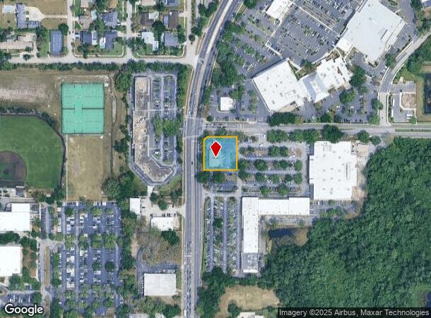
971 N State Road 434, Altamonte Springs, FL 32714


NEARBY LISTINGS FOR SALE OR LEASE
Property Detail
971 N State Road 434
09-21-29-512-0A00-0000
R And R Subdivision
Financialbuilding
TRACT A R & R SUBDIVISION PB 33 PGS 23 & 24
X
Seminole
12095C0145F
Florida
2024
0.59 AC
2024
Altamonte/Douglas
021613
Orlando
3,962 SF
Orlando-Kissimmee-Sanford, FL
DEMOGRAPHICS near 971 N State Road 434
1 Mile
3 Mile
5 Mile
2024 Total Population
11,923
89,602
190,609
2029 Population
12,463
93,289
197,880
Pop Growth 2024-2029
+ 4.53%
+ 4.11%
+ 3.81%
Average Age
40
41
41
2024 Total Households
4,839
37,312
76,468
HH Growth 2024-2029
+ 4.77%
+ 4.36%
+ 4.02%
Median Household Inc
$60,956
$67,209
$65,275
Avg Household Size
2.40
2.30
2.40
2024 Avg HH Vehicles
2.00
2.00
2.00
Median Home Value
$297,162
$337,457
$312,536
Median Year Built
1981
1982
1983
Nearby Places
Map Layers
Map Styles
 Street
 Aerial
- Restaurants
- Banks
- Shops
- Fitness
- Groceries
PUBLIC TRANSPORTATION
COMMUTER RAIL
DRIVE
WALK
Distance
11 min
5.3 mi
DRIVE
WALK
Distance
11 min
5.5 mi
AIRPORT
Orlando Sanford International
DRIVE
WALK
Distance
Orlando Sanford International
27 min
15.8 mi
Orlando International
DRIVE
WALK
Distance
Orlando International
39 min
24.0 mi
Daytona Beach International
DRIVE
WALK
Distance
Daytona Beach International
55 min
43.8 mi
Freight Ports
Port Canaveral
DRIVE
WALK
Distance
Port Canaveral
85 min
66.0 mi
Nearby Properties
Address
Land Use
TOTAL SIZE
Lot Size
Zoning
Address
Land Use
TOTAL SIZE
Lot Size
Zoning
630,861 SF
31.67 AC
PUDMO
Address
Land Use
TOTAL SIZE
Lot Size
Zoning
88,256 SF
39.64 AC
MOC3
Address
Land Use
TOTAL SIZE
Lot Size
Zoning
423,270 SF
3.45 AC
MOC3
Address
Land Use
TOTAL SIZE
Lot Size
Zoning
745,187 SF
18 AC
PUD
Address
Land Use
TOTAL SIZE
Lot Size
Zoning
34,430 SF
19.99 AC
Address
Land Use
TOTAL SIZE
Lot Size
Zoning
1,674 SF
10.53 AC
R3
Address
Land Use
TOTAL SIZE
Lot Size
Zoning
129,745 SF
71.01 AC
PUD
Address
Land Use
TOTAL SIZE
Lot Size
Zoning
357 SF
17.05 AC
Address
Land Use
TOTAL SIZE
Lot Size
Zoning
Address
Land Use
TOTAL SIZE
Lot Size
Zoning
1,416 SF
23.80 AC
Address
Land Use
TOTAL SIZE
Lot Size
Zoning
391,714 SF
42.59 AC
A1
Address
Land Use
TOTAL SIZE
Lot Size
Zoning
400 SF
13.82 AC
R1AA
Address
Land Use
TOTAL SIZE
Lot Size
Zoning
5,256 SF
1.10 AC
PUDRES
Address
Land Use
TOTAL SIZE
Lot Size
Zoning
11,392 SF
8.44 AC
Address
Land Use
TOTAL SIZE
Lot Size
Zoning
1,428 SF
8.56 AC
MOR3
Address
Land Use
TOTAL SIZE
Lot Size
Zoning
1,170 SF
17.75 AC
A1
Address
Land Use
TOTAL SIZE
Lot Size
Zoning
5,913 SF
14.46 AC
Address
Land Use
TOTAL SIZE
Lot Size
Zoning
254,477 SF
13.14 AC
MOR2
Address
Land Use
TOTAL SIZE
Lot Size
Zoning
268,195 SF
50.24 AC
O
Address
Land Use
TOTAL SIZE
Lot Size
Zoning
5,924 SF
17.38 AC
R1A
Address
Land Use
TOTAL SIZE
Lot Size
Zoning
3,680 SF
17.70 AC
PUD
Address
Land Use
TOTAL SIZE
Lot Size
Zoning
249,311 SF
21.11 AC
R3A
Address
Land Use
TOTAL SIZE
Lot Size
Zoning
3,140 SF
15.89 AC
PUD
Address
Land Use
TOTAL SIZE
Lot Size
Zoning
3,390 SF
18.59 AC
PUD
Address
Land Use
TOTAL SIZE
Lot Size
Zoning
228,362 SF
214.60 AC
PUD
Address
Land Use
TOTAL SIZE
Lot Size
Zoning
254,371 SF
15.63 AC
R1A
Address
Land Use
TOTAL SIZE
Lot Size
Zoning
6,466 SF
18.97 AC
MOC3
Address
Land Use
TOTAL SIZE
Lot Size
Zoning
279,457 SF
20.56 AC
R3
Address
Land Use
TOTAL SIZE
Lot Size
Zoning
259,436 SF
11.23 AC
A1
Address
Land Use
TOTAL SIZE
Lot Size
Zoning
3,854 SF
14.33 AC
PUD
The World's #1 Commercial Real Estate Marketplace
Connect with us
© 2025 CoStar Group
The information above has been obtained from sources believed reliable. While we do not doubt its accuracy we have not verified it and make no guarantee, warranty or representation about it. It is your responsibility to independently confirm its accuracy and completeness. Any projections, opinions, assumptions, or estimates used are for example only and do not represent the current or future performance of the property. The value of this transaction to you depends on tax and other factors which should be evaluated by your tax, financial, and legal advisors. You and your advisors should conduct a careful, independent investigation of the property to determine to your satisfaction the suitability of the property for your needs.