Property Record
971 State Highway 121, Allen, TX 75013
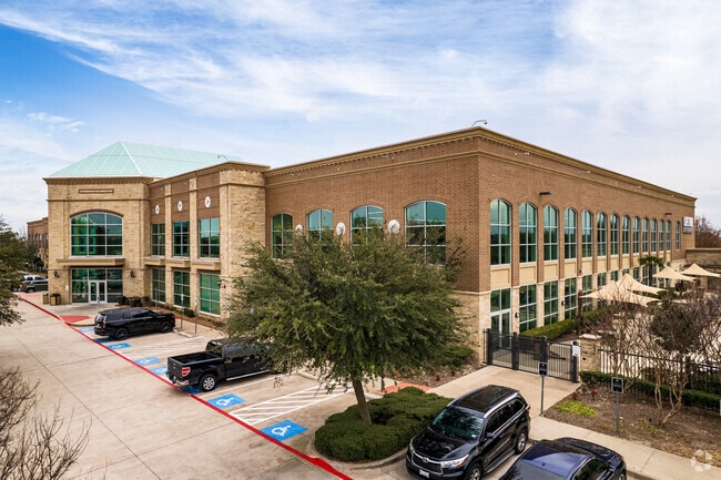


Property Detail
971 State Highway 121
Dallas-Fort Worth-Arlington, TX
STARCREEK COMMERCIAL, BLK A, LOT 1
R-8748-00A-0010-1
COLLIN
Commercialnec
Texas
B and X Area of moderate flood hazard, usually the area between the limits of the 100-year and 500-year floods.
1
2025
12.94 AC
2025
Allen
031507
Dallas/Ft Worth
126,311 SF
NEARBY LISTINGS FOR SALE OR LEASE
DEMOGRAPHICS near 971 State Highway 121
1 mile
3 mile
5 mile
2024 Total Population
12,309
131,338
325,177
2029 Population
14,327
150,290
370,892
Pop Growth 2024-2029
+ 16.39%
+ 14.43%
+ 14.06%
Average Age
36
38
38
2024 Total Households
4,167
48,519
115,170
HH Growth 2024-2029
+ 16.63%
+ 14.76%
+ 14.33%
Median Household Inc
$154,759
$121,079
$126,818
Avg Household Size
2.90
2.70
2.80
2024 Avg HH Vehicles
2.00
2.00
2.00
Median Home Value
$691,007
$557,396
$555,792
Median Year Built
2011
2009
2005
Nearby Places
Map Layers
Map Styles
 Street
 Aerial
Transit
 Traffic
 Biking
Places
Listings with unknown addresses are not visible on the map
- Restaurants
- Banks
- Shops
- Fitness
- Groceries
PUBLIC TRANSPORTATION
AIRPORT
Dallas Love Field
Drive
Walk
Distance
Dallas Love Field
40 min
29.4 mi
Dallas-Fort Worth International
Drive
Walk
Distance
Dallas-Fort Worth International
37 min
31.0 mi
Nearby Properties
Address
Land Use
TOTAL SIZE
Lot Size
Zoning
Address
Land Use
TOTAL SIZE
Lot Size
Zoning
1,089,284 SF
90.69 AC
Address
Land Use
TOTAL SIZE
Lot Size
Zoning
638,539 SF
42.76 AC
Address
Land Use
TOTAL SIZE
Lot Size
Zoning
472,185 SF
63.51 AC
AO
Address
Land Use
TOTAL SIZE
Lot Size
Zoning
611,780 SF
59.06 AC
L1
Address
Land Use
TOTAL SIZE
Lot Size
Zoning
720,571 SF
68.28 AC
Address
Land Use
TOTAL SIZE
Lot Size
Zoning
709,804 SF
32.68 AC
Address
Land Use
TOTAL SIZE
Lot Size
Zoning
256,445 SF
10.42 AC
Address
Land Use
TOTAL SIZE
Lot Size
Zoning
162,000 SF
34 AC
L1
Address
Land Use
TOTAL SIZE
Lot Size
Zoning
387,377 SF
64.34 AC
Address
Land Use
TOTAL SIZE
Lot Size
Zoning
585,170 SF
18.69 AC
MF RG-18
Address
Land Use
TOTAL SIZE
Lot Size
Zoning
511,762 SF
28.81 AC
Address
Land Use
TOTAL SIZE
Lot Size
Zoning
495,048 SF
7.37 AC
Address
Land Use
TOTAL SIZE
Lot Size
Zoning
557,288 SF
9.18 AC
Address
Land Use
TOTAL SIZE
Lot Size
Zoning
518,353 SF
28.51 AC
MF-M
Address
Land Use
TOTAL SIZE
Lot Size
Zoning
479,620 SF
14.02 AC
Address
Land Use
TOTAL SIZE
Lot Size
Zoning
435,382 SF
6.95 AC
MF-E
Address
Land Use
TOTAL SIZE
Lot Size
Zoning
288,826 SF
18.71 AC
CC
Address
Land Use
TOTAL SIZE
Lot Size
Zoning
556,741 SF
8.70 AC
MF-R
Address
Land Use
TOTAL SIZE
Lot Size
Zoning
586,110 SF
10.50 AC
LI
Address
Land Use
TOTAL SIZE
Lot Size
Zoning
511,383 SF
10.89 AC
PD-OC
Address
Land Use
TOTAL SIZE
Lot Size
Zoning
369,702 SF
5.10 AC
Address
Land Use
TOTAL SIZE
Lot Size
Zoning
509,085 SF
11.63 AC
PD-OC
Address
Land Use
TOTAL SIZE
Lot Size
Zoning
442,695 SF
24.65 AC
MF-M
Address
Land Use
TOTAL SIZE
Lot Size
Zoning
483,386 SF
4.62 AC
MF-R
Address
Land Use
TOTAL SIZE
Lot Size
Zoning
414,198 SF
72.67 AC
Address
Land Use
TOTAL SIZE
Lot Size
Zoning
464,454 SF
11.04 AC
PD
Address
Land Use
TOTAL SIZE
Lot Size
Zoning
397,395 SF
12.25 AC
Address
Land Use
TOTAL SIZE
Lot Size
Zoning
199,115 SF
1.36 AC
Address
Land Use
TOTAL SIZE
Lot Size
Zoning
350,018 SF
7.02 AC
MF-E
Address
Land Use
TOTAL SIZE
Lot Size
Zoning
357,097 SF
19.68 AC
MF-M
The World's #1 Commercial Real Estate Marketplace
Connect with us
© 2026 CoStar Group
The information above has been obtained from sources believed reliable. While we do not doubt its accuracy we have not verified it and make no guarantee, warranty or representation about it. It is your responsibility to independently confirm its accuracy and completeness. Any projections, opinions, assumptions, or estimates used are for example only and do not represent the current or future performance of the property. The value of this transaction to you depends on tax and other factors which should be evaluated by your tax, financial, and legal advisors. You and your advisors should conduct a careful, independent investigation of the property to determine to your satisfaction the suitability of the property for your needs.