Property Record
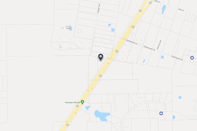
971 State Highway 35 Byp S, Rockport, TX 78382


Property Detail
971 State Highway 35 Byp S
Corpus Christi, TX
ABERNATHY TRACTS, LOT 32, NW PT OF, ACRES 2.715
R63875
ARANSAS
Commercialnec
Texas
B and X Area of moderate flood hazard, usually the area between the limits of the 100-year and 500-year floods.
32
2025
2.72 AC
2025
Rockport/N Aransas
950302
Corpus Christi
4,960 SF
NEARBY LISTINGS FOR SALE OR LEASE
DEMOGRAPHICS near 971 State Highway 35 Byp S
1 mile
3 mile
5 mile
2025 Total Population
247
6,512
15,823
2030 Population
240
6,770
16,544
Pop Growth 2025-2030
(2.83%)
+ 3.96%
+ 4.56%
Average Age
46
45
45
2025 Total Households
102
2,626
6,436
HH Growth 2025-2030
(3.92%)
+ 4.34%
+ 4.91%
Median Household Inc
$62,935
$55,064
$49,544
Avg Household Size
2.20
2.30
2.30
2025 Avg HH Vehicles
2.00
2.00
2.00
Median Home Value
$223,077
$177,003
$218,492
Median Year Built
1984
1991
1993
Nearby Places
Map Layers
Map Styles
 Street
 Aerial
Transit
 Traffic
 Biking
Places
Listings with unknown addresses are not visible on the map
- Restaurants
- Banks
- Shops
- Fitness
- Groceries
PUBLIC TRANSPORTATION
AIRPORT
Corpus Christi International
Drive
Walk
Distance
Corpus Christi International
41 min
33.6 mi
Freight Ports
Port of Corpus Christi
Drive
Walk
Distance
Port of Corpus Christi
29 min
25.6 mi
Nearby Properties
Address
Land Use
TOTAL SIZE
Lot Size
Zoning
Address
Land Use
TOTAL SIZE
Lot Size
Zoning
163,293 SF
13.66 AC
Address
Land Use
TOTAL SIZE
Lot Size
Zoning
65,191 SF
Address
Land Use
TOTAL SIZE
Lot Size
Zoning
437.18 AC
Address
Land Use
TOTAL SIZE
Lot Size
Zoning
3,524 SF
14.03 AC
Address
Land Use
TOTAL SIZE
Lot Size
Zoning
165,600 SF
12.32 AC
Address
Land Use
TOTAL SIZE
Lot Size
Zoning
4,352 SF
4.38 AC
Address
Land Use
TOTAL SIZE
Lot Size
Zoning
62,355 SF
3.21 AC
Address
Land Use
TOTAL SIZE
Lot Size
Zoning
1,840 SF
2.70 AC
Address
Land Use
TOTAL SIZE
Lot Size
Zoning
89.07 AC
Address
Land Use
TOTAL SIZE
Lot Size
Zoning
98,990 SF
13.40 AC
Address
Land Use
TOTAL SIZE
Lot Size
Zoning
7,915 SF
0.61 AC
Address
Land Use
TOTAL SIZE
Lot Size
Zoning
9,865 SF
15.86 AC
Address
Land Use
TOTAL SIZE
Lot Size
Zoning
9,618 SF
7.50 AC
Address
Land Use
TOTAL SIZE
Lot Size
Zoning
389.11 AC
Address
Land Use
TOTAL SIZE
Lot Size
Zoning
3,634 SF
9.89 AC
Address
Land Use
TOTAL SIZE
Lot Size
Zoning
7,740 SF
1.21 AC
Address
Land Use
TOTAL SIZE
Lot Size
Zoning
3,536 SF
6 AC
Address
Land Use
TOTAL SIZE
Lot Size
Zoning
99,840 SF
19 AC
Address
Land Use
TOTAL SIZE
Lot Size
Zoning
10,067 SF
393.44 AC
Address
Land Use
TOTAL SIZE
Lot Size
Zoning
2,510 SF
7.13 AC
Address
Land Use
TOTAL SIZE
Lot Size
Zoning
192.63 AC
Address
Land Use
TOTAL SIZE
Lot Size
Zoning
1,216 SF
3.27 AC
Address
Land Use
TOTAL SIZE
Lot Size
Zoning
2,520 SF
27.18 AC
Address
Land Use
TOTAL SIZE
Lot Size
Zoning
40,300 SF
3.97 AC
Address
Land Use
TOTAL SIZE
Lot Size
Zoning
14,086 SF
37 AC
Address
Land Use
TOTAL SIZE
Lot Size
Zoning
Address
Land Use
TOTAL SIZE
Lot Size
Zoning
8,280 SF
4.85 AC
Address
Land Use
TOTAL SIZE
Lot Size
Zoning
5.85 AC
Address
Land Use
TOTAL SIZE
Lot Size
Zoning
59,866 SF
3.31 AC
Address
Land Use
TOTAL SIZE
Lot Size
Zoning
1,040 SF
17.34 AC
The World's #1 Commercial Real Estate Marketplace
Connect with us
© 2026 CoStar Group
The information above has been obtained from sources believed reliable. While we do not doubt its accuracy we have not verified it and make no guarantee, warranty or representation about it. It is your responsibility to independently confirm its accuracy and completeness. Any projections, opinions, assumptions, or estimates used are for example only and do not represent the current or future performance of the property. The value of this transaction to you depends on tax and other factors which should be evaluated by your tax, financial, and legal advisors. You and your advisors should conduct a careful, independent investigation of the property to determine to your satisfaction the suitability of the property for your needs.