Property Record
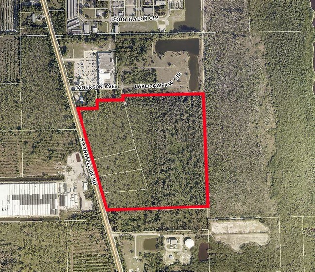
9720 Stringfellow Rd, Saint James City, FL 33956
Property Detail
9720 Stringfellow Rd
33-44-22-00-00008.0020
PARL IN NE1/4 EAST OF SR 767 DESC IN INST #2013000163192
Vacantlandnec
LEE
CC
Florida
AE The base floodplain where base flood elevations are provided. AE Zones are now used on new format FIRMs instead of A1-A30 Zones.
39.05 AC
0
The Islands
2025
Southwest Florida
070202
Cape Coral-Fort Myers, FL
NEARBY LISTINGS FOR SALE OR LEASE
DEMOGRAPHICS near 9720 Stringfellow Rd
1 mile
3 mile
5 mile
2025 Total Population
291
3,723
9,731
2030 Population
323
4,160
10,906
Pop Growth 2025-2030
+ 11.00%
+ 11.74%
+ 12.07%
Average Age
54
55
53
2025 Total Households
142
1,834
4,499
HH Growth 2025-2030
+ 10.56%
+ 11.07%
+ 11.45%
Median Household Inc
$60,500
$58,638
$71,030
Avg Household Size
1.90
1.90
2.10
2025 Avg HH Vehicles
2.00
2.00
2.00
Median Home Value
$384,482
$379,453
$466,366
Median Year Built
1984
1984
1991
Nearby Places
Map Layers
Map Styles
 Street
 Aerial
Layers
 Traffic
 Biking
Places
Listings with unknown addresses are not visible on the map
- Restaurants
- Banks
- Shops
- Fitness
- Groceries
PUBLIC TRANSPORTATION
AIRPORT
Punta Gorda
Drive
Walk
Distance
Punta Gorda
47 min
27.7 mi
Southwest Florida International
Drive
Walk
Distance
Southwest Florida International
53 min
31.6 mi
Freight Ports
Port Manatee
Drive
Walk
Distance
Port Manatee
127 min
99.4 mi
SALE & LEASE HISTORY
LISTING DATE
SALE/LEASE

Jun 14, 2018
For Sale
Nearby Properties
Address
Land Use
TOTAL SIZE
Lot Size
Zoning
Address
Land Use
TOTAL SIZE
Lot Size
Zoning
207.51 AC
AG-2
Address
Land Use
TOTAL SIZE
Lot Size
Zoning
69,398 SF
10.01 AC
C-1
Address
Land Use
TOTAL SIZE
Lot Size
Zoning
53,681 SF
14.43 AC
TFC2
Address
Land Use
TOTAL SIZE
Lot Size
Zoning
34,124 SF
40.50 AC
AG-2
Address
Land Use
TOTAL SIZE
Lot Size
Zoning
34,250 SF
5.84 AC
CPD
Address
Land Use
TOTAL SIZE
Lot Size
Zoning
784 SF
4,603.99 AC
AG-2
Address
Land Use
TOTAL SIZE
Lot Size
Zoning
30,439 SF
5.06 AC
AG-2
Address
Land Use
TOTAL SIZE
Lot Size
Zoning
175.30 AC
AG-2
Address
Land Use
TOTAL SIZE
Lot Size
Zoning
17,400 SF
51.01 AC
AG-2
Address
Land Use
TOTAL SIZE
Lot Size
Zoning
4,924 SF
0.94 AC
C-1
Address
Land Use
TOTAL SIZE
Lot Size
Zoning
4,569 SF
2.82 AC
CPD
Address
Land Use
TOTAL SIZE
Lot Size
Zoning
5,000 SF
1.07 AC
IG
Address
Land Use
TOTAL SIZE
Lot Size
Zoning
20.48 AC
RM-2
Address
Land Use
TOTAL SIZE
Lot Size
Zoning
259 SF
2.48 AC
PORT
Address
Land Use
TOTAL SIZE
Lot Size
Zoning
2,648 SF
7.19 AC
AG-2
Address
Land Use
TOTAL SIZE
Lot Size
Zoning
21,050 SF
1.35 AC
IL
Address
Land Use
TOTAL SIZE
Lot Size
Zoning
23,006 SF
1.68 AC
CG
Address
Land Use
TOTAL SIZE
Lot Size
Zoning
13,373 SF
0.60 AC
AG-2
Address
Land Use
TOTAL SIZE
Lot Size
Zoning
9,343 SF
1.07 AC
CC
Address
Land Use
TOTAL SIZE
Lot Size
Zoning
8,581 SF
0.87 AC
C-1
Address
Land Use
TOTAL SIZE
Lot Size
Zoning
8,750 SF
3.69 AC
AG-2
Address
Land Use
TOTAL SIZE
Lot Size
Zoning
8,689 SF
1.23 AC
C-1
Address
Land Use
TOTAL SIZE
Lot Size
Zoning
9,822 SF
0.89 AC
CC
Address
Land Use
TOTAL SIZE
Lot Size
Zoning
6,373 SF
4.60 AC
C1A
Address
Land Use
TOTAL SIZE
Lot Size
Zoning
9,622 SF
2.74 AC
TFC2
Address
Land Use
TOTAL SIZE
Lot Size
Zoning
1.64 AC
IG
Address
Land Use
TOTAL SIZE
Lot Size
Zoning
15,972 SF
5 AC
AG-2
Address
Land Use
TOTAL SIZE
Lot Size
Zoning
38.61 AC
AG-2
Address
Land Use
TOTAL SIZE
Lot Size
Zoning
9,152 SF
1.32 AC
C-1
Address
Land Use
TOTAL SIZE
Lot Size
Zoning
7,729 SF
17.36 AC
AG-2
The World's #1 Commercial Real Estate Marketplace
Connect with us
© 2026 CoStar Group
The information above has been obtained from sources believed reliable. While we do not doubt its accuracy we have not verified it and make no guarantee, warranty or representation about it. It is your responsibility to independently confirm its accuracy and completeness. Any projections, opinions, assumptions, or estimates used are for example only and do not represent the current or future performance of the property. The value of this transaction to you depends on tax and other factors which should be evaluated by your tax, financial, and legal advisors. You and your advisors should conduct a careful, independent investigation of the property to determine to your satisfaction the suitability of the property for your needs.