Property Record
9721 Belair Rd, Nottingham, MD 21236


NEARBY LISTINGS FOR SALE OR LEASE
Property Detail
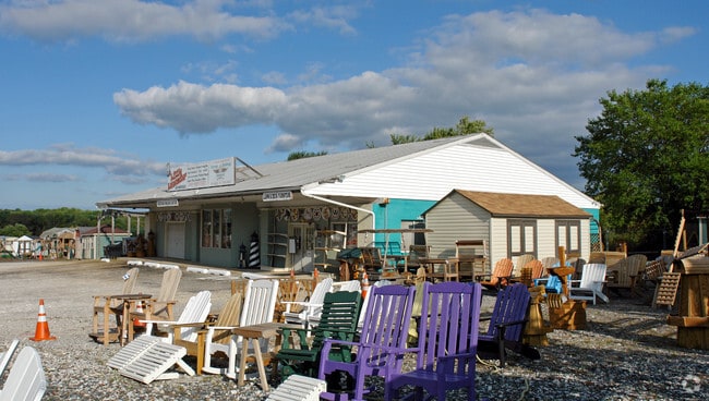
9721 Belair Rd
11-1101010120
Forge Village Centre
Lightindustrial
4.7474 AC FORGE VILLAGE CENTRE
X
Baltimore
2400100290G
Maryland
2024
4.75 AC
2025
Baltimore County East
411306
Baltimore
4,320 SF
Baltimore-Columbia-Towson, MD
DEMOGRAPHICS near 9721 Belair Rd
1 mile
3 mile
5 mile
2024 Total Population
9,347
54,721
127,025
2029 Population
9,294
53,969
125,542
Pop Growth 2024-2029
(0.57%)
(1.37%)
(1.17%)
Average Age
45
42
41
2024 Total Households
3,850
20,477
49,708
HH Growth 2024-2029
(0.68%)
(1.46%)
(1.29%)
Median Household Inc
$92,652
$102,765
$89,666
Avg Household Size
2.40
2.60
2.50
2024 Avg HH Vehicles
2.00
2.00
2.00
Median Home Value
$359,014
$344,525
$323,965
Median Year Built
1991
1986
1982
Nearby Places
Map Layers
Map Styles
 Street
 Aerial
Transit
 Traffic
 Biking
Places
Listings with unknown addresses are not visible on the map
- Restaurants
- Banks
- Shops
- Fitness
- Groceries
PUBLIC TRANSPORTATION
COMMUTER RAIL
Martin State Airport (PENN - WASHINGTON - Maryland Area Regional Commuter Trains (The MARC), Penn Line - Maryland Area Regional Commuter Trains (The MARC))
Drive
Walk
Distance
Martin State Airport (PENN - WASHINGTON - Maryland Area Regional Commuter Trains (The MARC), Penn Line - Maryland Area Regional Commuter Trains (The MARC))
16 min
8.7 mi
AIRPORT
Baltimore/Washington International Thurgood Marshall
Drive
Walk
Distance
Baltimore/Washington International Thurgood Marshall
40 min
26.0 mi
Freight Ports
Port of Baltimore
Drive
Walk
Distance
Port of Baltimore
28 min
17.4 mi
Nearby Properties
Address
Land Use
TOTAL SIZE
Lot Size
Zoning
Address
Land Use
TOTAL SIZE
Lot Size
Zoning
527,364 SF
18.11 AC
BM
Address
Land Use
TOTAL SIZE
Lot Size
Zoning
584,740 SF
32.61 AC
Address
Land Use
TOTAL SIZE
Lot Size
Zoning
16.08 AC
DR16
Address
Land Use
TOTAL SIZE
Lot Size
Zoning
214,738 SF
5.92 AC
Address
Land Use
TOTAL SIZE
Lot Size
Zoning
240,121 SF
9.97 AC
Address
Land Use
TOTAL SIZE
Lot Size
Zoning
12.20 AC
DR16
Address
Land Use
TOTAL SIZE
Lot Size
Zoning
225,070 SF
20.65 AC
Address
Land Use
TOTAL SIZE
Lot Size
Zoning
239,798 SF
11.90 AC
Address
Land Use
TOTAL SIZE
Lot Size
Zoning
222,711 SF
39.21 AC
DR55
Address
Land Use
TOTAL SIZE
Lot Size
Zoning
9.54 AC
DR16
Address
Land Use
TOTAL SIZE
Lot Size
Zoning
7.72 AC
DR5.5
Address
Land Use
TOTAL SIZE
Lot Size
Zoning
64,480 SF
20.43 AC
Address
Land Use
TOTAL SIZE
Lot Size
Zoning
12.81 AC
DR16
Address
Land Use
TOTAL SIZE
Lot Size
Zoning
12.09 AC
DR5.5
Address
Land Use
TOTAL SIZE
Lot Size
Zoning
7.85 AC
DR5.5
Address
Land Use
TOTAL SIZE
Lot Size
Zoning
9.79 AC
DR5.5
Address
Land Use
TOTAL SIZE
Lot Size
Zoning
13,708 SF
15.67 AC
BLCCC
Address
Land Use
TOTAL SIZE
Lot Size
Zoning
10,605 SF
12.96 AC
BL
Address
Land Use
TOTAL SIZE
Lot Size
Zoning
100,725 SF
6.30 AC
BL
Address
Land Use
TOTAL SIZE
Lot Size
Zoning
10.88 AC
DR16
Address
Land Use
TOTAL SIZE
Lot Size
Zoning
7.16 AC
BM
Address
Land Use
TOTAL SIZE
Lot Size
Zoning
16.96 AC
DR5.5
Address
Land Use
TOTAL SIZE
Lot Size
Zoning
24.17 AC
DR5.5
Address
Land Use
TOTAL SIZE
Lot Size
Zoning
115,185 SF
12.88 AC
BM
Address
Land Use
TOTAL SIZE
Lot Size
Zoning
165,000 SF
13.10 AC
Address
Land Use
TOTAL SIZE
Lot Size
Zoning
69,744 SF
9.19 AC
BL-CS
Address
Land Use
TOTAL SIZE
Lot Size
Zoning
97,874 SF
3.98 AC
Address
Land Use
TOTAL SIZE
Lot Size
Zoning
9.35 AC
DR5.5
Address
Land Use
TOTAL SIZE
Lot Size
Zoning
62,860 SF
26.96 AC
Address
Land Use
TOTAL SIZE
Lot Size
Zoning
4.68 AC
DR16
The World's #1 Commercial Real Estate Marketplace
Connect with us
© 2026 CoStar Group
The information above has been obtained from sources believed reliable. While we do not doubt its accuracy we have not verified it and make no guarantee, warranty or representation about it. It is your responsibility to independently confirm its accuracy and completeness. Any projections, opinions, assumptions, or estimates used are for example only and do not represent the current or future performance of the property. The value of this transaction to you depends on tax and other factors which should be evaluated by your tax, financial, and legal advisors. You and your advisors should conduct a careful, independent investigation of the property to determine to your satisfaction the suitability of the property for your needs.