Property Record
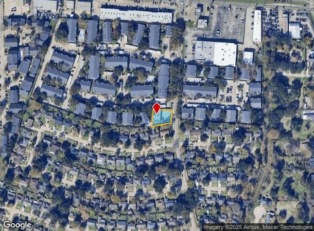
9722 Leawood Blvd, Houston, TX 77099

This Property Is For Sale
NEARBY LISTINGS FOR SALE OR LEASE
Property Detail
9722 Leawood Blvd
1033730010061
Parkglen West Sec 2
Storebuilding
RES A1 BLK 21 PARKGLEN WEST SEC 2
X
Harris
48157C0165L
Texas
2024
0.28 AC
2025
Sugar Land
453404
Houston
3,200 SF
Houston-The Woodlands-Sugar Land, TX
DEMOGRAPHICS near 9722 Leawood Blvd
1 Mile
3 Mile
5 Mile
2024 Total Population
28,307
200,560
516,321
2029 Population
30,014
214,787
555,176
Pop Growth 2024-2029
+ 6.03%
+ 7.09%
+ 7.53%
Average Age
36
37
37
2024 Total Households
9,415
67,774
185,852
HH Growth 2024-2029
+ 6.22%
+ 7.44%
+ 7.72%
Median Household Inc
$49,386
$50,391
$54,943
Avg Household Size
2.90
2.90
2.70
2024 Avg HH Vehicles
2.00
2.00
2.00
Median Home Value
$182,760
$223,049
$257,797
Median Year Built
1982
1980
1983
Nearby Places
Map Layers
Map Styles
 Street
 Aerial
- Restaurants
- Banks
- Shops
- Fitness
- Groceries
PUBLIC TRANSPORTATION
AIRPORT
William P Hobby
DRIVE
WALK
Distance
William P Hobby
37 min
23.5 mi
George Bush Intcntl/Houston
DRIVE
WALK
Distance
George Bush Intcntl/Houston
44 min
35.8 mi
Freight Ports
Port of Houston
DRIVE
WALK
Distance
Port of Houston
38 min
22.8 mi
Nearby Properties
Address
Land Use
TOTAL SIZE
Lot Size
Zoning
Address
Land Use
TOTAL SIZE
Lot Size
Zoning
7.46 AC
Address
Land Use
TOTAL SIZE
Lot Size
Zoning
12.98 AC
Address
Land Use
TOTAL SIZE
Lot Size
Zoning
11.58 AC
Address
Land Use
TOTAL SIZE
Lot Size
Zoning
12.08 AC
Address
Land Use
TOTAL SIZE
Lot Size
Zoning
627,632 SF
24.12 AC
Address
Land Use
TOTAL SIZE
Lot Size
Zoning
816,006 SF
40.26 AC
Address
Land Use
TOTAL SIZE
Lot Size
Zoning
422,123 SF
39.85 AC
Address
Land Use
TOTAL SIZE
Lot Size
Zoning
188,178 SF
18.49 AC
Address
Land Use
TOTAL SIZE
Lot Size
Zoning
126,308 SF
16.95 AC
Address
Land Use
TOTAL SIZE
Lot Size
Zoning
76,385 SF
17.48 AC
Address
Land Use
TOTAL SIZE
Lot Size
Zoning
526,945 SF
23.05 AC
Address
Land Use
TOTAL SIZE
Lot Size
Zoning
76,306 SF
15.84 AC
Address
Land Use
TOTAL SIZE
Lot Size
Zoning
12.22 AC
Address
Land Use
TOTAL SIZE
Lot Size
Zoning
61,006 SF
13.16 AC
X
Address
Land Use
TOTAL SIZE
Lot Size
Zoning
183,015 SF
9.91 AC
Address
Land Use
TOTAL SIZE
Lot Size
Zoning
154,586 SF
10.93 AC
SY
Address
Land Use
TOTAL SIZE
Lot Size
Zoning
19.55 AC
S
Address
Land Use
TOTAL SIZE
Lot Size
Zoning
291,196 SF
30.06 AC
SXY
Address
Land Use
TOTAL SIZE
Lot Size
Zoning
322,894 SF
17.51 AC
Address
Land Use
TOTAL SIZE
Lot Size
Zoning
84,509 SF
13.06 AC
Y
Address
Land Use
TOTAL SIZE
Lot Size
Zoning
355,887 SF
13.89 AC
Address
Land Use
TOTAL SIZE
Lot Size
Zoning
75,978 SF
10.13 AC
Address
Land Use
TOTAL SIZE
Lot Size
Zoning
269,067 SF
17.98 AC
Address
Land Use
TOTAL SIZE
Lot Size
Zoning
52,502 SF
13.60 AC
XYS
Address
Land Use
TOTAL SIZE
Lot Size
Zoning
226,700 SF
19.14 AC
M
Address
Land Use
TOTAL SIZE
Lot Size
Zoning
329,954 SF
15.55 AC
SH
Address
Land Use
TOTAL SIZE
Lot Size
Zoning
364,674 SF
13.79 AC
Address
Land Use
TOTAL SIZE
Lot Size
Zoning
314,657 SF
17.77 AC
S
Address
Land Use
TOTAL SIZE
Lot Size
Zoning
121,000 SF
12.20 AC
S
Address
Land Use
TOTAL SIZE
Lot Size
Zoning
45,216 SF
11.92 AC
SY
The World's #1 Commercial Real Estate Marketplace
Connect with us
© 2026 CoStar Group
The information above has been obtained from sources believed reliable. While we do not doubt its accuracy we have not verified it and make no guarantee, warranty or representation about it. It is your responsibility to independently confirm its accuracy and completeness. Any projections, opinions, assumptions, or estimates used are for example only and do not represent the current or future performance of the property. The value of this transaction to you depends on tax and other factors which should be evaluated by your tax, financial, and legal advisors. You and your advisors should conduct a careful, independent investigation of the property to determine to your satisfaction the suitability of the property for your needs.