Property Record
973 Rose Dr, Benicia, CA 94510
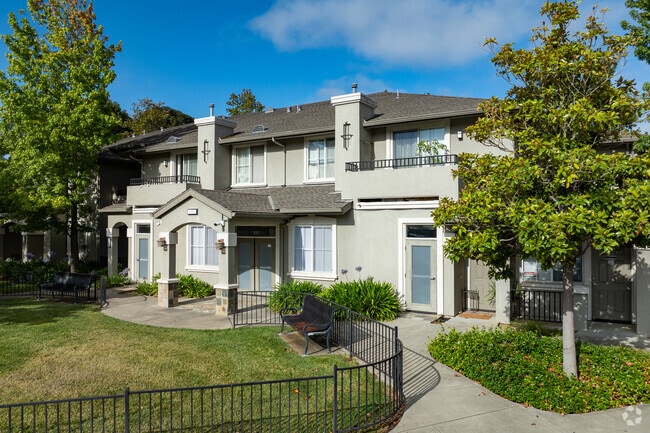


Property Detail
973 Rose Dr
0086-410-210
BK-BG 28-21
Multifamilydwelling
Solano
B and X Area of moderate flood hazard, usually the area between the limits of the 100-year and 500-year floods.
California
2024
3.72 AC
2025
Benicia
252104
North Bay/Santa Rosa
44,981 SF
Vallejo, CA
NEARBY LISTINGS FOR SALE OR LEASE
DEMOGRAPHICS near 973 Rose Dr
1 mile
3 mile
5 mile
2025 Total Population
8,683
79,713
138,556
2030 Population
8,748
80,222
139,554
Pop Growth 2025-2030
+ 0.75%
+ 0.64%
+ 0.72%
Average Age
46
42
42
2025 Total Households
3,230
29,216
51,128
HH Growth 2025-2030
+ 0.74%
+ 0.70%
+ 0.80%
Median Household Inc
$138,402
$109,451
$94,590
Avg Household Size
2.70
2.60
2.60
2025 Avg HH Vehicles
2.00
2.00
2.00
Median Home Value
$756,792
$707,615
$696,964
Median Year Built
1984
1977
1974
Nearby Places
Map Layers
Map Styles
 Street
 Aerial
Layers
 Traffic
 Biking
Places
Listings with unknown addresses are not visible on the map
- Restaurants
- Banks
- Shops
- Fitness
- Groceries
PUBLIC TRANSPORTATION
COMMUTER RAIL
Martinez (California Zephyr - Capitol Corridor Joint Powers Authority, Capitol Corridor - Capitol Corridor Joint Powers Authority, Coast Starlight - Capitol Corridor Joint Powers Authority, San Joaquins - Capitol Corridor Joint Powers Authority)
Drive
Walk
Distance
Martinez (California Zephyr - Capitol Corridor Joint Powers Authority, Capitol Corridor - Capitol Corridor Joint Powers Authority, Coast Starlight - Capitol Corridor Joint Powers Authority, San Joaquins - Capitol Corridor Joint Powers Authority)
12 min
8.4 mi
AIRPORT
Metro Oakland International
Drive
Walk
Distance
Metro Oakland International
48 min
36.9 mi
Freight Ports
Port of Richmond
Drive
Walk
Distance
Port of Richmond
32 min
22.6 mi
Nearby Properties
Address
Land Use
TOTAL SIZE
Lot Size
Zoning
Address
Land Use
TOTAL SIZE
Lot Size
Zoning
324.69 AC
Address
Land Use
TOTAL SIZE
Lot Size
Zoning
1,053 SF
7.78 AC
HI
Address
Land Use
TOTAL SIZE
Lot Size
Zoning
197,656 SF
18.63 AC
Address
Land Use
TOTAL SIZE
Lot Size
Zoning
Address
Land Use
TOTAL SIZE
Lot Size
Zoning
17.66 AC
Address
Land Use
TOTAL SIZE
Lot Size
Zoning
160,000 SF
13.67 AC
Address
Land Use
TOTAL SIZE
Lot Size
Zoning
7.86 AC
Address
Land Use
TOTAL SIZE
Lot Size
Zoning
175,831 SF
8.63 AC
Address
Land Use
TOTAL SIZE
Lot Size
Zoning
200,888 SF
19.11 AC
MR25
Address
Land Use
TOTAL SIZE
Lot Size
Zoning
151,720 SF
8 AC
HDR
Address
Land Use
TOTAL SIZE
Lot Size
Zoning
140,712 SF
9.54 AC
Address
Land Use
TOTAL SIZE
Lot Size
Zoning
12.80 AC
Address
Land Use
TOTAL SIZE
Lot Size
Zoning
86,116 SF
4.64 AC
Address
Land Use
TOTAL SIZE
Lot Size
Zoning
115,292 SF
9.85 AC
Address
Land Use
TOTAL SIZE
Lot Size
Zoning
65,856 SF
3.49 AC
Address
Land Use
TOTAL SIZE
Lot Size
Zoning
3.75 AC
RM
Address
Land Use
TOTAL SIZE
Lot Size
Zoning
29,773 SF
9.29 AC
Address
Land Use
TOTAL SIZE
Lot Size
Zoning
93,130 SF
4.17 AC
Address
Land Use
TOTAL SIZE
Lot Size
Zoning
35,576 SF
2.81 AC
Address
Land Use
TOTAL SIZE
Lot Size
Zoning
35,434 SF
1.66 AC
Address
Land Use
TOTAL SIZE
Lot Size
Zoning
2,423 SF
1.62 AC
Address
Land Use
TOTAL SIZE
Lot Size
Zoning
29,979 SF
1.75 AC
Address
Land Use
TOTAL SIZE
Lot Size
Zoning
7.09 AC
Address
Land Use
TOTAL SIZE
Lot Size
Zoning
4.95 AC
COM
Address
Land Use
TOTAL SIZE
Lot Size
Zoning
14,686 SF
1.47 AC
Address
Land Use
TOTAL SIZE
Lot Size
Zoning
48,695 SF
2.66 AC
GENERAL
Address
Land Use
TOTAL SIZE
Lot Size
Zoning
27.89 AC
Address
Land Use
TOTAL SIZE
Lot Size
Zoning
34,500 SF
3.08 AC
HEAVY INDU
Address
Land Use
TOTAL SIZE
Lot Size
Zoning
83,796 SF
7.84 AC
Address
Land Use
TOTAL SIZE
Lot Size
Zoning
45,519 SF
2.93 AC
The World's #1 Commercial Real Estate Marketplace
Connect with us
© 2026 CoStar Group
The information above has been obtained from sources believed reliable. While we do not doubt its accuracy we have not verified it and make no guarantee, warranty or representation about it. It is your responsibility to independently confirm its accuracy and completeness. Any projections, opinions, assumptions, or estimates used are for example only and do not represent the current or future performance of the property. The value of this transaction to you depends on tax and other factors which should be evaluated by your tax, financial, and legal advisors. You and your advisors should conduct a careful, independent investigation of the property to determine to your satisfaction the suitability of the property for your needs.