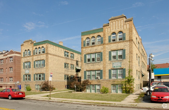
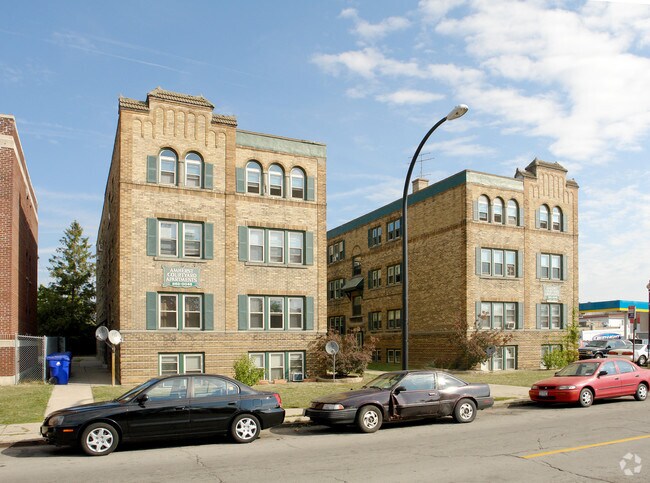
Property Record
974 Amherst St, Buffalo, NY 14216
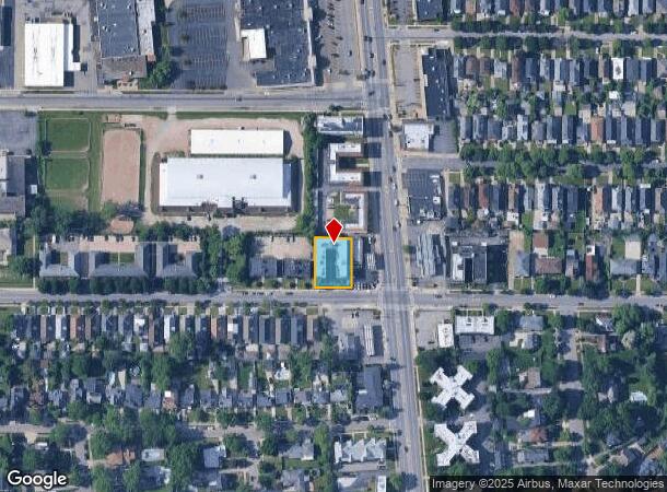
NEARBY LISTINGS FOR SALE OR LEASE
Property Detail
974 Amherst St
Buffalo-Cheektowaga-Niagara Falls, NY
Holland Land Companys Survey
140200-089-230-0001-005-000
65.90 W DELAWARE
Apartment
Erie
X
New York
36029C0205H
5.000
2025
0.29 AC
2024
Park Meadow
005400
Buffalo/Niagara Falls
18,690 SF
DEMOGRAPHICS near 974 Amherst St
1 Mile
3 Mile
5 Mile
2024 Total Population
15,158
184,988
344,537
2029 Population
14,604
180,409
338,270
Pop Growth 2024-2029
(3.65%)
(2.48%)
(1.82%)
Average Age
38
38
39
2024 Total Households
7,334
81,505
149,892
HH Growth 2024-2029
(3.75%)
(2.45%)
(1.79%)
Median Household Inc
$60,686
$49,397
$49,195
Avg Household Size
2.00
2.10
2.20
2024 Avg HH Vehicles
1.00
1.00
1.00
Median Home Value
$265,910
$177,425
$163,219
Median Year Built
1946
1946
1948
Nearby Places
- Restaurants
- Banks
- Shops
- Fitness
- Groceries
PUBLIC TRANSPORTATION
COMMUTER RAIL
DRIVE
WALK
Distance
13 min
6.0 mi
DRIVE
WALK
Distance
19 min
9.6 mi
AIRPORT
Buffalo Niagara International
DRIVE
WALK
Distance
Buffalo Niagara International
20 min
10.4 mi
Niagara Falls International
DRIVE
WALK
Distance
Niagara Falls International
28 min
13.0 mi
Nearby Properties
Address
Land Use
TOTAL SIZE
Lot Size
Zoning
Address
Land Use
TOTAL SIZE
Lot Size
Zoning
6,120 SF
87.10 AC
D-IL
Address
Land Use
TOTAL SIZE
Lot Size
Zoning
135,396 SF
146.32 AC
D-E
Address
Land Use
TOTAL SIZE
Lot Size
Zoning
22,010 SF
D-M
Address
Land Use
TOTAL SIZE
Lot Size
Zoning
401,805 SF
2.04 AC
D-M
Address
Land Use
TOTAL SIZE
Lot Size
Zoning
166,250 SF
0.59 AC
D-M
Address
Land Use
TOTAL SIZE
Lot Size
Zoning
151,371 SF
0.51 AC
D-M
Address
Land Use
TOTAL SIZE
Lot Size
Zoning
8,317 SF
39.03 AC
SPLIT ZONE
Address
Land Use
TOTAL SIZE
Lot Size
Zoning
646,259 SF
16.31 AC
D-M
Address
Land Use
TOTAL SIZE
Lot Size
Zoning
117,679 SF
0.41 AC
N-1C
Address
Land Use
TOTAL SIZE
Lot Size
Zoning
870,511 SF
4.40 AC
D-M
Address
Land Use
TOTAL SIZE
Lot Size
Zoning
121,015 SF
92.60 AC
D-E
Address
Land Use
TOTAL SIZE
Lot Size
Zoning
686,000 SF
3.62 AC
N-2R
Address
Land Use
TOTAL SIZE
Lot Size
Zoning
561,196 SF
16 AC
D-M
Address
Land Use
TOTAL SIZE
Lot Size
Zoning
251,908 SF
D-M
Address
Land Use
TOTAL SIZE
Lot Size
Zoning
86,825 SF
1.57 AC
D-M
Address
Land Use
TOTAL SIZE
Lot Size
Zoning
74,316 SF
0.25 AC
D-M
Address
Land Use
TOTAL SIZE
Lot Size
Zoning
21,200 SF
20.94 AC
D-IL
Address
Land Use
TOTAL SIZE
Lot Size
Zoning
66,655 SF
0.25 AC
D-M
Address
Land Use
TOTAL SIZE
Lot Size
Zoning
36,325 SF
12.50 AC
D-E
Address
Land Use
TOTAL SIZE
Lot Size
Zoning
239,735 SF
17.73 AC
TND
Address
Land Use
TOTAL SIZE
Lot Size
Zoning
12,641 SF
0.56 AC
N-2C
Address
Land Use
TOTAL SIZE
Lot Size
Zoning
19,608 SF
0.45 AC
N-3C
Address
Land Use
TOTAL SIZE
Lot Size
Zoning
156,870 SF
D-M
Address
Land Use
TOTAL SIZE
Lot Size
Zoning
94,680 SF
175.90 AC
D-OG
Address
Land Use
TOTAL SIZE
Lot Size
Zoning
540,154 SF
7.06 AC
D-E
Address
Land Use
TOTAL SIZE
Lot Size
Zoning
17,778 SF
14 AC
GB
Address
Land Use
TOTAL SIZE
Lot Size
Zoning
312,340 SF
3.83 AC
N-2R
Address
Land Use
TOTAL SIZE
Lot Size
Zoning
7,753 SF
1 AC
N-1C
Address
Land Use
TOTAL SIZE
Lot Size
Zoning
119,851 SF
1.35 AC
N-2R
Address
Land Use
TOTAL SIZE
Lot Size
Zoning
80,502 SF
3.25 AC
D-E
The World's #1 Commercial Real Estate Marketplace
Connect with us
© 2025 CoStar Group
The information above has been obtained from sources believed reliable. While we do not doubt its accuracy we have not verified it and make no guarantee, warranty or representation about it. It is your responsibility to independently confirm its accuracy and completeness. Any projections, opinions, assumptions, or estimates used are for example only and do not represent the current or future performance of the property. The value of this transaction to you depends on tax and other factors which should be evaluated by your tax, financial, and legal advisors. You and your advisors should conduct a careful, independent investigation of the property to determine to your satisfaction the suitability of the property for your needs.